Situation Summary
Antigua and Barbuda maintains a stable, low-threat security environment with no confirmed acute incidents in the past 24–48 hours. The nation remains ranked #167 globally (composite threat score 4) with baseline risks dominated by petty crime and maritime trafficking rather than active civil unrest, armed activity, or terrorism. Police and government institutions are functioning normally, and external travel advisories (U.S. State Department Level 1) reflect the current benign security posture.
Key Developments
- Antigua (nationwide) – 17 July 2026 – Attorney General, Cabinet, and Governor General issued public statements and initiated investigative activity related to unspecified government and student matters; no security impact or civil disruption has been reported.
- Antigua (nationwide) – 16–17 July 2026 – Police and military commandant issued public statements addressing criminal activity; no new shootings, major crimes against persons, or violent incidents were recorded during the reporting window.
- Antigua (nationwide) – 16 July 2026 – Prime Minister Gaston Browne and Foreign Affairs Ministry issued public statements; no parliamentary disruption, diplomatic incident, or infrastructure failure was confirmed.
- St. John's & wider Antigua – 17 July 2026 – A merchant issued a public statement; no commercial sector disruption, supply-chain incident, or economic impact has been documented.
- Antigua (nationwide) – 17 July 2026 – A student demand was recorded; no protest activity, roadblock, or public gathering disruption has been reported in the 24–48-hour window.
- Carnival security posture (forward-looking) – announced 15 July 2026 – Police announced an enhanced security plan and zero-tolerance weapons stance for Carnival 2026 (25 July–4 August), including increased patrols and stop-and-search operations; this is a preventive measure, not a response to an acute incident.
Highest-Risk Areas
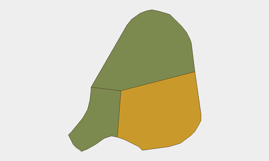
Antigua island (risk score 72) is the dominant driver of national risk, reflecting its concentration of population, commerce, government institutions, and routine property and street crime. Barbuda (risk 18) and Redonda (risk 8) present substantially lower risk profiles, with no recent incidents or acute threats reported on either island. Within Antigua, St. John's and surrounding urban zones account for the majority of baseline petty crime; rural and resort areas maintain comparatively lower incident rates. The sub-national ranking reflects cumulative crime prevalence and institutional vulnerability rather than active conflict or instability.
How GeoBit Would Assist
Security teams with personnel or assets in Antigua and Barbuda should leverage AOI Monitoring & Early Warning (persistent area-of-interest watch with alerting) on St. John's and key commercial/government districts to detect early signs of civil unrest, protest mobilization, or security force activity. Intel Sweep and multi-source OSINT fusion (including X/Twitter, local news, and radio SIGINT) enable continuous detection of emerging statements by government, police, or civil actors that may signal policy shifts, crime spikes, or institutional friction. Routing & Network Analysis and Maritime tracking support dynamic journey planning for personnel traveling to or within the nation, particularly during the Carnival period (25 July–4 August) when police stop-and-search operations will intensify.
7-Day Outlook
No acute security deterioration is expected over the next 7 days. Carnival 2026 (25 July–4 August) will see heightened police presence and weapons enforcement, a routine preventive measure that should not materially elevate risk for compliant residents and visitors. Baseline petty crime and maritime trafficking will remain the dominant background risks; any shift in political or institutional stability would likely emerge through government or legislative statements before manifesting in street-level disruption.
Highest-Risk Areas — Ranked
| # | State / Region | Risk |
|---|---|---|
| 1 | Antigua | 72 |
| 2 | Barbuda | 18 |
| 3 | Redonda | 8 |
Sources
Previous Daily Briefs
A new Antigua and Barbuda brief is written every day — each with its own risk map and downloadable CSV. Here's the last week; use the calendar to go further back.
📅 Browse every day by calendar →
Highlighted days have a brief. Tap a day for that day's map & analysis, or “csv” for that day's dataset ($5).
Atlas — our AI intelligence desk — emails them this snapshot personally. Nothing else, no list.