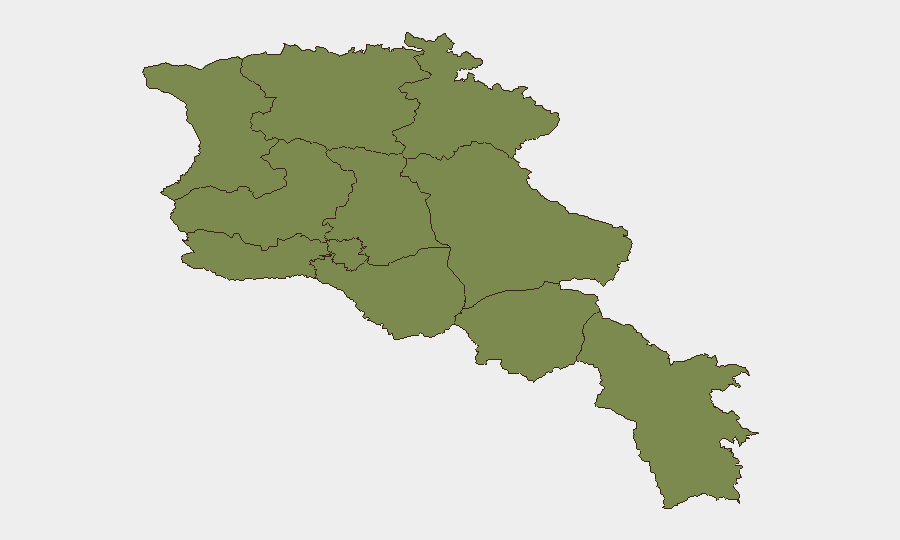
Situation Summary
Armenia faces a fragmented but elevated threat landscape dominated by concentrated risk in Yerevan (score 31.3), where recent armed violence, political tension, and law-enforcement operations create a volatile security environment. Provincial incidents—including a wolf attack in Syunik, food-poisoning cluster in Armavir, and military training accident in Lori—reflect broader vulnerabilities in civil safety and emergency response outside the capital. Geopolitical friction with Russia over sanctions and ongoing Kyrgyzstan tensions add macro-level instability, though no imminent large-scale conflict is indicated.
Key Developments
- Yerevan, 30 July – Law enforcement conducted early-morning searches at the residence of Ishkhan Saghatelyan (Armenian Revolutionary Federation senior figure) as part of opposition-circle investigations, signaling heightened domestic political pressure.
- Yerevan, 30 July – Heightened policing and civil tension noted following a recent armed shooting with grenade use (one fatality, one hospitalization, suspect detained); knock-on effects for downtown security posture remain in effect.
- Armavir Province, 29–30 July – Nine residents sought medical treatment for suspected food poisoning linked to donuts and lahmajo consumption; Food Safety Inspectorate launched outlet inspections, reflecting public-health incident-response activity.
- Lori Region (training ground), 30 July – Armenian serviceman severely injured during military training exercise, with reported loss of limb; soldier evacuated and internal investigation initiated.
- Syunik Province (southern), 29–30 July – Wolf attack injured six people including at least one child; ongoing tracking efforts for animal neutralization reported.
- National level (Yerevan institutions), 30 July – Armenian policymakers reported considering sanctions on Russia in response to Russian import restrictions and bilateral tensions; signals new phase of economic and trade friction within Eurasian Economic Union.
- Border regions, 29–30 July – EU-supported border demining and construction of three new checkpoints announced; near-term increase in border-area construction activity and security presence expected.
Highest-Risk Areas
Yerevan dominates the risk profile at 31.3—a 24-fold multiple over all other provinces—driven by active armed violence, political instability, and law-enforcement operations targeting opposition figures. Armavir Province (16.3) ranks second, reflecting the food-poisoning cluster and underlying civil-safety vulnerabilities. All remaining provinces cluster at 1.3, indicating that security risk in Armenia is highly concentrated in the capital and, secondarily, in Armavir's urban and commercial zones. Travelers and asset-holders should treat Yerevan as the primary point of friction; provincial incidents are localized and do not suggest systemic breakdown outside the capital.
How GeoBit Would Assist
Security teams would deploy Area-of-Interest (AOI) Monitoring & Early Warning on Yerevan downtown, key opposition meeting points, and police facilities to detect escalation in political arrests or armed incidents in near-real time. OSINT Fusion & Corroboration (X/Twitter, Telegram, local Armenian media, and multi-language search) provides continuous cross-checked signal on opposition activity, law-enforcement operations, and geopolitical friction, enabling duty-of-care teams to distinguish signal from noise. Risk & Threat Assessment capability, combined with Routing & Network Analysis, allows corporate security to identify safe transit corridors in Yerevan and re-plan supply or personnel movements around high-risk zones and checkpoints.
7-Day Outlook
Yerevan will likely remain under elevated tension as political opposition cases proceed and Russia–Armenia friction persists over sanctions. No imminent escalation to armed conflict is indicated. Border checkpoint construction and demining operations will increase security presence in frontier zones but carry minimal direct risk to most corporate operations.
Highest-Risk Areas — Ranked
| # | State / Region | Risk |
|---|---|---|
| 1 | Yerevan | 31.3 |
| 2 | Armavir Province | 16.3 |
| 3 | Lori Province | 1.3 |
| 4 | Tavush Province | 1.3 |
| 5 | Kotayk Province | 1.3 |
| 6 | Ararat Province | 1.3 |
| 7 | Gegharkunik Province | 1.3 |
| 8 | Vayots Dzor Province | 1.3 |
| 9 | Syunik Province | 1.3 |
| 10 | Shirak Province | 1.3 |
| 11 | Aragatsotn Province | 1.3 |
Sources
Previous Daily Briefs
A new Armenia brief is written every day — each with its own risk map and downloadable CSV. Here's the last week; use the calendar to go further back.
📅 Browse every day by calendar →
Highlighted days have a brief. Tap a day for that day's map & analysis, or “csv” for that day's dataset ($5).
Atlas — our AI intelligence desk — emails them this snapshot personally. Nothing else, no list.