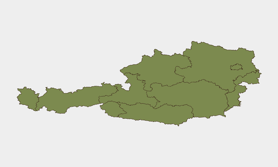
Situation Summary
Austria remains a low–threat environment globally (rank #134), but security activity has concentrated sharply in Vienna and Lower Austria over the past 48 hours, driven by violent youth crime, weapons incidents, and property crime. The sub-national risk profile shows Vienna carrying 31.4 of the composite risk score—roughly 95% of Austria's tracked threat weight—while remaining regions remain in the 1–18 range. Near-term trajectory suggests continued localized urban crime and infrastructure vulnerability rather than systemic or state-level destabilization.
Key Developments
- Vienna, Favoriten district (Wielandpark), evening 22 July 2026: A 15-year-old was fatally stabbed and two other youths injured during a knife fight; a 12-year-old suspect was arrested at the scene. This represents a high-lethality youth violence incident in Austria's capital and is the most severe single event in the reporting window.
- Vienna, private residence, early morning 22 July 2026: A 30-year-old Slovak national fired two shots from an alarm pistol into the ground and brandished a Glock at guests during a birthday party altercation. Cobra special police were deployed; weapons were seized and a temporary ban imposed. No injuries reported.
- Lower Austria, unspecified location, 22 July 2026: Police arrested a 28-year-old driver and detained a 44-year-old passenger suspected of burglary; cannabis and burglary tools were recovered from the vehicle.
- Upper Austria, Braunau am Inn, 22 July 2026: Authorities formally inaugurated the birthplace of Adolf Hitler as a district police headquarters, a security-driven redevelopment intended to deter extremist "pilgrimage" visits and reinforce state presence.
- Styria, Kapfenberg, 20 July 2026 (ongoing local impact): An excavator damaged a main gas pipeline during construction; hazardous materials response was activated, a company premises evacuated, and the B20 road closed. No injuries; temporary infrastructure disruption noted.
- Carinthia, Irschen, 20 July 2026 (investigation ongoing): A commercial/farm building burned to its foundations; adjacent residence was saved. Two livestock were killed; cause under investigation.
Highest-Risk Areas
Vienna dominates the threat landscape, accounting for 31.4 of Austria's composite risk score of 5. The Favoriten stabbing, firearms incident, and historical event concentration all point to urban crime, youth violence, and localized disorder as the primary drivers. Lower Austria's secondary ranking (17.8) reflects property crime and criminal mobility along transport corridors. All other regions score below 3, indicating that Austria's security posture outside Vienna and its immediate periphery remains stable and low-threat.
How GeoBit Would Assist
AOI Monitoring & Early Warning over Vienna's high-crime districts (Favoriten, Margareten, Donaustadt) would provide persistent watch and alerting for clustering youth violence, weapons incidents, or gang activity. Network & Actor Analysis and OSINT fusion (X/Twitter, Telegram, local police feeds) would enable real-time identification of organized crime networks or extremist groups operating in Vienna and Lower Austria. Routing & Network Analysis would support duty-of-care teams in planning safer movement patterns and identifying transport vulnerabilities for personnel or assets in or near Vienna.
7-Day Outlook
No indicators suggest escalation to organized extremism, terrorism, or state-level instability. Youth violence and property crime will likely remain the primary concern, concentrated in Vienna's urban precincts. Infrastructure incidents (gas, power, transport) may recur; routine monitoring of utility networks and road status is advisable for operational continuity.
Highest-Risk Areas — Ranked
| # | State / Region | Risk |
|---|---|---|
| 1 | Vienna | 31.4 |
| 2 | Lower Austria | 17.8 |
| 3 | Tyrol | 2.8 |
| 4 | Vorarlberg | 1.4 |
| 5 | Upper Austria | 1.4 |
| 6 | Salzburg | 1.4 |
| 7 | Carinthia | 1.4 |
| 8 | Styria | 1.4 |
| 9 | Burgenland | 1.4 |
Sources
Previous Daily Briefs
A new Austria brief is written every day — each with its own risk map and downloadable CSV. Here's the last week; use the calendar to go further back.
📅 Browse every day by calendar →
Highlighted days have a brief. Tap a day for that day's map & analysis, or “csv” for that day's dataset ($5).
Atlas — our AI intelligence desk — emails them this snapshot personally. Nothing else, no list.