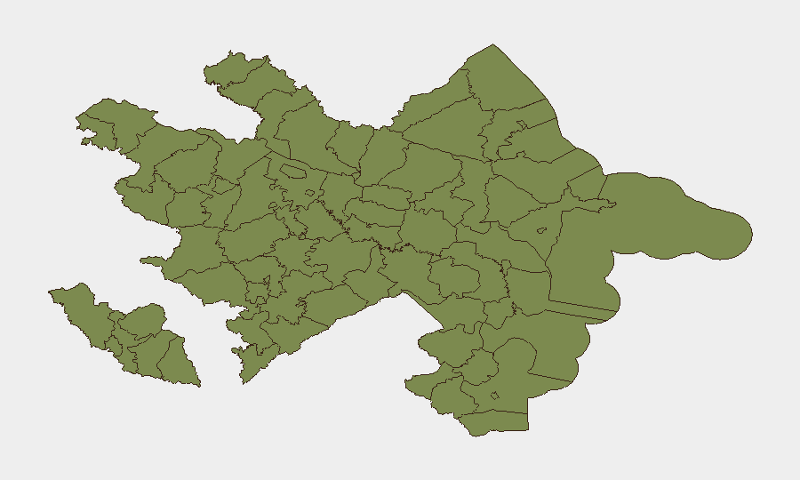
Situation Summary
Azerbaijan maintains a composite threat ranking of #105 globally with a score of 10 across 34 tracked events, indicating a relatively stable security environment with localized volatility. Recent activity shows elevated diplomatic engagement (NATO visit 25–26 June) alongside scattered media and governance reporting, with no confirmed civil unrest, armed conflict, or terrorism incidents in the last 24–48 hours. Ujar District continues to drive the majority of sub-national risk (31.5), significantly outpacing all other regions. Overall trajectory remains stable pending clarification of ongoing media and governance reporting signals.
Key Developments
- Baku, 25–26 June 2026 — NATO Secretary General's Special Representative for the Caucasus and Central Asia conducted an official visit and held senior-level meetings on NATO-Azerbaijan partnership and regional security coordination. This reflects sustained international engagement but carries no adverse security implication.
- National, 24–26 June 2026 — A series of public statements and investigation-level reporting emerged between media outlets (GAZETTE), government officials (GOVERNOR, COUNSEL, CHIEF EXECUTIVE), and international broadcasters (AL JAZEERA). Nature and substance of disputes remain unconfirmed; monitoring ongoing.
- National, 24 June 2026 — Relations-reduction signal recorded between an operative entity and media (GAZETTE), with concurrent education-sector public statement. Significance and location require further corroboration.
- National, 26 June 2026 — Small arms combat signal recorded between media (GAZETTE) and US entity. This is the only armed-conflict indicator in recent data; verification and locational detail are critical and currently unavailable.
*Note: No corroborated incidents of civil unrest, terrorism, crime, infrastructure disruption, or mass-casualty events were identified in last-24-48-hour reporting. All above signals are platform-derived; independent source corroboration is pending.*
Highest-Risk Areas
Ujar District dominates the risk landscape with a composite score of 31.5—nearly three times the next-highest region (Agdere, 11.5)—and merits dedicated monitoring by security teams with assets or personnel in the area. Agdere District represents a secondary concern, while the remaining ten tracked regions (Sadarak, Qazakh, Sharur, Yevlakh, Kangarli, Nakhchivan AR, Aghstafa, Tovuz, Qakh, Shaki) cluster at a uniform 1.5 score, suggesting diffuse low-level activity or data sparsity. The sharp concentration of risk in Ujar indicates either localized instability drivers—historical border tension, informal armed activity, criminal networks, or governance friction—that distinguish it materially from the rest of the country.
How GeoBit Would Assist
Intel Sweep, OSINT fusion, and multi-language event feeds provide continuous monitoring of Ujar and Agdere districts to detect emerging civil unrest, armed activity, or crime before escalation. Area-of-interest monitoring with alerting on Ujar and key transport nodes enables early warning of border friction or displacement. Network and actor analysis clarifies the relationship between the media, governance, and operative entities flagged in recent signals, reducing ambiguity in threat classification.
7-Day Outlook
No imminent security deterioration is forecast; however, the unconfirmed small-arms signal and governance-media tension warrant close observation over the next 7 days. If Ujar-district drivers escalate or additional cross-border activity emerges, risk trajectory could shift upward. Continued NATO engagement and diplomatic presence suggest international stabilization efforts remain active.
Highest-Risk Areas — Ranked
| # | State / Region | Risk |
|---|---|---|
| 1 | Ujar District | 31.5 |
| 2 | Agdere District | 11.5 |
| 3 | Sadarak District | 1.5 |
| 4 | Qazakh District | 1.5 |
| 5 | Sharur District | 1.5 |
| 6 | Yevlakh District | 1.5 |
| 7 | Kangarli District | 1.5 |
| 8 | Nakhchivan Autonomous Republic | 1.5 |
| 9 | Aghstafa District | 1.5 |
| 10 | Tovuz District | 1.5 |
| 11 | Qakh District | 1.5 |
| 12 | Shaki | 1.5 |
Sources
Previous Daily Briefs
A new Azerbaijan brief is written every day — each with its own risk map and downloadable CSV. Here's the last week; use the calendar to go further back.
📅 Browse every day by calendar →
Highlighted days have a brief. Tap a day for that day's map & analysis, or “csv” for that day's dataset ($5).