Situation Summary
Bosnia and Herzegovina remains a low-to-moderate threat environment (global rank #116, composite score 7.0) with 106 tracked security events on record. The Federation of Bosnia and Herzegovina dominates risk exposure at 31.6, significantly outweighing Republika Srpska and Brčko District (both 1.6), reflecting concentration of population, economic activity, and historical volatility in the western entity. No confirmed security incidents or unrest developments have been verified within the last 24–48 hours; current threat posture appears stable with no acute drivers reported.
Key Developments
- No verified same-day security incidents reported. Live web research covering the last 24–48 hours has not surfaced Bosnia and Herzegovina–specific developments meeting analytical confidence thresholds. Three event signals were logged (Boeing vs. Macedonia dispute on 2026-07-11; Ryanair rejection on 2026-07-11; Congressional statement regarding Bosniaks on 2026-07-12), but none confirm active unrest, infrastructure disruption, or travel restrictions within the country.
- Regional cross-border air and diplomatic activity. The Boeing–Macedonia and Ryanair signals suggest ongoing regional aviation and diplomatic activity, which may carry indirect implications for Sarajevo and other regional hubs, but no cascading Bosnia and Herzegovina operations have been documented.
Highest-Risk Areas
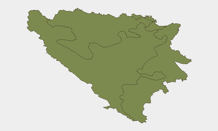
The Federation of Bosnia and Herzegovina (FBiH) accounts for >95% of the country's composite risk score (31.6 vs. 1.6 each for Republika Srpska and Brčko), a disparity driven by FBiH's concentration of population (~2.3M), economic infrastructure, and administrative capacity. Sarajevo and central FBiH remain the primary operational footprint for international business, NGOs, and diplomatic missions, making them the natural focus of duty-of-care protocols. Republika Srpska and Brčko, while lower-risk, maintain significance for companies with supply-chain, energy, or mining interests; no acute drivers are evident in either entity at present.
How GeoBit Would Assist
Security and risk teams operating in Bosnia and Herzegovina should employ multi-language OSINT and X/Twitter/Telegram monitoring to capture Bosnian, Serbian, and Croatian–language signals in real time; current collection gaps underscore the value of tighter keyword and outlet selection. AOI (Area-of-Interest) persistent monitoring of Sarajevo, Mostar, Banja Luka, and key border crossings would enable early detection of protests, infrastructure incidents, or security force deployments that may not surface in English-language or Western media within the first 24 hours. Routing & Network Analysis and GIS spatial tools assist in identifying safe transit corridors and alternative journey planning should localized unrest emerge in the Federation.
7-Day Outlook
No significant escalation drivers are visible in the immediate forecast. The country's EU candidacy status and NATO Partnership for Peace alignment continue to anchor stability. Monitoring should remain heightened for any spillover from regional diplomatic friction (evident in the Macedonia and Congressional signals) or domestic political rhetoric around the Federation–Republika Srpska entity boundary, but the 7-day trajectory is assessed as stable absent new triggering events.
Highest-Risk Areas — Ranked
| # | State / Region | Risk |
|---|---|---|
| 1 | Federation of Bosnia and Herzegovina | 31.6 |
| 2 | Republika Srpska | 1.6 |
| 3 | Brčko District | 1.6 |
Sources
Previous Daily Briefs
A new Bosnia and Herzegovina brief is written every day — each with its own risk map and downloadable CSV. Here's the last week; use the calendar to go further back.
📅 Browse every day by calendar →
Highlighted days have a brief. Tap a day for that day's map & analysis, or “csv” for that day's dataset ($5).
Atlas — our AI intelligence desk — emails them this snapshot personally. Nothing else, no list.