Situation Summary
Burkina Faso remains a high-threat environment (composite rank #21 globally, score 90) following the junta's formal diplomatic rupture with France on 26–28 June 2026, which has accelerated secondary risks for foreign nationals and raised internal repression. Armed group pressure in rural and northern zones persists, while urban centers face intensifying state coercion of civic space and organized dissent. The security posture is volatile and trajectory is downward, with diplomatic realignment and tightened border/foreigner controls creating cascading operational friction for multinational personnel and supply chains.
Key Developments
- Nationwide – 26–28 June 2026 (within prior 72h): The junta formally severed diplomatic relations with France, expelled French diplomats, and ordered termination of French military presence, sharply elevating diplomatic tension and signaling potential secondary restrictions on other Western personnel and operations.
- Ouagadougou – 26–28 June 2026: Government authorities intensified domestic coercive measures, including property seizures and detention of civic activists, indicating elevated risk of civil unrest and repression spillover in the capital and commercial hubs.
- Nationwide – 28 June 2026: A vague directive affecting tourist and foreign national movement was issued; enforcement mechanisms and scope remain unclear, but signals tightening of controls on foreign persons and cross-border transit.
- Ouagadougou – 27–28 June 2026: The presidency publicized renewed strategic diplomatic engagement with Israel's ambassador, signaling geopolitical realignment in security partnerships that may affect Western operational access and risk exposure.
- Centre, North, and Sahel regions – through 28 June 2026: Military operations against armed militant strongholds continued with increased rural deployments; no confirmed mass-casualty attack was reported in the immediate period, but militant pressure and IED/ambush risk remains endemic.
Note: Open-source reporting does not corroborate specific new attacks or major incidents dated 30 June–1 July 2026 meeting evidentiary standards for inclusion.
Highest-Risk Areas
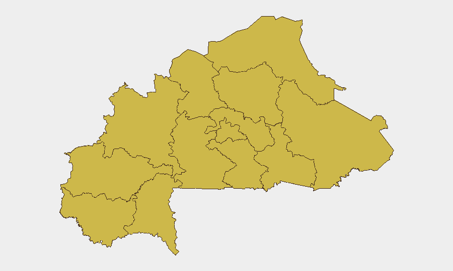
All 12 tracked regions show identical composite risk (62.9), indicating nationwide pervasiveness of threats rather than regional clustering. Upper-Basins, Boucle du Mouhoun, Central-West, Central-South, Central-East, and Sahel rank first alphabetically but carry equivalent risk weights. Threat drivers are dual-natured: (1) armed group activity and military operations in northern and eastern rural zones, and (2) state repression, roadblock enforcement, and arbitrary detention in urban and peri-urban areas including the Centre region (Ouagadougou). Personnel in any region face composite exposure to militant attack, banditry, checkpoint harassment, and unpredictable state action.
How GeoBit Would Assist
Security teams should deploy AOI Monitoring & Early Warning on Ouagadougou, key border crossings, and supply-chain transit corridors to flag diplomatic incidents, roadblock tightening, and militant movement in real time. Intel Sweep and multi-language OSINT fusion (including X/Telegram, local media, and regime statements) will track shifts in foreigner restrictions, arrest patterns, and militant communications to enable rapid duty-of-care escalation. Routing & Network Analysis and satellite imagery support identification of alternative supply routes and secure movement corridors as primary transit channels face disruption from checkpoints and insecurity.
7-Day Outlook
The diplomatic break with France is unlikely to reverse in the near term, sustaining elevated risk for Western nationals and complicating logistics. Civil unrest and state repression will probably intensify in urban centers as the junta consolidates control and demonstrates sovereignty. Armed group activity in rural zones will remain at current endemic levels absent major military offensive; however, secondary effects of diplomatic isolation (reduced humanitarian access, supply-chain friction) may worsen humanitarian conditions and migration pressure, indirectly elevating banditry and instability by mid-July.
Highest-Risk Areas — Ranked
| # | State / Region | Risk |
|---|---|---|
| 1 | Upper-Basins | 62.9 |
| 2 | Boucle du Mouhoun | 62.9 |
| 3 | Central-West | 62.9 |
| 4 | Central-South | 62.9 |
| 5 | Central-East | 62.9 |
| 6 | Waterfalls | 62.9 |
| 7 | Southwest | 62.9 |
| 8 | Sahel | 62.9 |
| 9 | Central-North | 62.9 |
| 10 | East | 62.9 |
| 11 | North | 62.9 |
| 12 | Centre | 62.9 |
Sources
Previous Daily Briefs
A new Burkina Faso brief is written every day — each with its own risk map and downloadable CSV. Here's the last week; use the calendar to go further back.
📅 Browse every day by calendar →
Highlighted days have a brief. Tap a day for that day's map & analysis, or “csv” for that day's dataset ($5).