Situation Summary
Central African Republic remains ranked #30 globally (composite threat score 69) with significant geographic concentration of risk in Bangui (78) and moderate-to-high threat levels across peripheral prefectures. The security environment is shaped by ongoing MINUSCA mission drawdown, historical armed-group presence, and fragile state capacity. Current open-source reporting from the last 24–48 hours reveals no major armed clashes, civil unrest, or infrastructure disruptions, though migration and deportation activity has introduced a documented operational event in the capital region.
Key Developments
- Bangui, 13–14 June 2026: A U.S. deportation flight carrying approximately 24 third-country nationals (including Afghan, Iranian, Turkish, and Georgian nationals) landed in Bangui under a U.S.–CAR third-country agreement. The arrival has generated international human-rights commentary regarding the security and welfare implications of relocating non-CAR nationals into a fragile operating environment.
- Bangui, 15 June 2026: Presidential public statement issued; specific content and implications remain under review via open-source corroboration.
- Bangui, 15 June 2026: Police rejection of a perpetrator; limited open-source detail available on nature or context of incident.
- Bangui, 14 June 2026: Central Bank administrative sanctions imposed on multiple companies; economic/sectoral implications require further clarification.
- Bangui, 13 June 2026: Central African Republic government expulsion/deportation of migrant(s); scale and nationality profile not yet fully detailed in available reporting.
- Regional, 13 June 2026: Reports indicate violent protest/riot activity involving opposition groups versus government, and corresponding violent repression by government and police elements. Geographic scope and casualty figures not yet confirmed in 24–48h open sources.
No major armed clashes, mass-casualty events, or transport/infrastructure disruptions have been independently verified in the last 48 hours outside Bangui.
Highest-Risk Areas
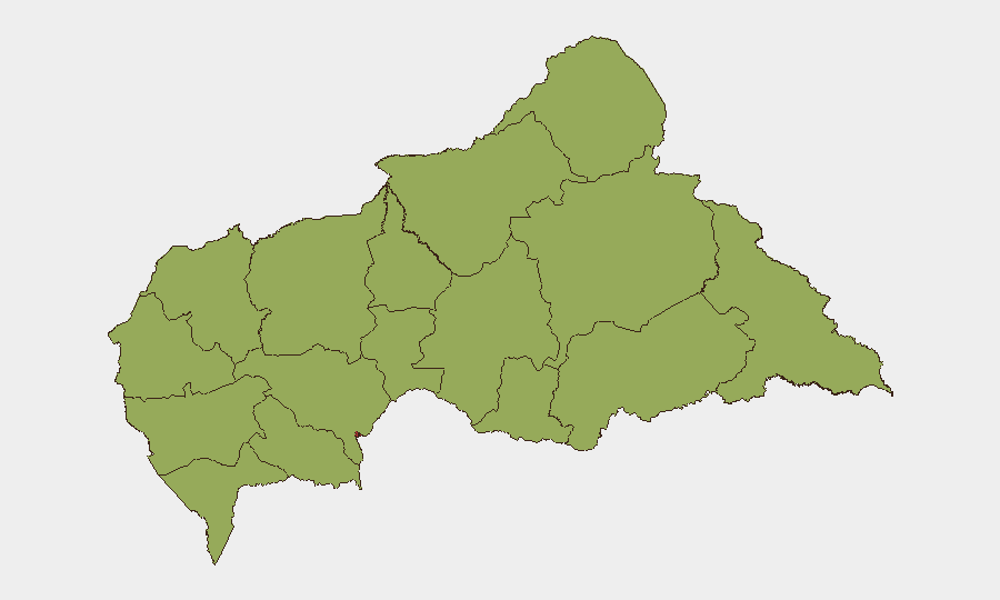
Bangui dominates the threat landscape, with a composite risk score of 78—nearly 60% above the national average—driven by concentration of government institutions, protest activity, police and security-force operations, and migrant/deportation processing. The remaining 11 prefectures (Ouaka, Bamingui-Bangoran, Vakaga, Haute-Kotto, and others) all cluster at risk score 48, reflecting endemic armed-group presence, weak state authority, and limited economic or communication infrastructure. Ouaka (48.9) edges marginally higher than peer prefectures, likely reflecting proximity to conflict zones and cross-border activity. For corporate and duty-of-care operations, Bangui presents acute operational risk (demonstrations, administrative actions, police response); peripheral regions present chronic instability (armed groups, limited rapid-response capacity, seasonal access constraints).
How GeoBit Would Assist
Security teams operating in CAR would use AOI Monitoring & Early Warning to track Bangui and key prefectures for protest activity, armed-group movement, and checkpoint changes; OSINT Fusion & Corroboration (X/Telegram OSINT, multi-language search, entity extraction) to validate and time-stamp incidents in real time; and Risk & Threat Assessment to integrate migration flows, government statements, and force-disposition changes into actionable duty-of-care and evacuation-trigger protocols. Routing & Network Analysis supports alternative route planning around volatile prefectures and migration-processing sites.
7-Day Outlook
Near-term trajectory suggests continued Bangui-centric administrative and political activity, with low probability of major kinetic escalation in the capital but elevated risk of protest cycles and police response. Peripheral armed-group presence remains endemic; no imminent large-scale offensive activity is apparent in open reporting. Migration flows tied to U.S. deportation agreements may create secondary administrative and public-order strain.
Highest-Risk Areas — Ranked
| # | State / Region | Risk |
|---|---|---|
| 1 | Bangui | 78 |
| 2 | Ouaka | 48.9 |
| 3 | Bamingui-Bangoran | 48 |
| 4 | Vakaga | 48 |
| 5 | Haute-Kotto | 48 |
| 6 | Haut-Mbomou | 48 |
| 7 | Mbomou | 48 |
| 8 | Nana-Mambéré | 48 |
| 9 | Ouham-Pendé | 48 |
| 10 | Mambéré-Kadéï | 48 |
| 11 | Sangha-Mbaéré | 48 |
| 12 | Ouham | 48 |
Sources
Previous Daily Briefs
A new Central African Republic brief is written every day — each with its own risk map and downloadable CSV. Here's the last week; use the calendar to go further back.
📅 Browse every day by calendar →
Highlighted days have a brief. Tap a day for that day's map & analysis, or “csv” for that day's dataset ($5).