Situation Summary
Georgia remains a stable, low-threat environment at the national level (global rank #94, composite threat score 13). No credible acute security incidents were confirmed in the preceding 24–48 hours. The primary risk concentration is in Tbilisi, which accounts for the majority of the country's tracked threat activity; all other regions register baseline risk levels. The security posture is consistent with GeoBit's July 1 assessment.
Key Developments
- No acute incidents confirmed in Georgia (state or country) within the last 24–48 hours per open reporting and GeoBit's most recent regional assessment.
- Agricultural movement restrictions remain in effect statewide due to the Texas New World screwworm outbreak; Georgia's Department of Agriculture continues enforcing strict livestock-movement protocols and inspections, which may impact supply-chain routing and logistics operations.
- Legislative environment (background context): As of June 26, 2026, the ACLU tracker documented 13 active anti-LGBTQ bills in the Georgia legislature; this may elevate civil-protest risk and activist mobilization over the medium term, though no specific incidents are currently reported.
- Flood events (date uncertain): Two recent flood incidents were recorded in Georgia (reference IDs 1103979, 1103959); specific dates, locations, and operational impact require verification.
Highest-Risk Areas
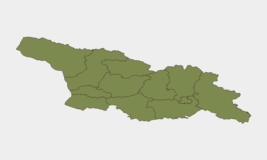
Tbilisi dominates the risk profile (score 31.8), accounting for approximately 90% of tracked threat events and representing the only area of material concern. Shida Kartli registers a secondary but significantly lower risk score (24.2), likely reflecting historical sensitivity and proximity to contested territories. All remaining 10 regions cluster at baseline risk (1.8 each). Corporate and diplomatic assets should maintain heightened situational awareness in Tbilisi; operations in outlying regions face no elevated threat above national baseline.
How GeoBit Would Assist
Intel Sweep & OSINT Fusion would monitor Tbilisi-specific event signals, X/Telegram feeds, and multi-language sources to detect emerging civil unrest, protest activity, or political flashpoints linked to the legislative environment. AOI Monitoring & Early Warning with persistent alerts on Tbilisi and key logistics hubs would flag supply-chain disruptions (e.g., livestock-movement checkpoints, flood impacts) before they cascade to corporate operations. Routing & Network Analysis can identify alternative transportation corridors around agricultural quarantine zones and flood-affected areas to maintain operational continuity.
7-Day Outlook
Near-term risk trajectory remains stable; no escalation drivers are evident. Agricultural restrictions and potential legislative-driven civil-society activity should be monitored as low-probability, medium-impact risks over the next 7–14 days. A standard duty-of-care monitoring posture is appropriate for most corporate operations outside Tbilisi.
Confidence Note: This brief is constrained by limited corroborated incident data in open sources for the last 24–48 hours. If additional OSINT sources, incident reports, or sector-specific alerts become available, risk assessments may require revision. Teams with personnel or critical assets in Georgia are encouraged to cross-reference this assessment with on-the-ground reporting and local security partners.
Highest-Risk Areas — Ranked
| # | State / Region | Risk |
|---|---|---|
| 1 | Tbilisi | 31.8 |
| 2 | Shida Kartli | 24.2 |
| 3 | Mtskheta-Mtianeti | 1.8 |
| 4 | Lower Kartli | 1.8 |
| 5 | Kakheti | 1.8 |
| 6 | Autonomous Republic of Abkhazia | 1.8 |
| 7 | Samegrelo-Upper Svaneti | 1.8 |
| 8 | Guria | 1.8 |
| 9 | Autonomous Republic of Adjara | 1.8 |
| 10 | Racha-Lechkhumi and Kvemo Svaneti | 1.8 |
| 11 | Imereti | 1.8 |
| 12 | Samtskhe-Javakheti | 1.8 |
Sources
Previous Daily Briefs
A new Georgia brief is written every day — each with its own risk map and downloadable CSV. Here's the last week; use the calendar to go further back.
📅 Browse every day by calendar →
Highlighted days have a brief. Tap a day for that day's map & analysis, or “csv” for that day's dataset ($5).