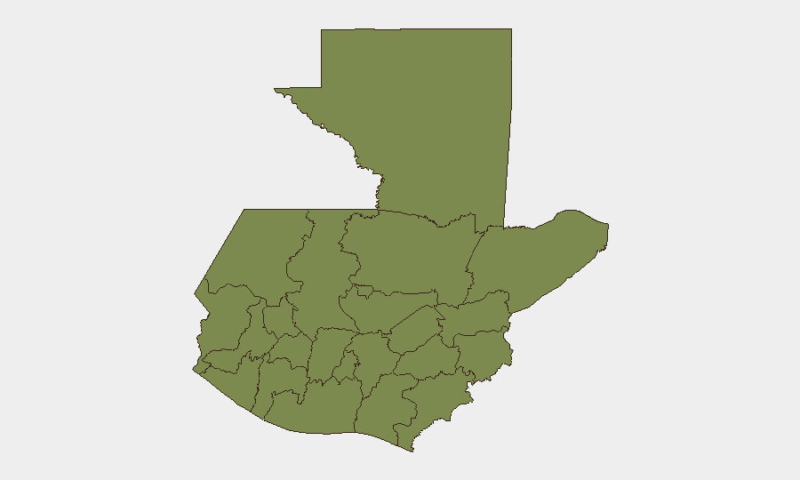
Situation Summary
Guatemala remains a mid-tier global security concern (rank #55, composite score 27) with 41 tracked threat events, characterized by persistent violent crime, political tensions, and natural-hazard exposure. The past 48 hours have brought a cluster of armed attacks across multiple departments, concurrent with significant rainfall emergencies in Alta Verapaz, and reported territorial occupation incidents and prosecutor-level security threats. The security posture reflects ongoing criminal and institutional instability rather than acute systemic collapse, but localized risk remains acute in northern and central regions.
Key Developments
- Escuintla, Quetzaltenango, Guatemala City (17 July 2026): Armed attacks across three jurisdictions resulted in five fatalities and two injuries, indicating coordinated or copycat violent-crime activity spanning the southern and central urban corridor.
- Alta Verapaz Department (16–17 July 2026): Heavy rainfall triggered flooding emergencies affecting over 17,000 people with three confirmed deaths; local authorities activated displacement and shelter-response protocols, compounding existing governance and security-resource strain in the highest-risk department nationally.
- Pacific Coast / Santa Rosa Department (16–17 July 2026): Two moderate earthquakes (magnitudes 5.6, depths ~69 km) were recorded offshore, with limited direct surface damage but ongoing INSIVUMEH monitoring for aftershocks and infrastructure integrity in coastal zones.
- Prosecutor vs. Mexico Border Area (18 July 2026): Small-arms combat reported involving Guatemalan prosecution services and cross-border actors, signaling either criminal-network enforcement or transnational law-enforcement engagement near the southern frontier.
- Police Small-Arms Engagement (18 July 2026): Domestic police force reported in armed combat, location and opposing party unconfirmed in available open sources.
- Presidential Threat Report (16 July 2026): Credible threat directed at the national executive, with minimal detail in open reporting; suggests ongoing political-security risk or criminal extortion targeting state leadership.
- Territory Occupation Incidents (16–17 July 2026): Multiple reports of organized occupation of territory by unspecified actors; specifics unavailable in current open-source feeds but consistent with prior gang, indigenous-protest, or anti-trafficking operation patterns.
Highest-Risk Areas
Alta Verapaz (score 31.7) dominates national risk—nearly three times higher than Guatemala Department (10.8)—driven by both organized crime presence and environmental vulnerability, as evidenced by this week's flooding emergency. Guatemala Department (capital zone) remains the second-tier concern due to urban violent crime, institutional instability, and political flashpoints. Izabal, Quetzaltenango, and Petén round out the secondary-risk tier, each with active criminal networks, trafficking corridors, or historical gang activity; Escuintla's cluster of armed attacks on 17 July underscores that departmental scores lag behind immediate event severity in some cases.
How GeoBit Would Assist
Intel Sweep and OSINT Fusion would correlate the armed-attack cluster across Escuintla, Quetzaltenango, and the capital to determine whether incidents are connected, criminal, or political. AOI Monitoring & Early Warning with persistent watch on Alta Verapaz, prosecutor-frontier zones, and Guatemala City would provide real-time alerting for territory occupation, armed engagement, or protest escalation before they reach corporate assets. GIS & Spatial Analysis layered with Routing & Network Analysis would enable duty-of-care teams to plot safe transit corridors and identify which high-risk departments pose immediate transit or facility risk for personnel.
7-Day Outlook
Violent crime is likely to persist at elevated baseline levels across urban zones and trafficking corridors; no de-escalation drivers are apparent. Alta Verapaz flooding response will strain local security and governance capacity, potentially creating localized windows of reduced law-enforcement presence. Political and prosecutorial tensions appear to remain high; monitor for further threats or arrests targeting state actors.
Highest-Risk Areas — Ranked
| # | State / Region | Risk |
|---|---|---|
| 1 | Alta Verapaz | 31.7 |
| 2 | Guatemala Department | 10.8 |
| 3 | Izabal | 2.7 |
| 4 | Quetzaltenango | 2.2 |
| 5 | Totonicapán | 2.2 |
| 6 | Sololá | 2.2 |
| 7 | Petén | 1.7 |
| 8 | Huehuetenango | 1.7 |
| 9 | San Marcos | 1.7 |
| 10 | Retalhuleu | 1.7 |
| 11 | Quiché | 1.7 |
| 12 | Chimaltenango | 1.7 |
Sources
Previous Daily Briefs
A new Guatemala brief is written every day — each with its own risk map and downloadable CSV. Here's the last week; use the calendar to go further back.
📅 Browse every day by calendar →
Highlighted days have a brief. Tap a day for that day's map & analysis, or “csv” for that day's dataset ($5).
Atlas — our AI intelligence desk — emails them this snapshot personally. Nothing else, no list.