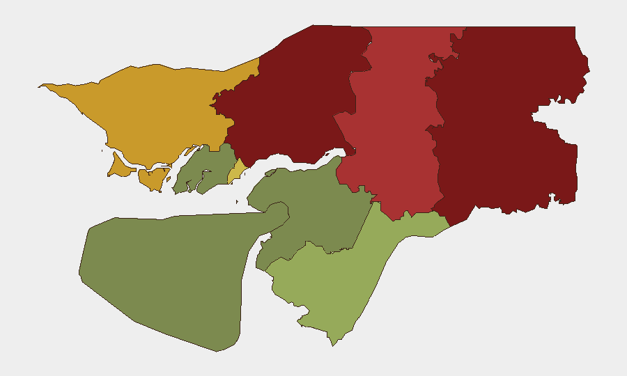
Situation Summary
Guinea-Bissau remains in a period of political and institutional fragility with no verified security incidents, armed clashes, or street unrest reported in the last 24–48 hours. Underlying tensions persist around judicial authority, military-civilian relations, and unresolved diplomatic friction with Cape Verde, but the immediate security environment shows no acute deterioration. The country's composite threat score remains elevated (9/100), reflecting chronic structural vulnerabilities rather than imminent operational risk.
Key Developments
No significant security incidents, protests, armed clashes, or infrastructure disruptions were verified in Guinea-Bissau during the 24–48 hour reporting window (31 July–1 August 2026). Open-source monitoring detected no new border frictions, detention orders, or movement restrictions. Diplomatic tensions with Cape Verde remain unresolved since the political freeze earlier in 2026, but no new retaliatory measures or cross-border incidents were reported. Routine law-enforcement activity and baseline political uncertainty continue without escalation.
Highest-Risk Areas
Gabu Region (risk 92) and Oio Region (risk 85) represent the country's highest-risk zones, likely driven by a combination of remote geography, limited state presence, cross-border trafficking vulnerabilities, and historical military activity. Bafatá Region (78) and Cacheu Region (72) follow, reflecting similar patterns of isolation and porous borders. Bissau Autonomous Sector (68), while lower-ranked than the northern regions, remains a focal point for political instability, detention activity, and security-force concentration. Southern regions (Tombali, Quinara, Bolama) present significantly lower risk profiles, suggesting that northern and central Guinea-Bissau merit prioritized monitoring for corporate assets, personnel, and supply-chain exposure.
How GeoBit Would Assist
Teams with personnel or assets in Guinea-Bissau should leverage AOI Monitoring & Early Warning to establish persistent watch over Bissau and high-risk northern regions (Gabu, Oio, Bafatá), with alerting configured for detention activity, security-force movements, or border incidents. Intel Sweep and multi-language OSINT (X/Twitter, Telegram, local radio) provide real-time signal on political developments, military statements, and street-level activity without reliance on delayed official reporting. Network & Actor Analysis can map judicial, military, and political factions to forecast flashpoints around institutional power struggles and inform duty-of-care decisions on travel, relocation, or operational continuity.
7-Day Outlook
No imminent security escalation is anticipated over the next week absent new political shocks or border incidents. Routine institutional friction between civilian and military leadership and unresolved Cape Verde tensions will likely persist. Corporate teams should maintain current security posture and enhance monitoring of northern regions and Bissau; evacuation or lockdown is not warranted based on current intelligence, but contingency planning remains prudent.
Highest-Risk Areas — Ranked
| # | State / Region | Risk |
|---|---|---|
| 1 | Gabu Region | 92 |
| 2 | Oio Region | 85 |
| 3 | Bafatá Region | 78 |
| 4 | Cacheu Region | 72 |
| 5 | Bissau Autonomous Sector | 68 |
| 6 | Tombali Region | 45 |
| 7 | Quinara Region | 38 |
| 8 | Biombo Region | 32 |
| 9 | Bolama Region | 15 |
Sources
Previous Daily Briefs
A new Guinea-Bissau brief is written every day — each with its own risk map and downloadable CSV. Here's the last week; use the calendar to go further back.
📅 Browse every day by calendar →
Highlighted days have a brief. Tap a day for that day's map & analysis, or “csv” for that day's dataset ($5).
Atlas — our AI intelligence desk — emails them this snapshot personally. Nothing else, no list.