Situation Summary
Indonesia maintains moderate security risk (rank #40 globally, composite score 49) with fragmented but concerning signals across institutional stability, armed separatism, and civil-space restriction. The most recent reliably dated incidents fall just outside the 24–48-hour window, reflecting sparse real-time open-source reporting; however, confirmed developments through mid-July point to sustained tension between security forces and armed groups in Papua, institutional friction within the state apparatus in Jakarta, and tightening restrictions on political expression. Risk trajectory remains elevated in Jakarta and Papua, with secondary concern in West Java.
Key Developments
- Jakarta institutional friction (8–10 July, confirmed): Indonesian National Police corruption units raided 12+ locations linked to Deputy Attorney General Febrie Adriansyah, seizing ~74 kg gold and US$26–27 million in cash. Military units subsequently guarded the prosecutor's residence, signaling elite-level power struggle within state institutions and risk of further politically motivated investigations and public unrest around legal establishments.
- Yahukimo Regency, Papua Highlands (4 July, confirmed): Armed separatists attacked a civilian aircraft at Ipdeheik airstrip, shot and killed American pilot Nicholas F. Goselin, and burned the plane. Seven Papuan passengers survived; Indonesian security forces launched pursuit operations for seven suspected group members. Demonstrates direct targeting of aviation assets and foreign nationals in remote highlands.
- Intan Jaya Regency, Central Papua (2–4 July, confirmed): Four civilians killed in clashes between Indonesian forces and pro-independence armed group, including a pregnant woman (Melkiana Duwitau, Wandoga village, 2 July) and a 20-year-old evangelist. Local and international monitors report security forces targeting civilians; displacement and security operations continuing into mid-July.
- Central Papua displacement surge (26–27 June, confirmed): Indonesian military operations including drone strikes displaced ~3,000 people from Agisiga-area villages in Intan Jaya, with four civilian deaths, four injuries, and houses burned. IDPs integrating into larger protracted displacement crisis; humanitarian access remains restricted.
- Multi-city documentary suppression (early July, confirmed): Police and military personnel shut down screenings of *Pig Feast: Colonialism in Our Times* in Jakarta and other venues, labeling it anti-government. Part of wider tightening of civil-society space and political expression, particularly around West Papua issues; elevated risk of event disruption and selective detentions at rights-related gatherings.
- Papua regional security operations (ongoing, confirmed through early July): Expanded military operations across Papua/Yahukimo/Intan Jaya regencies following 4 July Yahukimo attack and Intan Jaya civilian killings; operations likely continuing into mid-July with ongoing pursuit of separatist elements and risk of secondary civilian casualties.
Highest-Risk Areas
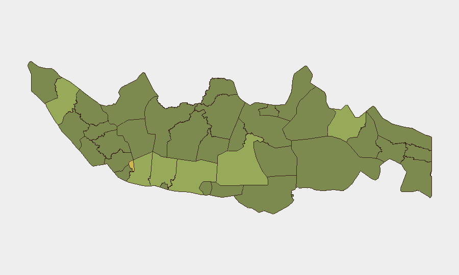
Jakarta (64.5) and West Java (58.1) dominate institutional and urban security risk, driven by anti-corruption investigations, elite power friction, and demonstrated police–military coordination tensions. Papua-region regencies—particularly Intan Jaya, Yahukimo, and Southwest Papua (41.8)—face armed-conflict and human-rights risk from intensified security operations, separatist activity targeting civilians and foreign nationals, and large-scale displacement. Central Java (45.4) and East Java (43.6) register secondary concern, likely reflecting protest activity and broader criminality linked to Jakarta institutional instability spillover.
How GeoBit Would Assist
Security teams would deploy AOI Monitoring & Early Warning on Jakarta legal institutions, airfields in Papua highlands, and displacement zones in Intan Jaya to detect operational tempo changes and pursuit movements. Network & Actor Analysis on separatist and state-security entities, combined with OSINT fusion (X/Telegram feeds, local reporting, humanitarian channels), would enable tracking of elite-level power struggles and armed-group coordination. Routing & Network Analysis supports alternative-journey planning for personnel in Papua and Jakarta, circumventing high-risk airstrips and institutional flashpoints.
7-Day Outlook
Continued security-force operations in Papua will likely generate secondary civilian casualties and displacement through late July. Jakarta's institutional friction may trigger additional high-profile investigations or public demonstrations. Political expression remains constrained; aviation and ground movement in Papua highlands carry elevated targeting risk. No major de-escalation signals are evident.
Highest-Risk Areas — Ranked
| # | State / Region | Risk |
|---|---|---|
| 1 | Special capital Region of Jakarta | 64.5 |
| 2 | West Java | 58.1 |
| 3 | Central Java | 45.4 |
| 4 | East Java | 43.6 |
| 5 | North Sumatra | 42.2 |
| 6 | Southwest Papua | 41.8 |
| 7 | South Sulawesi | 41.1 |
| 8 | East Kalimantan | 38.1 |
| 9 | Special Region of Yogyakarta | 37.9 |
| 10 | Riau | 37.5 |
| 11 | Bengkulu | 36.6 |
| 12 | West Kalimantan | 36.6 |
Sources
Previous Daily Briefs
A new Indonesia brief is written every day — each with its own risk map and downloadable CSV. Here's the last week; use the calendar to go further back.
📅 Browse every day by calendar →
Highlighted days have a brief. Tap a day for that day's map & analysis, or “csv” for that day's dataset ($5).
Atlas — our AI intelligence desk — emails them this snapshot personally. Nothing else, no list.