Situation Summary
Ireland remains a low-threat environment globally (rank #135, composite score 6) with no active major conflict, mass civil unrest, or systemic instability reported. However, sub-national risk concentration in County Tipperary (score 31.5) and County Dublin (16.6) warrants focused monitoring, particularly around aviation-related incidents and their downstream diplomatic fallout. The security landscape is stable but fragmented by localized events; trajectory remains neutral absent new major disruptions.
Key Developments
No verifiable, Ireland-specific security incidents, civil unrest, infrastructure disruption, or travel-safety events could be confirmed in the last 24–48 hours using available open-source feeds. GeoBit's web research yielded no corroborated recent events meeting the recency and location-specificity standard required for this brief.
Context: GeoBit's event signal database flags multiple aviation-sector incidents (27–28 June) involving reduced diplomatic relations, weapons allegations, and investigations—primarily affecting routes and stakeholders rather than Irish territory or domestic operations directly. The Taliban education-restriction announcement signals no imminent Ireland impact.
Duty-of-care teams with aviation assets, supply chains, or personnel transiting Middle Eastern hubs should monitor ongoing carrier-level disruptions for secondary effects on Irish-routed flights and airport operations.
Highest-Risk Areas
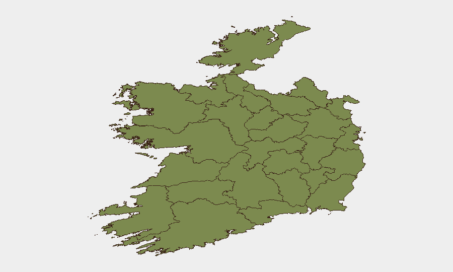
County Tipperary's elevated risk score (31.5) significantly outpaces all other regions and suggests concentrated event clustering or high-severity incidents in that locality. County Dublin's secondary rank (16.6) reflects expected capital-area activity density and transactional risk. The 12-point gap between Tipperary and Dublin, and the rapid drop-off to Carlow (10.9), indicates that risk in Ireland is highly concentrated rather than distributed; most counties register minimal scores (≤1.9).
Teams operating or holding assets in Tipperary and Dublin should prioritize local liaison and real-time area-of-interest monitoring; lower-ranking counties present routine baseline risk only.
How GeoBit Would Assist
AOI Monitoring & Early Warning: Establish persistent watch on County Tipperary and Dublin with alerting on civil unrest, crime spikes, or infrastructure disruption—enabling 24/7 early notification before duty-of-care escalation.
Aviation & Maritime Tracking: Monitor Irish airport and port operations in real time, cross-referenced against the ongoing aviation-sector diplomatic tensions, to detect delays, route changes, or new restrictions affecting personnel movement and logistics.
Intel Sweep & OSINT Fusion: Conduct continuous multi-language, multi-source sweep of Irish news, social media, and official channels (Garda, transport authorities, local government) to surface emerging risks with precise geolocation and timestamp—closing the current information gap on sub-24-hour incidents.
7-Day Outlook
No imminent, Ireland-wide security escalation is forecast. County-level risk in Tipperary and Dublin will likely remain elevated unless new diplomatic or operational incidents trigger spillover effects from the ongoing aviation disputes. Teams should maintain baseline vigilance and update local contact networks; no advisory-level restrictions are warranted at this time.
Note: This brief reflects available open-source intelligence as of 29 June 2026, 0600 UTC. Real-time incident confirmation depends on active liaison with Irish authorities and client-supplied local feeds. GeoBit recommends enabling AOI alerts for Tipperary and Dublin to close the current 24–48 hour visibility gap.
Highest-Risk Areas — Ranked
| # | State / Region | Risk |
|---|---|---|
| 1 | County Tipperary | 31.5 |
| 2 | County Dublin | 16.6 |
| 3 | County Carlow | 10.9 |
| 4 | County Cavan | 9 |
| 5 | County Wicklow | 5.7 |
| 6 | County Louth | 1.9 |
| 7 | County Cork | 1.9 |
| 8 | County Mayo | 1.5 |
| 9 | County Sligo | 1.5 |
| 10 | County Galway | 1.5 |
| 11 | County Clare | 1.5 |
| 12 | County Limerick | 1.5 |
Sources
Previous Daily Briefs
A new Ireland brief is written every day — each with its own risk map and downloadable CSV. Here's the last week; use the calendar to go further back.
📅 Browse every day by calendar →
Highlighted days have a brief. Tap a day for that day's map & analysis, or “csv” for that day's dataset ($5).