Situation Summary
Jordan experienced a significant external military threat on July 9–10, 2026, when Iran launched ballistic missiles and drones toward Jordanian territory, including targeting the strategic Muwaffaq Al-Salti Air Base. Jordanian air defenses and the Royal Air Force successfully intercepted all incoming threats, with no confirmed casualties or material damage reported, though debris fell in populated areas near Amman. The incident triggered emergency protocols, including U.S. Embassy shelter-in-place directives and kingdom-wide air-raid sirens. Jordan's overall threat profile (rank #58 globally) remains contained, but the attack signals heightened regional volatility and a renewed risk of secondary escalation.
Key Developments
- Amman & Muwaffaq Al-Salti Air Base, July 9, 2026 – Iran conducted ballistic missile and drone strikes on Jordanian territory. Jordanian air defenses and Royal Air Force jets engaged and intercepted all incoming munitions; no casualties or confirmed damage reported. Debris fell near the capital and other population centers.
- Amman, July 9, 2026 – U.S. Embassy issued emergency security alert directing all personnel and U.S. citizens to shelter in place, seek overhead cover, and monitor local authorities during the airspace incursion.
- Kingdom-wide, July 9, 2026 – Air-raid sirens sounded across multiple cities. Videos on social media documented interception events and explosions; local authorities issued guidance urging the public to rely only on official information.
- Amman (government statements), July 9–10, 2026 – Jordanian officials publicly condemned the Iranian strikes as a serious escalation, a violation of sovereignty, and a threat to regional security and civilian safety.
- Multiple locations, early July 9, 2026 – Minor property damage reported at several impact sites from missile debris; no injuries recorded.
Highest-Risk Areas
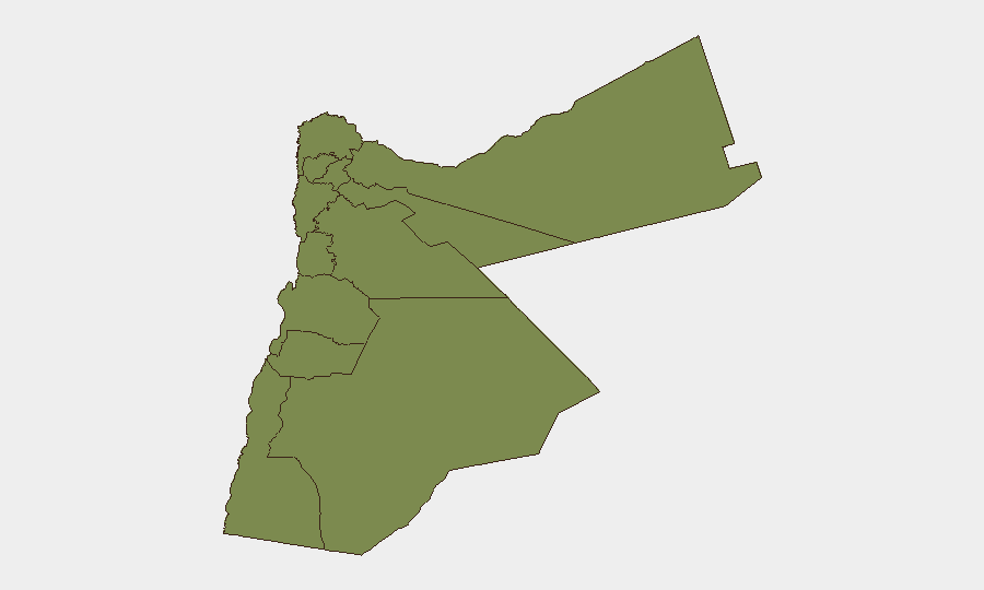
Karak (composite risk 31.5) is the standout highest-risk governorate, more than 2.5 times the risk of Zarqa (12.1), the second-ranked region. The concentration of risk in Karak warrants investigation into local drivers—whether border proximity, militant activity, weapons trafficking, or criminality. Zarqa's secondary elevation may reflect its industrial zone and proximity to Baghdad; all other governorates cluster at baseline (1.5), including Amman. Security teams with operations or personnel in Karak should confirm situational awareness and contingency access to cover, medical, and evacuation routes.
How GeoBit Would Assist
Teams securing Jordan operations should use Intel Sweep and global event feeds to monitor evolving Iranian and regional actor statements for signals of follow-on strikes or sustained pressure campaigns. AOI Monitoring & Early Warning on Karak, Zarqa, military bases, and diplomatic quarters will alert to protest, armed mobilization, or security force activity within hours of onset. Conflict & Military (battle mapping, force-structure, weapons-capability tracking) and Satellite & Imagery analysis will establish baseline air-defense posture and early detection of preparations for secondary threats, while Routing & Network Analysis will support contingency evacuation and personnel movement in contested or debris-affected areas.
7-Day Outlook
Immediate risk of secondary Iranian strikes remains low given successful Jordanian interception, but diplomatic and social-media rhetoric will likely intensify, raising the risk of crowd action or secondary security responses in or near Amman and Zarqa. Monitor for Israeli or U.S.-aligned counter-measures in the region, which could reignite tensions. Karak's elevated baseline risk should remain under close watch; confirm real-time intelligence feeds and liaison with local security contacts.
Highest-Risk Areas — Ranked
| # | State / Region | Risk |
|---|---|---|
| 1 | Karak | 31.5 |
| 2 | Zarqa | 12.1 |
| 3 | Irbid | 1.5 |
| 4 | Ajlun | 1.5 |
| 5 | Balqa | 1.5 |
| 6 | Jarash | 1.5 |
| 7 | Mafraq | 1.5 |
| 8 | Madaba | 1.5 |
| 9 | Amman | 1.5 |
| 10 | Tafilah | 1.5 |
| 11 | Aqaba | 1.5 |
| 12 | Maan | 1.5 |
Sources
Previous Daily Briefs
A new Jordan brief is written every day — each with its own risk map and downloadable CSV. Here's the last week; use the calendar to go further back.
📅 Browse every day by calendar →
Highlighted days have a brief. Tap a day for that day's map & analysis, or “csv” for that day's dataset ($5).
Atlas — our AI intelligence desk — emails them this snapshot personally. Nothing else, no list.