Situation Summary
Liberia's national security environment remains stable with no reported kinetic incidents, armed conflict, or major civil unrest in the past 24–48 hours. The country ranks #99 globally on composite threat score (10/100) with 20 tracked events, reflecting moderate underlying governance, health-security, and border-surveillance challenges rather than active armed violence. Sub-national risk is heavily concentrated in two southeastern counties—Grand Gedeh and Grand Bassa—where organized crime and territorial disputes drive elevated threat scores, while the capital and most populated areas remain quiet.
Key Developments
- Ganta City, Nimba County (14 July): An unidentified male, believed to be in his late 40s, was found deceased on a market table in LPRC Zone 3 after lying motionless for several hours; police responded and no foul play has been confirmed to date.
- Monrovia—Palm Grove Cemetery (through 14 July): The Monrovia City Corporation conducted intensified cleanup and "transformation" operations ahead of Independence Day celebrations, resulting in increased municipal presence and potential short-term traffic and access disruptions around the cemetery.
- National road corridors, including Lofa County (as of 14 July): A Joint Inspection Team from the Ministries of Public Works and Agriculture began field inspections of ongoing road projects, implying intermittent infrastructure work zones and potential travel delays rather than security incidents.
- Border surveillance (14 July): The National Public Health Institute of Liberia confirmed the country remains Ebola-free but reiterated "significant weaknesses" in border-crossing surveillance, emergency response capacity, laboratory capability, and logistics—indicating *structural health-security risk* at frontier checkpoints despite absence of active outbreak.
- Liberia-flagged maritime assets (recent, off Oman): Three Liberia-flagged tankers (*AL BAHYAH, MOMBASA B, STOLT MAGNESIUM*) were attacked off Musandam and South Al Sharqiyah, resulting in crew injuries, fire, and evacuations; this represents maritime risk to Liberian-registered shipping, not territorial Liberian security.
- No major incidents reported: Open-source monitoring and recent risk briefs explicitly note an absence of protests, riots, political violence, major organized crime events, or infrastructure sabotage within Liberia in the past 24–48 hours.
Highest-Risk Areas
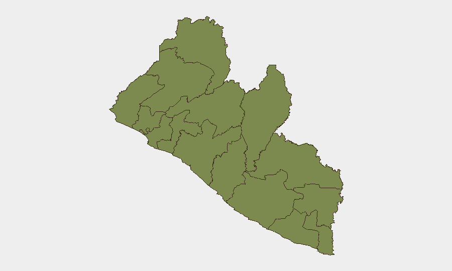
Grand Gedeh County (composite risk 31.8) and Grand Bassa County (22.8) account for the vast majority of sub-national threat concentration, driven by organized crime activity, land disputes, and limited state presence. These southeastern counties represent ~79 percent of the country's aggregated regional risk score and warrant focused monitoring and asset-protection measures. By contrast, Montserrado County (Monrovia; risk 2.3) and all other regions score below 2.0, indicating that capital-based and northern operations face substantially lower risk profiles than remote southeastern territories.
How GeoBit Would Assist
Security teams operating in Liberia would benefit from persistent AOI monitoring and early warning on Grand Gedeh and Grand Bassa Counties to detect organized-crime activity, trafficking routes, and territorial disputes in near real time. Conflict and crime-specific search and OSINT fusion—including Telegram, X, and local-language monitoring—would provide early detection of emerging political statements, public grievances, or criminal coordination before escalation. GIS and spatial analysis, combined with routing and network analysis, would enable secure journey planning and alternative-route identification for staff and asset movement in high-risk zones.
7-Day Outlook
No imminent escalation of armed conflict or mass civil unrest is anticipated in the next seven days. Routine governance and health-security deficiencies will persist, particularly at border crossings; Independence Day observances (mid-July) may temporarily increase municipal activity in Monrovia but pose no identified security threat. Continued focus on narcotics enforcement and land-use disputes in Grand Gedeh and Grand Bassa should be expected.
Highest-Risk Areas — Ranked
| # | State / Region | Risk |
|---|---|---|
| 1 | Grand Gedeh County | 31.8 |
| 2 | Grand Bassa County | 22.8 |
| 3 | Grand Cape Mount County | 5.6 |
| 4 | Montserrado County | 2.3 |
| 5 | Lofa County | 1.8 |
| 6 | Gbarpolu County | 1.8 |
| 7 | Bomi County | 1.8 |
| 8 | Margibi County | 1.8 |
| 9 | Bong County | 1.8 |
| 10 | Rivercess County | 1.8 |
| 11 | Nimba County | 1.8 |
| 12 | Sinoe County | 1.8 |
Sources
Previous Daily Briefs
A new Liberia brief is written every day — each with its own risk map and downloadable CSV. Here's the last week; use the calendar to go further back.
📅 Browse every day by calendar →
Highlighted days have a brief. Tap a day for that day's map & analysis, or “csv” for that day's dataset ($5).
Atlas — our AI intelligence desk — emails them this snapshot personally. Nothing else, no list.