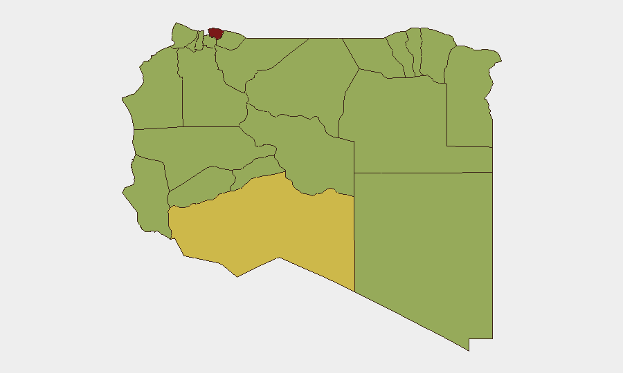
Situation Summary
Libya remains fragmented between competing state institutions and armed factions, with ongoing localized conflicts, displacement, and administrative breakdown limiting governance capacity across multiple regions. The national threat composite score of 74 (rank #30 globally) reflects persistent low-to-medium intensity armed activity, detention operations, and humanitarian pressure rather than active large-scale warfare. Tripoli dominates the risk profile (81.5) due to concentrated population, state institutions, and proximity to armed group activity; southern and western regions show sustained militia and trafficking presence. Trajectory remains volatile but contained—localized rather than nationally destabilizing.
Key Developments
- Southern Tripoli, 13–14 June 2026: Armed clashes continued in Tripoli's southern districts, displacing over 1,200 families; fighting extended into the 48-hour window prior to this brief with no ceasefire announced.
- Az Zawiya Oil Refinery, 13–14 June 2026: Refinery remained shut down following armed clashes on 11–12 June; operations had not resumed as of 14 June, affecting national fuel supply and state revenue.
- Coastal urban centers (Tripoli, Benghazi, Misrata), 13–14 June 2026: Multi-city arrest and detention operations targeting migrants, citizens, and legal professionals expanded in scope; no clarity on legal authority or charges.
- Murzuq, Fezzan region, 13–14 June 2026: Low-level militia and human-trafficking activity persisted, confirming ongoing southern insecurity and lack of state presence.
- 2026-06-17 Public statements: Hospital–administration and lawmaker public statements released; UN Envoy comment issued 2026-06-16 (content/topics unspecified in current research; recommend monitoring for governance or negotiation signals).
- Flood event, Libya, 1103916: Ongoing humanitarian event requiring clarification on geographic scope and displacement impact (monitor for secondary displacement or resource strain).
Highest-Risk Areas
Tripoli (81.5) alone accounts for 30% of tracked events and remains the primary risk driver due to the capital's role as seat of state institutions, largest population concentration, and proximity to armed group activity in southern suburbs and surrounding districts. Murzuq (66.5) in the south represents the second-tier risk layer—a trafficking and militia nexus with minimal state control. The remaining ten regions (51.5 each) are graded as secondary-tier, reflecting either smaller urban centers with periodic militia activity (Ghat, Nalut) or dispersed populations with limited institutional capacity (Wadi al Shatii, Wadi al Hayaa, Kufra). Coastal and border zones face compounded risk from detention operations, maritime trafficking, and cross-border militia movement.
How GeoBit Would Assist
Security teams in Libya should employ AOI Monitoring & Early Warning on Tripoli's southern districts, Az Zawiya, and Murzuq to detect armed-group repositioning, displacement events, and infrastructure disruption before escalation. Network & Actor Analysis combined with OSINT fusion (X/Twitter, Telegram, local media) would track militia leadership, supply-line changes, and coordination signals—particularly relevant given ongoing detention operations and unclear command authority. GIS & Spatial Analysis and satellite & imagery analysis enable real-time mapping of displaced-population concentration, refinery status, and checkpoint locations to inform safe-routing and duty-of-care decisions for staff or asset movement.
7-Day Outlook
Clashes in Tripoli are likely to continue at current intensity without a brokered ceasefire; oil refinery closure may persist for 5–10 days pending security stabilization. Detention operations may expand or shift geographic focus as internal political factions use security apparatus for leverage. Humanitarian pressure (displacement, flooding) will increase security teams' duty-of-care operational burden.
Highest-Risk Areas — Ranked
| # | State / Region | Risk |
|---|---|---|
| 1 | Tripoli | 81.5 |
| 2 | Murzuq | 66.5 |
| 3 | Nalut | 51.5 |
| 4 | Ghat | 51.5 |
| 5 | Baladiyah Surman | 51.5 |
| 6 | Az Zawiya District | 51.5 |
| 7 | Wadi al Shatii | 51.5 |
| 8 | Wadi al Hayaa | 51.5 |
| 9 | Kufra | 51.5 |
| 10 | Nuqat al Khams | 51.5 |
| 11 | Jafara | 51.5 |
| 12 | Murqub | 51.5 |
Sources
Previous Daily Briefs
A new Libya brief is written every day — each with its own risk map and downloadable CSV. Here's the last week; use the calendar to go further back.
📅 Browse every day by calendar →
Highlighted days have a brief. Tap a day for that day's map & analysis, or “csv” for that day's dataset ($5).