Situation Summary
Malawi remains a low-intensity threat environment (#148 globally) with persistent but manageable crime risk and no active armed conflict. However, the country faces acute humanitarian and social-stability pressures from an ongoing repatriation crisis: nearly 40,000 Malawian nationals have returned from South Africa since early June following anti-immigrant violence, with approximately 1,000 additional people currently stranded at the Johannesburg consulate. Domestically, political tensions have surfaced around alleged corruption in high-level appointments and contested constitutional amendments, creating information-space volatility that could escalate if public grievance hardens into organized mobilization.
Key Developments
- Lilongwe (Office of the President & Cabinet), 14 July 2026 – Chief Secretary Justin Saidi issued a formal public denial of allegations that South African businessman Zunaid Moti had been secretly appointed to a diplomatic role with preferential access to government contracts and mining licenses. The statement signals active elite-level controversy and reputational risk in the information space.
- Johannesburg (Malawian Consulate, impact on Malawi), 13–14 July 2026 – Approximately 1,000 Malawian nationals remain stranded outside the consulate, many sleeping outdoors, with 100–300 additional arrivals daily. Limited government support has prompted NGOs and churches to coordinate repatriation; the flow represents sustained humanitarian pressure on Malawi's reception capacity.
- South Africa–Malawi (national), updated reporting 10–11 July 2026 – South African authorities confirmed that 53,449 foreign nationals have been processed for deportation/repatriation since mid-June, with Malawians comprising over 80% of that cohort. This follows official Malawi Department of Disaster Management figures of 38,094 repatriated nationals between 7 June–8 July, with six deaths during transit.
- Malawi (national politics), 13 July 2026 – Human rights activist Redson Munlo publicly warned of alleged secret parliamentary meetings aimed at extending MPs' terms from five to seven years without a referendum, calling for citizen vigilance. No protests reported yet, but the statement flags latent constitutional-change risk.
- Malawi (travel security environment), mid-July 2026 advisory – Australian government travel advice continues to recommend "exercise a high degree of caution" due to persistent violent crime threat, with reference to local emergency numbers. This reflects underlying street-crime risk that remains independent of current political events.
Highest-Risk Areas
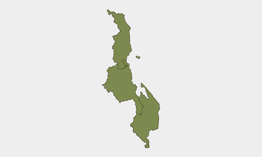
The Central Region dominates sub-national risk (31.5), driven primarily by Lilongwe's concentration of government, diplomatic, and commercial activity. The spike reflects information-space friction (corruption allegations, constitutional controversy) rather than violent incident clustering. Southern and Northern Regions carry equivalent baseline risk (1.5 each), consistent with lower-intensity crime and political activity; however, Southern Region's urban centers (Blantyre, Zomba) remain vulnerable to property crime and gang activity. The Central–Southern divide suggests that elite-level political instability and reputational shocks are concentrating risk at the national capital, while street-level security threats remain distributed across urban areas nationwide.
How GeoBit Would Assist
Security teams should deploy AOI Monitoring & Early Warning on Lilongwe government and opposition spaces to detect protest mobilization around the constitutional-amendment controversy before escalation. Multi-language OSINT and X/Twitter sentiment analysis will track public and activist narratives on corruption and parliamentary term-extension, providing early signals of polarization. Humanitarian & NGO data integration combined with border & network analysis should be used to monitor repatriation flows and returnee absorption capacity, identifying secondary displacement or tension points in receiving communities.
7-Day Outlook
No major security incident is anticipated in the immediate week. However, continued repatriation inflows and political messaging around the alleged Moti appointment and parliamentary terms may sustain low-level public agitation and social-media controversy. Monitoring for protest announcements, civil-society statements, and any signs of organized opposition mobilization will be essential to detect threshold shifts.
Highest-Risk Areas — Ranked
| # | State / Region | Risk |
|---|---|---|
| 1 | Central Region, Malawi | 31.5 |
| 2 | Southern Region, Malawi | 1.5 |
| 3 | Northern Region, Malawi | 1.5 |
Sources
Previous Daily Briefs
A new Malawi brief is written every day — each with its own risk map and downloadable CSV. Here's the last week; use the calendar to go further back.
📅 Browse every day by calendar →
Highlighted days have a brief. Tap a day for that day's map & analysis, or “csv” for that day's dataset ($5).
Atlas — our AI intelligence desk — emails them this snapshot personally. Nothing else, no list.