Situation Summary
Oman remains a relatively stable operating environment (global rank #144, composite threat score 6), but maritime security risk has escalated sharply in the Strait of Hormuz and Gulf of Oman over the past 48 hours, driven by multiple tanker attacks, crew injuries, and IRGC special-forces positioning along transit corridors. Onshore security is localized and routine—minor crime arrests in Muscat—with no indication of civil unrest or domestic political instability. The current threat is concentrated in maritime zones adjacent to Oman's coast rather than inland territory.
Key Developments
- Strait of Hormuz, Musandam coast (northern Oman) – June 30, 2026. An oil tanker was attacked with at least four crew injuries and full evacuation of 20 personnel, marking the most significant incident in the current maritime escalation cycle.
- Gulf of Oman, Oman coastal waters – June 30, 2026. A Singapore-flagged cargo vessel transiting near Oman's coast sustained bridge damage from a projectile or drone strike with no reported casualties, consistent with a 48-hour pattern of attacks.
- Gulf of Oman, Oman-adjacent waters – June 29–30, 2026. Two tanker attacks within 48 hours involved Indian crew members, with at least two reported missing persons, creating crew safety and operational disruption risks.
- Strait of Hormuz, Oman-side southern route – late June 2026, position updated June 30. The IRGC has deployed special forces with land, naval, and aerial intelligence systems along Iran's Persian Gulf coast to monitor and warn vessels using the Oman-side transit corridor, signaling intent to exert control over a route Oman and the U.S. are working to expand.
- UN IMO evacuation plan suspension – June 30, 2026. The International Maritime Organization suspended its Strait of Hormuz evacuation plan citing inadequate security guarantees, while Oman announced temporary authorized coastal sea routes coordinated with international maritime bodies.
- Iran–Oman maritime fee negotiations – June 30, 2026. Reports indicate disagreement over mandatory vs. voluntary "service payments" from transiting ships, creating regulatory and compliance uncertainty for vessels using Omani ports and coastal routing.
- Amerat, Muscat Governorate – July 3–4, 2026. Royal Oman Police arrested one individual for vandalism and theft at a commercial shop; routine localized crime with no broader security implication.
Highest-Risk Areas
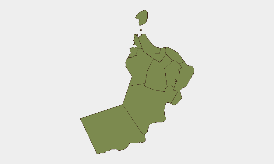
Al Wusta Governorate drives the national risk ranking by a substantial margin (31.4 vs. Dhofar's 2.6), though recent event data does not specify incidents in Al Wusta by name. The risk concentration reflects the governorate's remote southern position and historical governance challenges. Dhofar (risk 2.6) and the ten other governorates cluster near baseline (1.4 each), with Muscat—the capital and largest economic hub—among the lowest-risk zones. Maritime risk adjacent to Musandam Governorate and Oman's northern coast is acute but operationally distinct from subnational governance risk.
How GeoBit Would Assist
Security teams should deploy Maritime & Aviation tracking with AOI Monitoring & Early Warning on the Strait of Hormuz and Gulf of Oman to detect vessel attacks, crew incidents, and IRGC positioning in real time. OSINT fusion (X, Telegram, maritime incident feeds, and multi-language news sources) combined with Network & Actor Analysis would track IRGC special-forces deployments and Iranian negotiating posture on transit fees. Routing & Network Analysis capability supports alternative corridor planning for supply chains and personnel movements avoiding high-risk maritime zones.
7-Day Outlook
Maritime attack frequency and IRGC operational posture are likely to remain elevated through early July as regional tensions persist over Strait of Hormuz transit control. Onshore Oman will likely remain stable absent major escalation. Shipping firms and logistics operators should expect continued route disruptions and fee-negotiation uncertainty affecting Omani port operations.
Highest-Risk Areas — Ranked
| # | State / Region | Risk |
|---|---|---|
| 1 | Al Wusta Governorate | 31.4 |
| 2 | Dhofar Governorate | 2.6 |
| 3 | Muscat Governorate | 1.4 |
| 4 | Al Buraymi Governorate | 1.4 |
| 5 | Ad Dhahirah Governorate | 1.4 |
| 6 | Musandam Governorate | 1.4 |
| 7 | Al Batinah North Governorate | 1.4 |
| 8 | Al Batinah South Governorate | 1.4 |
| 9 | Ad Dakhiliyah Governorate | 1.4 |
| 10 | Ash Sharqiyah North Governorate | 1.4 |
| 11 | Ash Sharqiyah South Governorate | 1.4 |
Sources
Previous Daily Briefs
A new Oman brief is written every day — each with its own risk map and downloadable CSV. Here's the last week; use the calendar to go further back.
📅 Browse every day by calendar →
Highlighted days have a brief. Tap a day for that day's map & analysis, or “csv” for that day's dataset ($5).
Atlas — our AI intelligence desk — emails them this snapshot personally. Nothing else, no list.