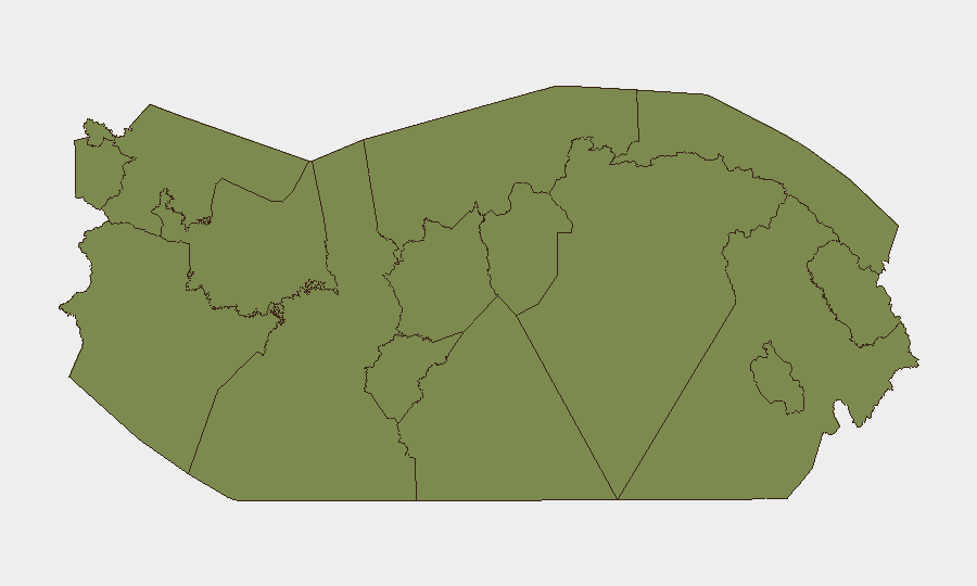
Situation Summary
Panama maintains composite threat ranking #56 globally (score 26) with 31 tracked events, reflecting sustained pressure from organized crime, trafficking networks, and localized gang violence rather than systemic state instability. Security operations have intensified across major urban centers and transit corridors over the past 72 hours, with law enforcement conducting large-scale arrests and weapons seizures under coordinated police initiatives. Colón Province—registering risk score 31.7—dominates the threat landscape and accounts for disproportionate violent-crime incidents, while Panama City and Canal Zone remain relatively controlled but under elevated police presence. Environmental factors (heavy rains, heat, Saharan dust) are now compounding routine travel and operational risk.
Key Developments
- Panama City, Juan B. Sosa school area (Panama Viejo) – 2026-07-17/18: Police responded to a shooting with multiple gunshots near the school, detained two suspects, seized two firearms, and reinforced tactical deployments in Panama Viejo and adjacent sectors to remove illegal weapons.
- Colón City, Parque 5 de Noviembre – early morning, recent Sunday (2026-07-14 or 2026-07-21, last 24–48h): A 15–17-year-old male was shot multiple times around 3:00 a.m. by armed attackers in black near the central park; victim evacuated to Hospital Dr. Manuel Amador Guerrero; police cordoned scene and launched criminal investigation.
- Sabanitas, Colón province – morning following Colón shooting (last 24–48h): Police apprehended at least one suspect linked to the minor's shooting; investigative and patrol operations continue in adjacent sectors.
- Panama City – Plan Firmeza police operation (2026-07-18, last 24h): National Police reported 172 arrests nationwide (124 on judicial warrants, 21 in flagrante, 38 administrative, 8 micro-trafficking-linked); 41 search raids, 3 firearms seized, 3 stolen vehicles recovered, 1,242 traffic fines issued, 116 vehicles towed.
- Panama City & Canal Zone – Operación Escudo Negro 2.0 launch (2026-07-17, within last 48h): SPI deployed ~500 security personnel to reinforce protection of government facilities and strategic infrastructure including Panama Canal and critical state assets.
- Panama (national) – concurrent environmental alerts (2026-07-17/18, last 24–48h): Heavy rains, extreme heat, strong coastal swells, and 3-day Saharan dust presence reported; official surveillance notices issued; affects air quality, road safety, and coastal transit.
Highest-Risk Areas
Colón Province (risk 31.7) is the primary driver of Panama's threat score, exhibiting acute gang violence, armed assault, and trafficking activity. The mid-week shooting of a minor in central Colón and follow-up police operations underscore sustained criminal competition and limited institutional capacity in peripheral urban zones. Panamá Province (risk 7.9)—which includes Panama City and the Canal Zone—registers secondary but significant risk; however, coordinated police operations (Plan Firmeza, Escudo Negro 2.0) demonstrate active state response and relative stabilization of critical infrastructure corridors. Remaining provinces (Darién, Bocas del Toro, Guna Yala, indigenous territories) score uniformly low (1.7) but reflect data sparsity and remote geography rather than verified safety.
How GeoBit Would Assist
Security teams should deploy AOI Monitoring & Early Warning on Colón City, Panama Viejo, and Canal Zone to detect emerging violence clusters and police operations in real time. OSINT Fusion (X/Twitter, Telegram, local news feeds) combined with Network & Actor Analysis would identify trafficking networks and gang leadership responding to current enforcement pressure. Routing & Network Analysis supports duty-of-care teams in real-time journey planning around active police cordons, weather hazards, and high-incident zones.
7-Day Outlook
Intensified police operations (Plan Firmeza, Escudo Negro 2.0) will likely continue, sustaining high arrest and seizure rates but also potentially displacing criminal activity to less-monitored peripheral zones. Colón Province violence is expected to remain elevated through the near term. Environmental hazards (dust, rains, coastal swells) will compound travel friction, particularly in Caribbean and coastal transit routes.
Highest-Risk Areas — Ranked
| # | State / Region | Risk |
|---|---|---|
| 1 | Colón | 31.7 |
| 2 | Panamá Province | 7.9 |
| 3 | Guna Yala | 1.7 |
| 4 | Darién | 1.7 |
| 5 | Emberá-Wounaan | 1.7 |
| 6 | Naso Tjër Di | 1.7 |
| 7 | Bocas del Toro | 1.7 |
| 8 | Ngäbe-Buglé | 1.7 |
| 9 | Chiriquí | 1.7 |
| 10 | Coclé | 1.7 |
| 11 | Panamá Oeste | 1.7 |
| 12 | Veraguas | 1.7 |
Sources
Previous Daily Briefs
A new Panama brief is written every day — each with its own risk map and downloadable CSV. Here's the last week; use the calendar to go further back.
📅 Browse every day by calendar →
Highlighted days have a brief. Tap a day for that day's map & analysis, or “csv” for that day's dataset ($5).
Atlas — our AI intelligence desk — emails them this snapshot personally. Nothing else, no list.