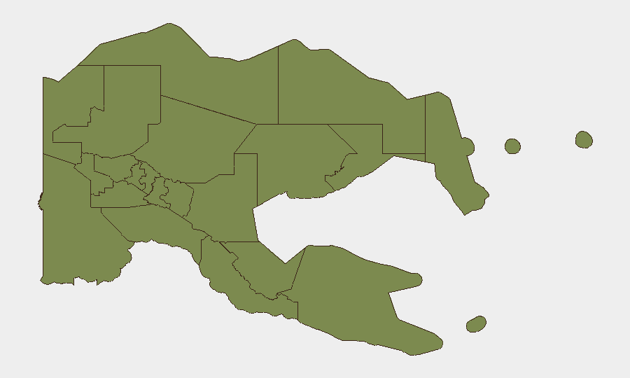
Situation Summary
Papua New Guinea remains at composite threat rank #110 globally with a score of 9/175 tracked events, indicating a moderate underlying security baseline but no acute crisis indicators in the current 24–48-hour window. The National Capital District (NCD) dominates risk exposure at 3.9× the country average, driven by persistent urban crime, gang activity, and civil-disorder potential; all other provinces cluster at substantially lower risk scores (1.9–3.0). No verified security incidents, conflict escalations, civil unrest, or infrastructure disruptions have been reported in the last 24–48 hours from multiple independent sources.
Key Developments
- No verified incidents in last 24–48 hours. Live web research across open-source security feeds, news wires, and social media did not yield any confirmed Papua New Guinea security events, civil unrest, crime spikes, political instability, or travel-risk incidents in the current reporting window.
- Baseline risk profile stable. Composite threat score and sub-national rankings remain consistent with historical trend; no escalation signals detected across monitored channels.
- NCD continues to dominate risk footprint. The National Capital District risk score (31.9) accounts for the overwhelming majority of national exposure; all other monitored provinces remain at or below score 3.0.
Highest-Risk Areas
The National Capital District—encompassing Port Moresby and surrounding urban centers—is the primary risk driver for any organization with PNG operations. Its composite risk score of 31.9 reflects endemic urban crime (armed robbery, carjacking, home invasion), gang-related violence, and episodic civil disorder; the concentration of government, finance, and expatriate populations amplifies consequence. Morobe Province (risk 3.0) is the secondary concern, though at one-tenth of NCD's risk level. All other provinces (Eastern Highlands, Southern Highlands, Gulf, Central, Oro, Manus, Madang, New Ireland, East and West New Britain) cluster at near-parity (1.9–2.4), indicating low differentiated risk and suggesting that national-level systemic issues—healthcare, logistics, regulatory stability—are more material than sub-provincial conflict or crime gradients.
How GeoBit Would Assist
Organizations with people or assets in PNG should leverage AOI Monitoring & Early Warning to establish persistent, automated watch over Port Moresby and key provincial centers, with alert triggers for crime, civil unrest, or infrastructure disruption. Intel Sweep, OSINT Fusion & Corroboration, and multi-language X/Twitter/Telegram monitoring will detect emerging incidents, rumor, and civil sentiment shifts in real time—critical for duty-of-care escalation in NCD. Risk & Threat Assessment alongside Network & Actor Analysis will map local criminal and political networks, informing site-hardening and personnel routing decisions; Routing & Network Analysis supports alternative journey planning to avoid high-risk urban corridors.
7-Day Outlook
No acute threat trajectory change is anticipated in the near term absent exogenous shocks (major political event, resource-sector disruption, or natural disaster). The NCD risk profile will remain the primary monitoring priority. Sustained baseline monitoring across OSINT, social sentiment, and sub-national incident feeds is the appropriate posture for ongoing duty-of-care compliance.
Highest-Risk Areas — Ranked
| # | State / Region | Risk |
|---|---|---|
| 1 | National Capital District | 31.9 |
| 2 | Morobe | 3 |
| 3 | Southern Highlands | 2.4 |
| 4 | Eastern Highlands | 1.9 |
| 5 | Gulf | 1.9 |
| 6 | Madang | 1.9 |
| 7 | Manus | 1.9 |
| 8 | West New Britain | 1.9 |
| 9 | New Ireland | 1.9 |
| 10 | East New Britain | 1.9 |
| 11 | Central | 1.9 |
| 12 | Oro | 1.9 |
Sources
Previous Daily Briefs
A new Papua New Guinea brief is written every day — each with its own risk map and downloadable CSV. Here's the last week; use the calendar to go further back.
📅 Browse every day by calendar →
Highlighted days have a brief. Tap a day for that day's map & analysis, or “csv” for that day's dataset ($5).