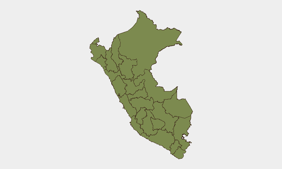
Situation Summary
Peru remains a moderate-risk environment (global rank #60; composite threat score 19) with fragmented security pressures across multiple sub-national zones rather than a unified national crisis. The dominant near-term risk is infrastructural—a nationwide 60-day state of emergency declared July 2 in response to El Niño-driven heavy rains affecting approximately 40% of the country—creating elevated risk of flooding, landslides, and transport disruption. No major verified security incidents (protest, terror, or large-scale crime) were independently corroborated in the past 24–48 hours, though lower-intensity event signals continue across police, commercial, and governance actors.
Key Developments
- Nationwide – July 2, 2026 – Government declared 60-day state of emergency across 796 districts due to imminent heavy rains and El Niño impacts, granting civil-defense and security authorities exceptional powers and creating elevated travel and logistics risk.
- Ayacucho, Cusco, Junín – July 2–3, 2026 – Emergency measures extended to these departments; civil-defense authorities activated for rainfall response and possible evacuation support.
- Multiple actors – July 3–5, 2026 – Recent event signals include police small-arms engagements (July 3), a firefighter investigation alert (July 5), and public statements from sovereign, government, and ecclesiastical figures; no unified incident narrative confirmed in open reporting.
- Huánuco region – Ongoing – Maintains highest sub-national composite risk (31.5) but no acute verified incident in the current 24–48 hour window; structural vulnerabilities to lower-scale disruption remain.
- Lima region – Ongoing – Second-highest sub-national risk (15.4); monitoring found no acute security incident in current window, though remains flagged for potential low-level disruption.
Highest-Risk Areas
Huánuco and Lima together account for the majority of Peru's tracked risk, with Huánuco's composite score (31.5) more than double that of Lima (15.4), indicating either higher underlying instability or greater event frequency in the central highlands. La Libertad (14.6) rounds out the high-risk tier. These three regions—spanning central and northern Peru—should be the primary focus for duty-of-care teams with personnel or assets on the ground. Piura (7.2) and Cajamarca (4.8) represent secondary but measurable risk zones. The clustering of risk in Huánuco and surrounding central regions reflects historical patterns of narcotics trafficking, informal mining, and indigenous-state tensions; current heavy rains may compound access and supply-chain challenges in these areas.
How GeoBit Would Assist
Security teams with Peru exposure would employ AOI Monitoring & Early Warning to establish persistent watches on Huánuco, Lima, and La Libertad for emerging protest activity, criminal incidents, or supply-chain disruption. Intel Sweep, multi-language OSINT, and Telegram/X monitoring would track real-time incident signals and actor communications, enabling faster verification of fragmented event reports. Routing & Network Analysis would help operations teams identify alternative supply and personnel routes around rain-affected districts and areas of elevated unrest. Satellite & Imagery analysis would assess infrastructure damage and road/bridge accessibility in isolated zones post-rainfall.
7-Day Outlook
The 60-day state of emergency will dominate near-term risk, with peak rainfall expected to drive localized flooding, landslide closures, and supply-chain delays through mid-to-late July, particularly in Ayacucho, Cusco, and Junín. Security incident frequency is not expected to spike materially, but logistics, telecommunications, and fuel availability may tighten in remote areas. Personnel and asset teams in Huánuco or high-altitude zones should anticipate reduced mobility and extended response times for 10–14 days.
Highest-Risk Areas — Ranked
| # | State / Region | Risk |
|---|---|---|
| 1 | Huánuco | 31.5 |
| 2 | Lima | 15.4 |
| 3 | La Libertad | 14.6 |
| 4 | Piura | 7.2 |
| 5 | Cajamarca | 4.8 |
| 6 | Apurímac | 3.1 |
| 7 | Junín | 2.1 |
| 8 | Loreto | 1.9 |
| 9 | constitucional del Callao Province | 1.9 |
| 10 | Tumbes | 1.5 |
| 11 | Lambayeque | 1.5 |
| 12 | Amazonas | 1.5 |
Sources
Previous Daily Briefs
A new Peru brief is written every day — each with its own risk map and downloadable CSV. Here's the last week; use the calendar to go further back.
📅 Browse every day by calendar →
Highlighted days have a brief. Tap a day for that day's map & analysis, or “csv” for that day's dataset ($5).
Atlas — our AI intelligence desk — emails them this snapshot personally. Nothing else, no list.