Situation Summary
Saint Kitts and Nevis remains in a stable, low-threat baseline with no confirmed security incidents, civil unrest, major crime, or infrastructure disruptions reported in the last 24–48 hours. The U.S. State Department travel advisory stands at Level 1 ("exercise normal precautions"), with no recent elevation or advisory change. The overall composite threat ranking places the nation at #200 globally, reflecting a sustained environment suitable for normal business and operational activity across both islands.
Key Developments
- Countrywide – July 15–16, 2026: No security incidents, protests, strikes, violence, or infrastructure disruptions reported across Saint Kitts and Nevis in the last 24–48 hours; aggregated security feeds, OSINT, and news sources confirm continuation of stable baseline conditions.
- U.S. State Department Advisory Status – July 7–16, 2026: Level 1 advisory remains in force with no incident-driven elevation or new restrictions issued; no change reported in the last 24–48 hours.
- Regional Context – Saint Lucia vs. Saint Kitts and Nevis – July 10 onward: Neighboring Saint Lucia raised to Level 2 due to crime trends; Saint Kitts and Nevis explicitly remained at Level 1 and was not associated with similar incident patterns, reinforcing distinct security postures within the Caribbean.
- Maritime – St. Kitts and Nevis-flagged vessel – Outside national territory: A vessel flagged to the nation sank in the Strait of Hormuz; this event involved flag registry only and has no bearing on domestic security conditions or travel risk within the islands.
- No protest, curfew, or location-specific violence activity detected in immediate pre-window period (July 13–14) or current 24–48 hour window, indicating stability is not anomalous.
Highest-Risk Areas
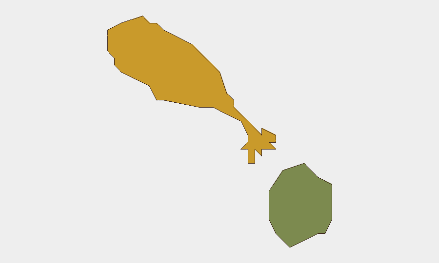
Saint Kitts island carries the higher composite sub-national risk score (72) relative to Nevis (28), though both remain within the broader low-threat national classification. The differential reflects Saint Kitts' larger population, urbanization concentration, and historical petty-crime exposure in specific neighborhoods; Nevis's lower score reflects its smaller population density and tourism-oriented profile. Neither island presents acute current security concern, and the risk variance is relative rather than absolute. Teams with personnel or assets in Basseterre or other Saint Kitts urban centers should maintain standard duty-of-care vigilance for petty theft and street crime, but no elevated alert is warranted based on current reporting.
How GeoBit Would Assist
Security teams monitoring Saint Kitts and Nevis should leverage AOI Monitoring & Early Warning for persistent watch on key facilities, ports, and urban centers to detect any escalation in crime, unrest, or infrastructure disruption; Intel Sweep and global event feeds to maintain real-time awareness of Caribbean regional trends (e.g., spillover from nearby islands); and Risk & Threat Assessment with OSINT fusion to track changes in travel advisory status, maritime incidents, or economic/political shifts that could alter the threat landscape. Routing & Network Analysis can support contingency planning for personnel movement if conditions change.
7-Day Outlook
No indicators suggest material change to the current stable threat picture in the next seven days. Seasonal factors (hurricane season onset in the Atlantic basin) and regional stability trends favor continuation of Level 1 conditions. Security teams should maintain standard monitoring protocols and revisit risk assessments if regional incidents (e.g., escalation in nearby Caribbean nations) or weather events materialize.
Highest-Risk Areas — Ranked
| # | State / Region | Risk |
|---|---|---|
| 1 | Saint Kitts | 72 |
| 2 | Nevis | 28 |
Sources
Previous Daily Briefs
A new Saint Kitts and Nevis brief is written every day — each with its own risk map and downloadable CSV. Here's the last week; use the calendar to go further back.
📅 Browse every day by calendar →
Highlighted days have a brief. Tap a day for that day's map & analysis, or “csv” for that day's dataset ($5).
Atlas — our AI intelligence desk — emails them this snapshot personally. Nothing else, no list.