Situation Summary
Saint Vincent and the Grenadines presents a low acute threat environment as of 25 July 2026, with no verified security, civil unrest, or major crime incidents reported in the last 24–48 hours. The nation's composite threat score of 2 reflects ongoing endemic crime concentrations in urban areas—particularly Kingstown and its environs—but no current destabilizing events, political instability, or infrastructure disruption. Routine law enforcement traffic operations continue across multiple communities, with no linked disorder or clashes reported. The security posture remains stable, though geographic disparities in risk persist.
Key Developments
- No new security incidents in the last 24–48 hours (23–25 July 2026). Multi-source OSINT monitoring across news outlets, social media, and official channels has identified no verified reports of armed conflict, civil unrest, major crime spikes, shootings, protests, or infrastructure failures in the monitoring window.
- Routine traffic law enforcement operations ongoing (activity reported for weekend prior to 21 July, continuing). The RSVGPF Traffic Branch maintains heightened enforcement targeting vehicle compliance (registration, documentation, lights, tyres, tint, and roadway obstructions) across multiple communities. No linked incidents of disorder or serious clashes reported within the 24–48 hour window.
- Older incidents remain outside current reporting window. A triple homicide in Chinatown, Kingstown (19–20 July), a suspected police officer suicide at SSU Old Montrose (22 July), and a machete assault in Barrouallie (18 July) fall outside the 24–48 hour threshold but indicate ongoing endemic violence in prior weeks.
Highest-Risk Areas
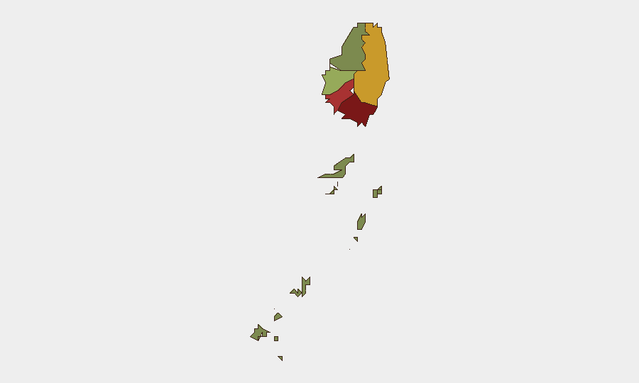
Saint George (composite risk 92) and Saint Andrew (78) drive the nation's risk profile, with Kingstown and its urban corridor accounting for the majority of recorded violent crime, including homicides and assaults. Charlotte (71) and Saint Patrick (58) show elevated secondary risk, while the Grenadines (12) remain significantly lower-risk. Urban density, socioeconomic pressures, and historical gang-related activity concentrate threat in the northern parishes; Saint David and the southern Grenadines present materially lower exposure for corporate operations and personnel.
How GeoBit Would Assist
A corporate security team with personnel or assets in Saint Vincent would employ AOI Monitoring & Early Warning on high-risk parishes (Saint George, Saint Andrew) to detect emerging incidents—violence, protests, or infrastructure disruption—in real time, with alerting triggered by OSINT signals. Intel Sweep and multi-platform OSINT monitoring (news, social media, X/Twitter, local radio SIGINT) provide continuous baseline assessment of the threat environment and early detection of destabilization. Routing & Network Analysis supports journey planning and site security assessments for high-risk urban areas, enabling duty-of-care compliance by identifying safer movement corridors and reducing exposure to crime hotspots.
7-Day Outlook
No indicators suggest escalating security risk over the next 7 days. The nation's low composite threat score, absence of political flashpoints, and routine law enforcement operations point to continued stability. Personnel and asset security postures calibrated to endemic urban crime patterns and parish-level geographic disparity should remain adequate, with ongoing monitoring of Kingstown and northern parishes for any spikes in homicides or gang activity.
Highest-Risk Areas — Ranked
| # | State / Region | Risk |
|---|---|---|
| 1 | Saint George | 92 |
| 2 | Saint Andrew | 78 |
| 3 | Charlotte | 71 |
| 4 | Saint Patrick | 58 |
| 5 | Saint David | 34 |
| 6 | Grenadines | 12 |
Sources
Previous Daily Briefs
A new Saint Vincent brief is written every day — each with its own risk map and downloadable CSV. Here's the last week; use the calendar to go further back.
📅 Browse every day by calendar →
Highlighted days have a brief. Tap a day for that day's map & analysis, or “csv” for that day's dataset ($5).
Atlas — our AI intelligence desk — emails them this snapshot personally. Nothing else, no list.