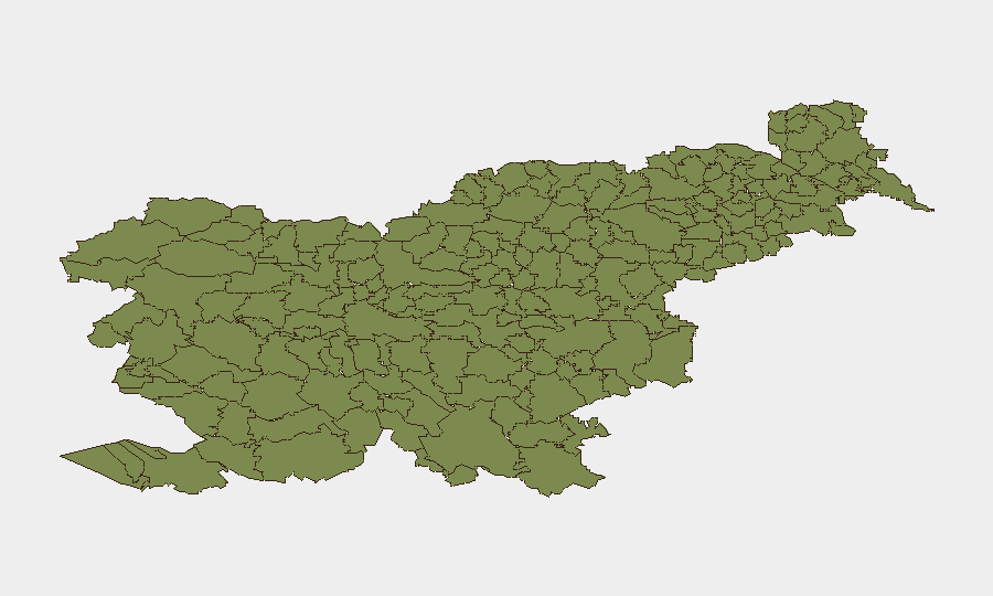
Situation Summary
Slovenia remains at very low security risk (global rank #179, composite threat score 3) with no tracked security incidents or civil unrest in the past 24–48 hours. Police reported routine activity across 691 interventions nationwide, including traffic incidents, border processing (106 illegal-entry cases), and public-order matters, with no escalation indicators. The threat trajectory is flat, and all sub-national regions maintain minimal risk scores. Recent weather-related flooding in Bovec (2026-08-08) remains the most significant event in the current reporting window.
Key Developments
- Bovec, 2026-08-08 – Flash floods following heavy thunderstorms caused significant damage to garages, a hotel, and a cultural center; flooding has since subsided and recovery operations are ongoing.
- Nationwide, 2026-08-09 to 2026-08-10 – Slovenian police recorded 691 interventions from 1,887 calls. No exceptional security escalation, violent incident, or infrastructure failure was reported during this period.
- Slovenia–Croatia border (Novo mesto, Ljubljana, Koper sectors), 2026-08-09 to 2026-08-10 – Border police processed 106 illegal-entry cases as part of routine border management; no organized smuggling activity or security breach was indicated.
- Nationwide, 2026-08-09 to 2026-08-10 – Cross-checked sources (major media outlets, social media, official police portals) revealed no protests, riots, attacks, sabotage, or political crisis meeting reporting thresholds.
- Nationwide, 2026-08-09 to 2026-08-10 – Interior Police warnings remain focused on seasonal fire-risk notices and routine public-safety prevention messaging, with no discrete disruptive incidents identified.
Highest-Risk Areas
All 12 sub-national regions tracked by GeoBit carry composite risk scores of 0, reflecting Slovenia's overall stability. The northwestern municipalities (Bovec, Kobarid, Kanal, Kranjska Gora, Tolmin, Bohinj) are listed first in the ranking primarily due to exposure to natural hazards—recent flash-flood activity in Bovec illustrates weather-driven rather than security-driven risk. Border municipalities (Šempeter-Vrtojba, Renče-Vogrsko, Miren-Kostanjevica) experience routine but manageable migrant-flow and smuggling-detection activity. No region exhibits elevated threat from civil unrest, terrorism, or organized crime at this time.
How GeoBit Would Assist
Corporate security teams with personnel or assets in Slovenia can use GeoBit's AOI Monitoring & Early Warning capability to maintain persistent watch on key business locations (offices, logistics hubs, manufacturing sites) with real-time alerting if localized incidents emerge. Intel Sweep, multi-language OSINT, and sentiment analysis provide 24-hour intelligence fusion to detect early signs of labor action, supply-chain disruption, or border congestion before operational impact. GIS & Spatial Analysis combined with Environmental & Health data enable rapid route and contingency planning if flooding, extreme weather, or border delays affect staff mobility or asset movement.
7-Day Outlook
No escalation in security risk is anticipated over the next seven days. Seasonal flooding risk in northwestern regions will remain elevated through late summer; weather forecasts and river-level monitoring should guide business continuity planning. Border-processing times are expected to remain within normal ranges, and police resource allocation shows no signs of strain.
Highest-Risk Areas — Ranked
| # | State / Region | Risk |
|---|---|---|
| 1 | Bovec | 0 |
| 2 | Kobarid | 0 |
| 3 | Kanal | 0 |
| 4 | Kranjska Gora | 0 |
| 5 | Gorje | 0 |
| 6 | Tolmin | 0 |
| 7 | Bohinj | 0 |
| 8 | Cerkno | 0 |
| 9 | Brda | 0 |
| 10 | Šempeter-Vrtojba | 0 |
| 11 | Renče-Vogrsko | 0 |
| 12 | Miren-Kostanjevica | 0 |
Sources
Previous Daily Briefs
A new Slovenia brief is written every day — each with its own risk map and downloadable CSV. Here's the last week; use the calendar to go further back.
📅 Browse every day by calendar →
Highlighted days have a brief. Tap a day for that day's map & analysis, or “csv” for that day's dataset ($5).
Atlas — our AI intelligence desk — emails them this snapshot personally. Nothing else, no list.