Situation Summary
Tonga remains a low-threat environment with no verified security incidents, civil unrest, armed conflict, or major crime activity reported in the last 24–48 hours. The country's overall composite threat score remains minimal, though ongoing seismic activity south of the archipelago and a continuing police manhunt in Nuku'alofa warrant routine monitoring. No changes to travel advisories or infrastructure alerts are in effect.
Key Developments
- No new security, conflict, civil-unrest, or major-crime incidents verified in Tonga for 26–28 July 2026. Multi-source OSINT monitoring (news wires, regional Pacific media, social media) confirms absence of incident-level developments nationwide in the requested 24–48 hour window.
- Seismic activity south of Tonga continues (recent window). Magnitude 5.2, 5.1, and 4.6–4.9 events have been recorded south of the archipelago and near Hihifo (Tongatapu); no tsunami alerts, damage reports, or secondary disruptions are corroborated. Haʻapai region experienced a M 4.9 event around 22 July with minor aftershock monitoring ongoing, but no infrastructure failures reported.
- Police manhunt for two escapees from Central Police Station remains active (ongoing since 21–23 July). Liuaki Fungalei Kokohu Vi and Adam Zabid Hussein remain at large in or near Nuku'alofa; public warnings and TOP$5,000 rewards per suspect are in effect. No new apprehensions or related incidents reported in the last 24–48 hours.
Highest-Risk Areas
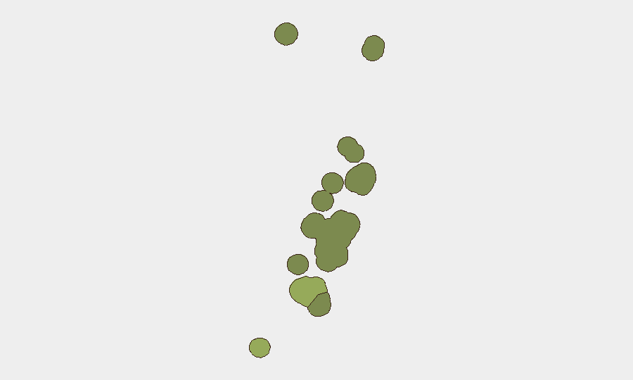
Tongatapu (risk score 45) dominates the sub-national ranking and accounts for the majority of assessed risk, driven by the capital's role as the economic and administrative hub, concentration of key infrastructure, and the ongoing police operation. Vavaʻu (28) ranks second, reflecting its role as a secondary population center and maritime gateway; Haʻapai (22), ʻEua (18), and Ongo Niua (12) carry lower but measurable risk, primarily from seismic exposure and geographic isolation. Risk scores reflect hazard exposure (seismic/volcanic) and operational concentration rather than conflict or political instability.
How GeoBit Would Assist
Security teams with personnel or assets in Tonga should employ AOI Monitoring & Early Warning to track Tongatapu, Vavaʻu, and maritime zones for police operations, infrastructure events, or seismic developments with real-time alerting. Multi-language OSINT & social media search (X, Telegram, regional Pacific news feeds) and sentiment & temporal analysis enable continuous detection of emerging civil unrest, crime activity, or travel-risk changes. Routing & Network Analysis and Environmental & Health monitoring support contingency planning for personnel evacuation or relocation if seismic or weather events escalate.
7-Day Outlook
Tonga is forecast to remain in a low-threat posture over the next seven days. Seismic activity south of the archipelago may continue with minor tremors; no major quake or tsunami risk is currently assessed. The police manhunt is expected to remain contained to Nuku'alofa and surrounding areas; resolution or incident escalation should be monitored but is not anticipated to disrupt broader security conditions.
Highest-Risk Areas — Ranked
| # | State / Region | Risk |
|---|---|---|
| 1 | Tongatapu | 45 |
| 2 | Vavaʻu | 28 |
| 3 | Haʻapai | 22 |
| 4 | ʻEua | 18 |
| 5 | Ongo Niua | 12 |
Sources
Previous Daily Briefs
A new Tonga brief is written every day — each with its own risk map and downloadable CSV. Here's the last week; use the calendar to go further back.
📅 Browse every day by calendar →
Highlighted days have a brief. Tap a day for that day's map & analysis, or “csv” for that day's dataset ($5).
Atlas — our AI intelligence desk — emails them this snapshot personally. Nothing else, no list.