Situation Summary
Tuvalu remains one of the world's lowest-threat environments (composite score 2; #181 globally) with no tracked security incidents in the current assessment window. The nation faces chronic infrastructure vulnerabilities and climate-related risks rather than acute conflict or civil unrest. Recent discovery of World War II–era ordnance in Nanumea Lagoon has prompted international coordination but poses no immediate operational threat to residents or corporate assets.
Key Developments
- Nanumea Lagoon — 2026-07-21 — Australian underwater survey identified 48 unexploded 500-pound bombs, 3 100-pound bombs, and additional wartime ordnance. Government and Australian officials assessed no immediate threat to populated areas; ordnance removal timelines remain under discussion.
- No discrete security, civil-unrest, crime, or political-instability events have been detected in Tuvalu during the last 24–48 hours via OSINT feeds, social media signals, or travel-risk indicators.
- Regional context (not current Tuvalu incident) — Pacific Islands Forum engagement on regional maritime security and UN support mechanisms continues, but this reflects ongoing diplomatic posture rather than an acute development affecting Tuvalu directly.
Highest-Risk Areas
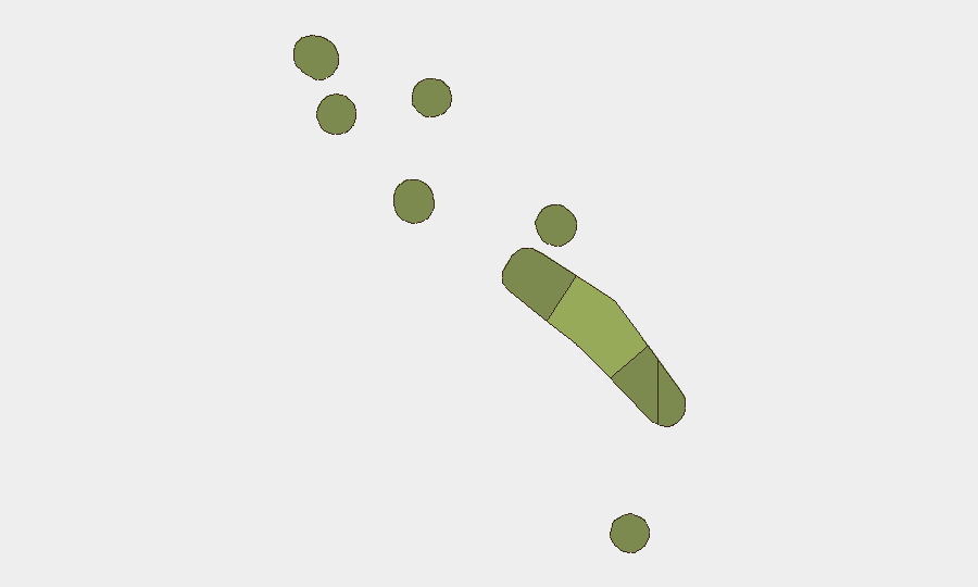
Funafuti (composite risk 45) drives the country-level threat ranking by a substantial margin, reflecting its role as the capital, primary port, and concentration of government, commerce, and foreign presence. Vaitupu, Nui, and Nukufetau show moderate elevation (28–22) likely due to population density, maritime access, or infrastructure criticality; the remaining islands carry low composite scores (12–20). Risk concentration in Funafuti suggests duty-of-care and asset-protection planning should prioritize that atoll while monitoring port operations, utility resilience, and any disruptions to inter-island transport.
How GeoBit Would Assist
AOI Monitoring & Early Warning on Funafuti, Nanumea, and key maritime zones would enable corporate teams to receive real-time alerts on infrastructure disruptions, port congestion, or emerging civil unrest before it affects supply chains or personnel. Maritime & Aviation Tracking linked to vessel and flight schedules serving Tuvalu would reduce exposure to unexpected route closures or delays. Multi-language OSINT and X/Twitter signals focused on Tuvalu-specific channels would capture labor disputes, utility failures, or political developments hours before formal government announcements, supporting rapid duty-of-care response.
7-Day Outlook
No escalation in security incidents is anticipated; Tuvalu's threat environment is expected to remain stable and low. Ordnance remediation discussions and regional maritime-security diplomacy will proceed as background activity. Corporate and duty-of-care teams should maintain standard monitoring of port operations, inter-island transport schedules, and weather disruptions, which remain the primary operational risk drivers in the region.
Highest-Risk Areas — Ranked
| # | State / Region | Risk |
|---|---|---|
| 1 | Funafuti | 45 |
| 2 | Vaitupu | 28 |
| 3 | Nui | 25 |
| 4 | Nukufetau | 22 |
| 5 | Niutao | 20 |
| 6 | Nanumanga | 18 |
| 7 | Nanumea | 15 |
| 8 | Nukulaelae | 12 |
Sources
Previous Daily Briefs
A new Tuvalu brief is written every day — each with its own risk map and downloadable CSV. Here's the last week; use the calendar to go further back.
📅 Browse every day by calendar →
Highlighted days have a brief. Tap a day for that day's map & analysis, or “csv” for that day's dataset ($5).
Atlas — our AI intelligence desk — emails them this snapshot personally. Nothing else, no list.