Situation Summary
Vanuatu's security environment remains stable with no material civil unrest, crime escalation, or political incidents reported in the last 24–48 hours. A magnitude 6.1 offshore earthquake struck northeast of Espiritu Santo on 16 August, but caused no casualties, significant damage, or tsunami threat. Routine background risks—petty crime, maritime hazards, weather exposure—persist across the archipelago, but the overall trajectory is one of baseline stability.
Key Developments
- Offshore earthquake, Espiritu Santo – 16 August 2026
A magnitude 6.1 earthquake occurred approximately 56 km northeast of Port Olry at intermediate depth (155–188 km). USGS and regional seismic agencies issued low-level ("green") alerts. No casualties, infrastructure damage, or tsunami warnings reported; monitoring continues for aftershocks and delayed impacts.
- No other material security incidents reported in the last 24–48 hours.
Open-source intelligence across news, social media, and government sources shows no new verified events involving civil unrest, organized crime, terrorism, piracy, or political instability in the Vanuatu archipelago during this window.
Note on background context (outside current 24–48 h window):
A maritime search for six missing persons from the Erromango–Tanna route began 7–11 August; this remains an ongoing incident but not a new development as of 16 August.
Highest-Risk Areas
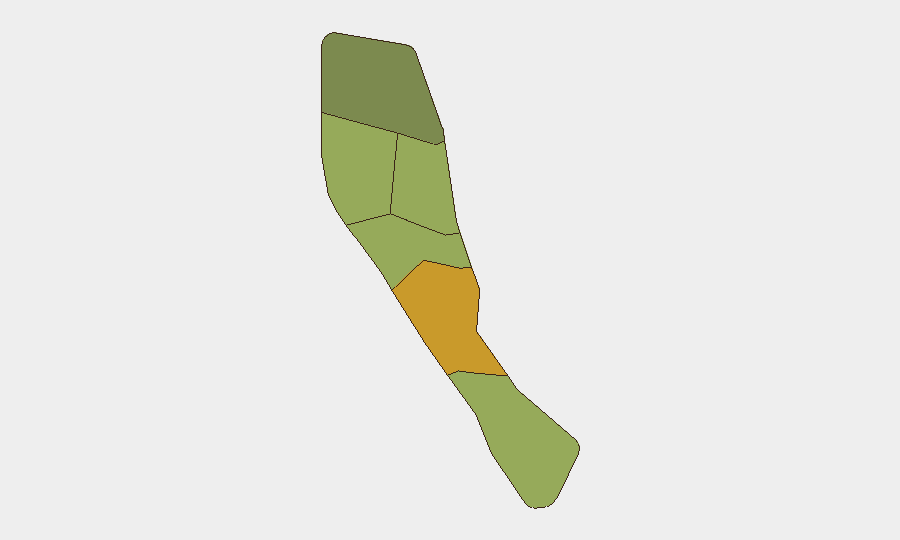
Shefa Province (composite risk score 72) emerges as the dominant risk driver, likely reflecting Port Vila's concentration of population, informal settlements, petty crime, and maritime exposure. Penama (58) and Sanma (52) follow, suggesting northern and central archipelago zones face elevated exposure to crime, weather, and isolated infrastructure vulnerabilities. Malampa, Tafea, and Torba carry lower but non-trivial scores, consistent with more dispersed, remote populations and limited state capacity. The 16 August earthquake, centered off Espiritu Santo (in Sanma), did not produce secondary hazards, but seismic risk remains a latent concern across all provinces.
How GeoBit Would Assist
Corporate security teams with personnel or assets in Vanuatu would deploy AOI Monitoring & Early Warning to track Port Vila and other high-risk urban centers for emerging crime, unrest, or infrastructure disruption in real time, coupled with Satellite & Imagery Analysis to assess earthquake, cyclone, or maritime incident damage post-event. Intel Sweep and multi-language OSINT fusion across social media, local news, and maritime reports would provide 24/7 early signals of civil unrest, labor disputes, or piracy before they escalate. Environmental & Health monitoring would flag seismic, cyclone, and health alerts affecting duty-of-care obligations.
7-Day Outlook
No new major security, civil unrest, or geopolitical triggers are forecast for the next 7 days. Seismic aftershock activity in the Espiritu Santo–Sanma zone should be monitored; seasonal weather patterns (late southern winter) present routine maritime and flooding risks. The baseline stability observed on 16 August is likely to persist unless external shocks (cyclone, renewed maritime incidents, or political crises) materialize.
Highest-Risk Areas — Ranked
| # | State / Region | Risk |
|---|---|---|
| 1 | Shefa Province | 72 |
| 2 | Penama | 58 |
| 3 | Sanma | 52 |
| 4 | Malampa | 48 |
| 5 | Tafea | 45 |
| 6 | Torba | 35 |
Sources
Previous Daily Briefs
A new Vanuatu brief is written every day — each with its own risk map and downloadable CSV. Here's the last week; use the calendar to go further back.
- August 14, 2026
- August 12, 2026
- August 10, 2026
- August 8, 2026
- August 6, 2026
- August 5, 2026
- August 4, 2026
📅 Browse every day by calendar →
Highlighted days have a brief. Tap a day for that day's map & analysis, or “csv” for that day's dataset ($5).
Atlas — our AI intelligence desk — emails them this snapshot personally. Nothing else, no list.