Situation Summary
Albania remains at composite threat level 5 (#136 globally), with a managed but active security environment characterized by routine crime, civil-order incidents, and environmental hazards. The last 24–48 hours show a typical operational picture: distributed law-enforcement actions against weapons, narcotics, and theft; natural-hazard events (wildfires, structure fires); and a fatal traffic accident. Risk concentration is extreme—Elbasan County accounts for 76% of the national threat score—while most other regions remain low-risk. The trajectory is stable with no indicators of acute destabilization.
Key Developments
- Qafë Thana wildfire (Elbasan/Pogradec border), 19 Jul 2026: Large-scale wildfire driven by high temperatures and strong winds; smoke and potential road disruption pose travel risk to the region and may impact logistics and evacuation routes.
- Stan Karbunarë house fire (Lushnjë, Elbasan County), 19 Jul 2026: Significant structural fire with no reported casualties; response by local firefighters and police was successful; reflects elevated fire risk during heat conditions.
- Journalist Enrik Mehmeti fatal motorcycle accident (Porto Novo beach, Vlorë), 19 Jul 2026: Single-vehicle crash resulted in death of 40-year-old journalist; confirmed by multiple outlets; highlights road-safety risks in recreational zones.
- Nationwide weapons and narcotics operations (multiple locations), 18–19 Jul 2026: State Police report 4 arrest operations yielding 8 firearms, 1 vehicle, and seizures across 7 narcotics cases; reflects routine enforcement and ongoing organized-crime activity.
- Lushnjë burglary operation (Plug village area), 18–19 Jul 2026: Police arrested 36-year-old suspect for two thefts within two days and prior property crimes; operation "Again" cleared cases in the last 48 hours; illustrates persistent localized theft patterns.
Highest-Risk Areas
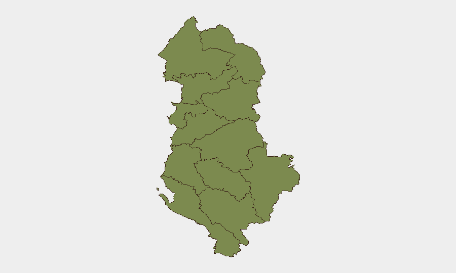
Elbasan County (risk score 31.9) dominates the threat landscape, representing approximately 76% of Albania's total composite risk and driving the national score significantly upward. The recent wildfire in the Qafë Thana area and multiple fire incidents in Lushnjë municipality (within Elbasan) underscore both environmental and crime-related pressures. Vlorë County (14.5) ranks second but at less than half Elbasan's risk level; all other counties cluster at 1.9, indicating that security risk in Albania is geographically concentrated rather than dispersed. Organizations with personnel or assets in Elbasan County should apply elevated monitoring and contingency planning.
How GeoBit Would Assist
Security teams should deploy AOI (Area-of-Interest) Monitoring & Early Warning on Elbasan County and key transportation corridors to track wildfire spread, road closures, and incident escalation in real time. Intel Sweep and multi-language OSINT fusion would consolidate State Police bulletins, local media, and situational reporting to maintain current awareness of arrests, weapons seizures, and organized-crime activity. GIS & Spatial Analysis combined with Routing & Network Analysis would enable alternative-route planning around active fire zones and identify safe corridors for personnel and supply movement.
7-Day Outlook
No acute escalation is forecasted over the next seven days. High temperatures are expected to persist, sustaining wildfire and structural fire risk in Elbasan and adjacent zones; routine law-enforcement operations will continue. Civil and political tensions reflected in recent government/opposition signals are currently low-intensity and do not indicate imminent unrest. Duty-of-care teams should maintain standard monitoring and prepare contingency routes for Elbasan-based operations.
Highest-Risk Areas — Ranked
| # | State / Region | Risk |
|---|---|---|
| 1 | Elbasan County | 31.9 |
| 2 | Vlorë County | 14.5 |
| 3 | Durrës County | 1.9 |
| 4 | Shkodër County | 1.9 |
| 5 | Kukës County | 1.9 |
| 6 | Lezhë County | 1.9 |
| 7 | Dibër County | 1.9 |
| 8 | Tirana County | 1.9 |
| 9 | Fier County | 1.9 |
| 10 | Berat County | 1.9 |
| 11 | Korçë County | 1.9 |
| 12 | Gjirokastër County | 1.9 |
Sources
Previous Daily Briefs
A new Albania brief is written every day — each with its own risk map and downloadable CSV. Here's the last week; use the calendar to go further back.
📅 Browse every day by calendar →
Highlighted days have a brief. Tap a day for that day's map & analysis, or “csv” for that day's dataset ($5).
Atlas — our AI intelligence desk — emails them this snapshot personally. Nothing else, no list.