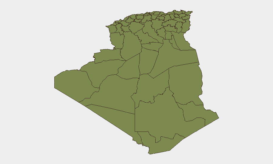
Situation Summary
Algeria faces a dual acute threat landscape: active counterterrorism operations in the south and center, and a severe nationwide wildfire crisis driven by sustained heatwave conditions affecting northern provinces. Over the past 24–48 hours, the National People's Army has conducted lethal strikes against armed terrorist elements in Chlef province while civil protection and military units have mobilized across multiple northern wilayas to suppress over 100 active forest and brush fires. The wildfire emergency has inflicted infrastructure damage, particularly to electrical grids, and has strained response capacity in rural communities. Overall threat trajectory remains elevated but operationally contained, with no indication of coordinated terrorist escalation or systemic state collapse.
Key Developments
- Chlef Province (First Military Region), 27 July 2026, evening: Joint Army and security service detachments killed two armed terrorists and seized two Kalashnikov submachine guns, ammunition, and other materiel in the Chlef military sector; operations part of ongoing counterterrorism campaign.
- Multiple northern wilayas, 28–29 July 2026 (past 24 hours): Civil protection and army units extinguished 91 forest and brush fires out of 103 reported; 97% of active fires nationwide brought under control; firefighting operations ongoing with volunteers and civil defence personnel.
- Northern Algeria (rural communities), 27–29 July 2026: Severe wildfires continue across rural northern areas; local response hampered by limited access to heavy equipment; communities relying on improvised suppression methods (manual tools, branches); social media reports show active fire fronts and smoke plumes.
- Multiple northern provinces, 27–29 July 2026: Heatwave-linked wildfire activity continues; electricity grid segments damaged by fire fronts; Sonelgaz teams deployed for grid security and power restoration once containment achieved.
- National level, past 24–48 hours: National People's Army reported surrender of one terrorist element in In Guezzam and arrests of nine terrorist-support personnel as part of ongoing counterterrorism operations.
- Northern Algeria (civil protection), 27–29 July 2026: Governors tasked to assess property damage and casualties from sustained wildfire wave; compensation mechanisms being activated.
Highest-Risk Areas
Algiers dominates the sub-national risk ranking (31.3) and reflects capital-region sensitivity to security incidents, governance disruption, and asset concentration. The remaining ranked provinces (Bechar, Beni Abbes, Adrar, Bordj Badji Mokhtar, and others in the 1.3 band) show markedly lower composite scores, indicating that current acute threats—counterterrorism in Chlef and wildfires across the north—are dispersed and operationally managed. The wildfire emergency, while affecting multiple northern wilayas simultaneously, has not triggered secondary security deterioration (e.g., civilian unrest, supply-chain collapse, or territorial contestation). Risk in Chlef and the southern/central regions remains endemic rather than escalating.
How GeoBit Would Assist
Security teams operating in Algeria should employ AOI Monitoring & Early Warning to track persistent wildfire activity and Army counterterrorism operations in real time across northern and central provinces; Intel Sweep and global event feeds to corroborate military and civil protection claims on casualty, equipment, and fire-suppression metrics; and GIS & Spatial Analysis with Satellite & Imagery analysis to map active fire fronts, grid damage zones, and population exposure in rural communities. These tools enable duty-of-care teams to anticipate supply-chain and personnel-movement disruptions and to validate official briefings against ground truth.
7-Day Outlook
Wildfire activity is expected to recede as heatwave conditions moderate, but electrical infrastructure repairs will extend 7–10 days in affected provinces. Counterterrorism operations will likely persist at current tempo in the south and center; no intelligence suggests imminent mass-casualty attacks or territorial gains by armed groups. Corporate and NGO operations should monitor power restoration timelines and checkpoint activity along northern routes.
Highest-Risk Areas — Ranked
| # | State / Region | Risk |
|---|---|---|
| 1 | Algiers | 31.3 |
| 2 | Bechar | 1.3 |
| 3 | Beni Abbes | 1.3 |
| 4 | Adrar | 1.3 |
| 5 | Bordj Badji Mokhtar | 1.3 |
| 6 | El Bayadh | 1.3 |
| 7 | Ghardaia | 1.3 |
| 8 | Saïda | 1.3 |
| 9 | Boumerdes | 1.3 |
| 10 | Tizi Ouzou | 1.3 |
| 11 | Chlef | 1.3 |
| 12 | Relizane | 1.3 |
Sources
Previous Daily Briefs
A new Algeria brief is written every day — each with its own risk map and downloadable CSV. Here's the last week; use the calendar to go further back.
📅 Browse every day by calendar →
Highlighted days have a brief. Tap a day for that day's map & analysis, or “csv” for that day's dataset ($5).
Atlas — our AI intelligence desk — emails them this snapshot personally. Nothing else, no list.