Situation Summary
Armenia remains a low-threat environment globally (composite score 21) with no active large-scale conflict or unrest reported in the last 24–48 hours. Security developments are concentrated in routine border coordination, military training, and infrastructure/regulatory matters. The capital Yerevan and border provinces continue baseline monitoring for cross-border incidents and mine-contamination hazards, but no acute incidents have escalated risk materially since late July.
Key Developments
- Lori Province (Vanadzor area), 31 July 2026 – A serviceman sustained a serious training-related injury (amputation) during a Ministry of Defense exercise. No hostile-fire involvement reported; incident reflects ongoing casualty risk in active military training environments.
- Yerevan, 31 July 2026 – Armenia's Minister of Internal Affairs awarded France's South Caucasus Internal Security Attaché a medal for joint law-enforcement cooperation, signaling continued Western security partnership and institutional capacity-building.
- Georgia–Armenia Border, 27–30 July 2026 – Armenia's NSS Border Guard delegation (Colonel Garik Muradyan, lead) completed an official visit to Georgia to coordinate border-police cooperation, reflecting active cross-border security management despite historical tensions.
- Nationwide (Telecommunications), 31 July 2026 – Government approved draft legislation requiring centralized registration of all mobile phones, officially to combat illegal device imports. This expands the state's surveillance and communication-monitoring environment with potential implications for device tracking of foreign nationals and corporate communications.
- Nationwide (Energy), 31 July 2026 – National energy regulator confirmed household natural gas tariffs will remain stable through year-end despite Russian pressure on future supplies. No immediate supply disruption; indicates medium-term awareness of energy-supply vulnerability.
- Border Hazard Zones (nationwide), 31 July 2026 – Armenia received two EU-supplied remote-controlled demining vehicles to clear landmines in border-adjacent areas. Persistent explosive hazard remains; equipment deployment is incremental mitigation only.
Highest-Risk Areas
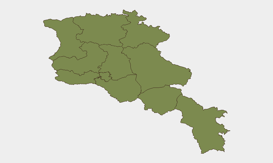
Yerevan dominates the composite risk ranking (31.3) and accounts for the majority of trackable security events, law-enforcement activity, and international engagement. All remaining provinces cluster at 1.3 risk, reflecting relatively uniform baseline conditions outside the capital. Border provinces (Tavush, Gegharkunik, Syunik) retain latent risks from mine contamination and cross-border coordination sensitivity, but no current escalation is evident. Yerevan's elevated score reflects its status as the political, economic, and administrative hub where regulatory, diplomatic, and institutional activity is concentrated—not an indication of acute unrest.
How GeoBit Would Assist
Security teams should employ AOI Monitoring & Early Warning on Yerevan and border provinces (Tavush, Gegharkunik, Syunik) to detect cross-border incidents or military activities in real time. Intel Sweep and multi-language OSINT (including Armenian media, Telegram, and X/Twitter signals) enable continuous tracking of government regulatory changes (e.g., telecom registration rules, energy policy) that affect corporate communications and asset compliance. Border & Disputed-Territory Search and Routing & Network Analysis support alternative-route planning and risk assessment for personnel transiting border zones or hazardous areas affected by mine contamination.
7-Day Outlook
No significant escalation is anticipated. Border-coordination activity and infrastructure stability suggest a maintained status quo. Attention should focus on continued telecom-registration rollout (effective 1 August) and potential downstream effects on corporate device and communication policies for operations in Armenia.
Highest-Risk Areas — Ranked
| # | State / Region | Risk |
|---|---|---|
| 1 | Yerevan | 31.3 |
| 2 | Lori Province | 1.3 |
| 3 | Tavush Province | 1.3 |
| 4 | Kotayk Province | 1.3 |
| 5 | Ararat Province | 1.3 |
| 6 | Gegharkunik Province | 1.3 |
| 7 | Vayots Dzor Province | 1.3 |
| 8 | Syunik Province | 1.3 |
| 9 | Shirak Province | 1.3 |
| 10 | Aragatsotn Province | 1.3 |
| 11 | Armavir Province | 1.3 |
Sources
Previous Daily Briefs
A new Armenia brief is written every day — each with its own risk map and downloadable CSV. Here's the last week; use the calendar to go further back.
📅 Browse every day by calendar →
Highlighted days have a brief. Tap a day for that day's map & analysis, or “csv” for that day's dataset ($5).
Atlas — our AI intelligence desk — emails them this snapshot personally. Nothing else, no list.