Situation Summary
The Bahamas faces a persistent baseline of violent crime concentrated in New Providence and Freeport, with no systemic escalation over the past 24–48 hours but a series of discrete incidents—homicides, maritime accident, infrastructure damage—that underscore underlying instability in high-risk urban centers. The national threat ranking remains low globally (composite score 15), reflecting the geographic isolation of risk to specific population centers rather than systemic state fragility. Critical infrastructure vulnerabilities, illustrated by recent power-station damage, compound security challenges in Nassau where security operations and humanitarian services depend on reliable utilities.
Key Developments
- Spanish Cay, Exuma (Saturday, 25 July): a commercial boat carrying seven construction workers exploded; one fatality, six rescued from water. Cause under investigation; maritime accident or sabotage not yet ruled out by local authorities.
- Blue Hills Power Station, Nassau (25 July): lightning strike triggered explosion at Bahamas Power and Light facility, compounding outages affecting residents, businesses, hotels, airport, and Princess Margaret Hospital. Outage timeline and restoration estimate unclear.
- Palmetto Avenue (Blue Hill Road area), Nassau (25 July): male victim died from severe burns sustained in residential house fire; origin under investigation.
- Yellow Elder, Nassau (26 July morning): 49-year-old man fatally shot; details on assailant, motive, or gang affiliation not yet public.
- Nassau Village, Nassau (26 July): 28-year-old male killed in separate violent incident; preliminary details insufficient to confirm exact nature or motive.
- Dundas Town, Abaco (early 25 July): gunmen ambushed and killed 32-year-old man near a nightclub; local stakeholders renewing calls for venue closure and heightened police presence.
Highest-Risk Areas
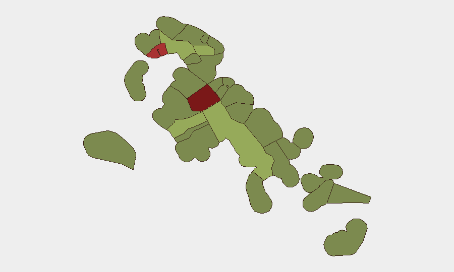
New Providence (risk score 92) and Freeport (risk score 78) dominate the sub-national ranking and account for the majority of recorded homicides and violent crime in the Bahamas. Both are urban centers with high population density, active gang presence, and limited police resource saturation. Central Abaco (score 52) and Central Andros (score 48) show elevated risk, likely reflecting spillover gang activity and limited law-enforcement capacity in lower-population, more dispersed island communities. Exuma, despite lower baseline ranking (45), saw the weekend maritime incident, indicating that risk is not uniformly distributed even within nominally lower-threat islands.
How GeoBit Would Assist
A corporate security team with personnel or assets in New Providence or Freeport would employ Intel Sweep and X/Twitter OSINT to monitor real-time gang activity, labor unrest, and port/maritime incidents; AOI Monitoring & Early Warning on the Blue Hills Power Station and other critical infrastructure to detect disruption patterns; and Risk & Threat Assessment to generate dynamic, location-specific threat profiles for staff movement, facility hardening, and duty-of-care decisions. Maritime & Aviation tracking would support due diligence on inter-island logistics and supply-chain security given the weekend boat incident and ongoing maritime exposure in Bahamas operations.
7-Day Outlook
Violent crime in Nassau and Freeport will likely remain at seasonal baseline levels absent a major triggering event (police action, gang retaliation, or territorial dispute). Infrastructure stress—power outages, water supply delays—may amplify secondary security risks (civil unrest, opportunistic crime) if restoration timelines extend beyond 48–72 hours. No intelligence suggests an imminent systemic shock, but persistent low-order instability in high-risk zones will require continuous operational vigilance and contingency staffing adjustments.
Highest-Risk Areas — Ranked
| # | State / Region | Risk |
|---|---|---|
| 1 | New Providence | 92 |
| 2 | City of Freeport | 78 |
| 3 | Central Abaco | 52 |
| 4 | Central Andros | 48 |
| 5 | Exuma | 45 |
| 6 | East Grand Bahama | 42 |
| 7 | South Andros | 38 |
| 8 | North Abaco | 35 |
| 9 | North Eleuthera | 33 |
| 10 | South Abaco | 32 |
| 11 | Cat Island | 30 |
| 12 | Mangrove Cay | 28 |
Sources
Previous Daily Briefs
A new Bahamas brief is written every day — each with its own risk map and downloadable CSV. Here's the last week; use the calendar to go further back.
📅 Browse every day by calendar →
Highlighted days have a brief. Tap a day for that day's map & analysis, or “csv” for that day's dataset ($5).
Atlas — our AI intelligence desk — emails them this snapshot personally. Nothing else, no list.