Situation Summary
Bahrain is experiencing acute military escalation following reported Iranian missile and drone attacks on U.S.-linked facilities in the kingdom on the night of July 17–18, 2026. Air-raid sirens were activated kingdom-wide; Bahrain's Defense Force reported successful interception of multiple Iranian aerial attacks, though explosions were heard across Manama and surrounding districts. The Northern and Southern Governorates remain highest-risk zones, with regional military tensions involving Kuwait, Oman, Qatar, Jordan, and Syria also active as of July 18. Trajectory is deteriorating, with sustained Iranian strike activity and ongoing air-defense engagement creating persistent civilian shelter-in-place conditions and elevated risk of collateral damage or secondary incidents.
Key Developments
- Manama & kingdom-wide (night of July 17–18, 2026): Bahrain's Interior Ministry activated air-raid sirens across all populated areas after detection of incoming Iranian missiles and drones; residents instructed to seek immediate shelter. Bahrain's Defense Force reported successful interception of multiple waves of Iranian aerial attacks targeting U.S.-linked military installations and critical infrastructure.
- U.S. air base near Manama (late July 17, 2026): Iranian military and IRGC claimed coordinated missile and drone strikes on a U.S.-linked air base in Bahrain as retaliation for prior U.S. strikes on Iran; Bahrain's armed forces confirmed air-defense engagement and reported no major confirmed casualties or damage, though explosions audible across central Manama.
- Manama central districts (late July 17, 2026): Multiple explosions reported following siren activation; social media video documented fresh blast activity and residents sheltering in place. Official sources (Bahrain, U.S.) confirmed air-defense activity but denied major structural damage or mass casualties to date.
- Bahrain airspace (July 17–18, 2026): OSINT and regional monitoring confirmed continued Iranian strike attempts and Bahrain's repeated air-defense activation; warning sirens maintained as ongoing Iranian activity and U.S.–Iran confrontation centered on Strait of Hormuz region persist.
- Regional military posture (July 18, 2026): Bahrain's military simultaneously engaged in conventional force operations or escalation signals with Oman, Kuwait, Qatar, Jordan, and Syria, suggesting either coordinated Gulf Cooperation Council (GCC) response or parallel regional instability.
- French Ministry advisory (July 17, 2026): France upgraded travel warning for Bahrain to advise against non-essential travel and instructed nationals to follow shelter-in-place protocols during siren activation—first major diplomatic advisory since Iranian strikes commenced.
- Debris & hazard warnings (July 17, 2026): Bahrain's Defense Force warned civilian population to avoid debris fields and potential unexploded ordnance in sheltered areas and on streets; reinforces ongoing active-conflict environment.
Highest-Risk Areas
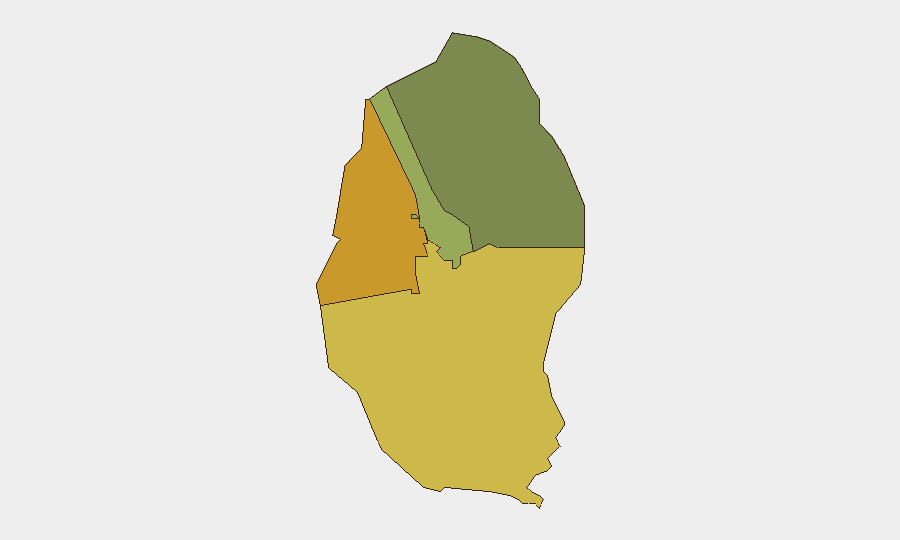
The Northern Governorate (risk 72) and Southern Governorate (risk 68) dominate Bahrain's threat profile, likely reflecting proximity to Iranian launch zones, strategic military installations, and populated civilian centers vulnerable to missile or drone impact. The Capital Governorate (risk 45)—home to Manama and densely populated administrative/commercial districts—has elevated risk driven by active air-defense engagement, siren activation, and collateral-damage exposure. Muharraq Governorate (risk 38) remains secondary but elevated; all four governorates are now under active military threat from external strike activity.
How GeoBit Would Assist
Security teams should deploy AOI Monitoring & Early Warning on Bahrain's four governorates to track siren activation patterns, air-defense engagement timing, and Iranian/regional military signal chatter in real time. OSINT fusion & corroboration (X/Twitter, Telegram, IRGC statements, satellite imagery) will disambiguate Iranian strike claims from confirmed damage and casualty reports, enabling rapid duty-of-care decisions. Conflict & Military battle mapping and Satellite & Imagery analysis provide damage assessment and force-disposition tracking to identify safe corridors and secondary-incident risks.
7-Day Outlook
Sustained Iranian strike activity and Bahraini air-defense engagement are likely to persist through late July as regional U.S.–Iran tensions remain acute. Civilian populations will remain under intermittent shelter-in-place protocols; secondary risks (traffic disruption, infrastructure damage, unexploded ordnance) will compound security operations for corporate teams. GCC military coordination may intensify, raising risk of inadvertent escalation or miscalculation in crowded airspace over the capital and northern zones.
Highest-Risk Areas — Ranked
| # | State / Region | Risk |
|---|---|---|
| 1 | Northern Governorate | 72 |
| 2 | Southern Governorate | 68 |
| 3 | Capital Governorate | 45 |
| 4 | Muharraq Governorate | 38 |
Sources
Previous Daily Briefs
A new Bahrain brief is written every day — each with its own risk map and downloadable CSV. Here's the last week; use the calendar to go further back.
📅 Browse every day by calendar →
Highlighted days have a brief. Tap a day for that day's map & analysis, or “csv” for that day's dataset ($5).
Atlas — our AI intelligence desk — emails them this snapshot personally. Nothing else, no list.