Situation Summary
Barbados remains in a stable, low-threat security environment with no validated acute incidents reported in the last 48 hours. The nation ranks composite threat level 3 globally with zero tracked events in the current window. Law enforcement presence has been elevated around the Crop Over festival (planned policing posture, not incident response), and routine security baseline conditions persist across the island.
Key Developments
- No acute security incidents validated in Barbados during the 24–48 hour reporting window (2026-08-01 to 2026-08-02); web sources, local outlets, and official channels confirm stable conditions countrywide.
- Crop Over festival policing (ongoing, multi-parish): elevated police visibility in Saint Michael, Saint James, and Saint George reflects scheduled festival-period resource deployment rather than response to discrete events or civil unrest.
- Routine port and maritime activity continues without reported disruption; no incidents affecting transportation, commerce, or critical infrastructure noted in the last 48 hours.
Highest-Risk Areas
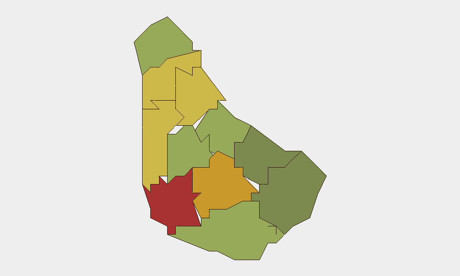
Saint Michael (risk 78) and Saint George (risk 72) carry the highest sub-national risk scores, likely reflecting urban density, population concentration, and routine crime prevalence in Bridgetown and surrounding parishes. Saint James (68) and Saint Andrew (65) follow, consistent with mixed urban–rural demographics and historical crime clustering. The southern parishes (Saint Philip, 28; Saint John, 35) present materially lower risk profiles. Risk elevation in the top four parishes reflects baseline criminality patterns rather than current crisis or instability; the composite scores do not indicate systemic breakdown or imminent escalation but rather differentiate routine operational exposure for teams with personnel or assets in higher-density urban centers.
How GeoBit Would Assist
Teams with duty-of-care obligations in Barbados would deploy AOI Monitoring & Early Warning on Saint Michael and Saint George to detect shifts from baseline; Intel Sweep and multi-language OSINT (X/Twitter, local outlets, radio SIGINT) to catch emerging incident clusters or civil-unrest signals in real time; and Risk & Threat Assessment modules to update exposure profiles as personnel or asset locations shift. Routing & Network Analysis capabilities support alternative journey planning if localized disruption occurs, and Economic & Trade monitoring flags port or commerce interruptions affecting supply chains or operations.
7-Day Outlook
Barbados is forecast to remain in low-threat posture over the next 7 days. Crop Over festival policing will continue through early August, with no indicators of uncontrolled escalation or secondary incident clusters. Routine crime and urban-parish baseline risk will persist; no geopolitical, infrastructure, or weather-related acute drivers are evident in the near term.
Next Brief: 2026-08-03 | Data Cutoff: 2026-08-02 16:00 UTC
Highest-Risk Areas — Ranked
| # | State / Region | Risk |
|---|---|---|
| 1 | Saint Michael | 78 |
| 2 | Saint George | 72 |
| 3 | Saint James | 68 |
| 4 | Saint Andrew | 65 |
| 5 | Saint Peter | 62 |
| 6 | Saint Joseph | 58 |
| 7 | Saint Thomas | 52 |
| 8 | Saint Lucy | 48 |
| 9 | Christ Church | 42 |
| 10 | Saint John | 35 |
| 11 | Saint Philip | 28 |
Sources
Previous Daily Briefs
A new Barbados brief is written every day — each with its own risk map and downloadable CSV. Here's the last week; use the calendar to go further back.
📅 Browse every day by calendar →
Highlighted days have a brief. Tap a day for that day's map & analysis, or “csv” for that day's dataset ($5).
Atlas — our AI intelligence desk — emails them this snapshot personally. Nothing else, no list.