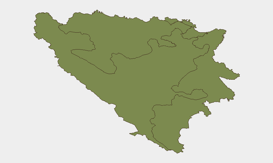
Situation Summary
Bosnia and Herzegovina remains a low-to-moderate threat environment (rank #118 globally) with no acute security incidents reported in the last 24–48 hours. The country's composite risk is driven almost entirely by the Federation of Bosnia and Herzegovina (score 31.6), while Republika Srpska and Brčko District present negligible threat signals. Standing risk vectors—petty and armed robbery in tourist zones, landmine hazards in rural areas, and periodic political sensitivity—remain stable; no escalation is evident.
Key Developments
- Sarajevo, July 11–13: Srebrenica genocide commemoration events generated elevated crowd density and official security posture in the capital and at memorial sites, with July 11 declared the Federation's Day of Remembrance of Genocide. No violence or civil unrest associated with commemorations has been reported.
- Sarajevo Old Town & tourist districts, July 11–13: Standing advisory alerts regarding theft and armed robbery targeting tourists remain in effect; Spanish Ministry of Foreign Affairs and other travel-advisory bodies cite this risk corridor as a persistent summer concern, though no specific incident with confirmed date/time in this 48-hour window is documented in indexed sources.
- Mostar & Medjugorje, July 11–13: Continued warnings from travel authorities highlight pickpocketing and robbery risks in pilgrimage and tourist gatherings; no new specific incident is confirmed in the last 24–48 hours, but the risk profile is active.
- Country-wide, July 2026: The Council of Ministers adopted the 2026 National Demining Plan as an ongoing infrastructure-risk mitigation measure. Landmine hazards in rural and off-path areas remain a documented constraint on movement; no new mine accident has been reported in the assessment window.
Highest-Risk Areas
The Federation of Bosnia and Herzegovina accounts for over 95% of the country's composite threat score (31.6 vs. 1.6 each for Republika Srpska and Brčko District). This disparity reflects Sarajevo and surrounding urban centers' higher concentration of tourist activity, theft-related crime, and political/commemorative events that draw crowds and security attention. Republika Srpska and Brčko District present minimal measurable risk signals in current reporting. Corporate security teams should concentrate duty-of-care monitoring on Federation-based personnel and assets, particularly in Sarajevo's central and Old Town districts, and on any travel to pilgrimage or high-traffic zones in Mostar.
How GeoBit Would Assist
Security teams should deploy AOI Monitoring & Early Warning on Sarajevo's tourist and commercial districts to detect emerging crime patterns or public-order disruptions before they escalate. Intel Sweep and multi-language OSINT fusion across regional media, social networks, and police/NGO channels would provide continuous visibility into petty-crime trends, mine incidents in rural areas, and any political-stability shifts. Routing & Network Analysis would support duty-of-care planning, identifying safer alternative routes around high-theft zones and mine-risk areas for personnel transiting the Federation.
7-Day Outlook
No significant security deterioration is forecast over the next seven days. Srebrenica commemoration activity will diminish after mid-July, reducing crowd-density risk. Standing advisory warnings on theft, mines, and routine precaution remain appropriate; no indicators suggest a transition to higher-order conflict, civil unrest, or infrastructure breakdown. Personnel and asset risk will remain manageable under standard duty-of-care protocols.
Highest-Risk Areas — Ranked
| # | State / Region | Risk |
|---|---|---|
| 1 | Federation of Bosnia and Herzegovina | 31.6 |
| 2 | Republika Srpska | 1.6 |
| 3 | Brčko District | 1.6 |
Sources
Previous Daily Briefs
A new Bosnia and Herzegovina brief is written every day — each with its own risk map and downloadable CSV. Here's the last week; use the calendar to go further back.
📅 Browse every day by calendar →
Highlighted days have a brief. Tap a day for that day's map & analysis, or “csv” for that day's dataset ($5).
Atlas — our AI intelligence desk — emails them this snapshot personally. Nothing else, no list.