Situation Summary
Central African Republic remains ranked #29 globally in GeoBit's composite threat assessment (score 73), with Bangui significantly elevated above provincial areas (risk 81 vs. baseline 51 across remaining regions). The country faces persistent challenges from armed-group activity, criminal predation, and institutional fragility, compounded by cross-border spillover from Democratic Republic of Congo and Chad. Recent signals include presidential statements, central-bank administrative sanctions, and military-force deployment, suggesting domestic political and financial pressures; however, no confirmed new security incident in Bangui or the provinces has been independently verified and timestamped within the last 24–48 hours.
Key Developments
Data Gap Advisory: GeoBit's live web research (last 24 hours) has not identified any verifiable, location-specific security or civil-order incidents in Central African Republic with confirmed timestamps in the past 48 hours. Platform signals flagged 12 recent events (notably presidential and government statements, central-bank actions, and police/military activity on 15–16 June 2026), but open-source corroboration and precise incident details remain unavailable.
Recommended action: Security teams should treat the current period as a high-baseline-risk window pending real-time verification, rather than relying on unconfirmed headline signals. Continue monitoring UN MINUSCA situational updates, French embassy security notices, U.S. State Department advisories, and credible NGO/journalist feeds (cross-checked against at least two independent sources before operational decision-making).
Highest-Risk Areas
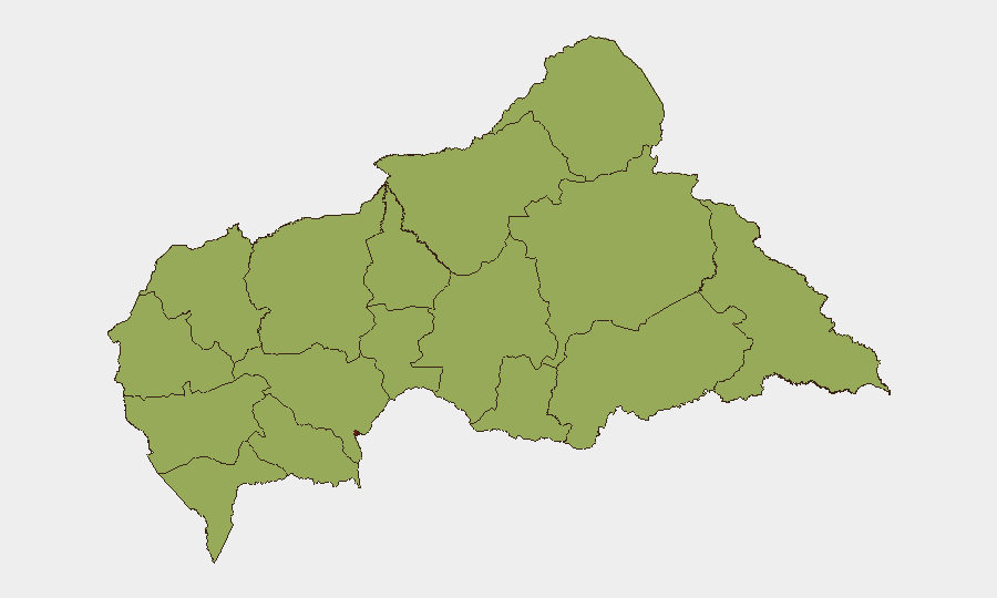
Bangui's risk score (81) substantially exceeds all provincial prefectures (all 51), reflecting the capital's concentration of government, banking, transport, and expatriate assets—and its historical vulnerability to street crime, occasional civil unrest, and security-force friction. The ring of northern and eastern prefectures (Bamingui-Bangoran, Vakaga, Haute-Kotto, Haut-Mbomou, Mbomou) carries elevated and uniform risk owing to proximity to Chad and DRC, active armed-group presence, and minimal state administrative reach. Western zones (Nana-Mambéré, Ouham-Pendé, Mambéré-Kadéï, Sangha-Mbaéré) face similar pressures from porous borders and criminal transit networks. Organizations with personnel or logistics in Bangui should prioritize situational awareness; those operating in provincial areas should assume baseline militia and banditry threats and maintain secure communication and extraction protocols.
How GeoBit Would Assist
Security teams should deploy AOI Monitoring & Early Warning on Bangui, key transport corridors, and provincial towns to detect emerging violence or unrest in near-real time. Parallel use of multi-language OSINT (Intel Sweep, X/Twitter & Telegram monitoring, NGO-data fusion) across French and Sango-language sources, cross-checked against entity and network analysis, will surface credible signals faster than single-source web search. Routing & Network Analysis supports contingency-planning for staff movement and supply-chain resilience in event of road closures or armed-group checkpoints.
7-Day Outlook
No imminent, high-probability spike in violence is signaled by available data, but the recent cluster of governmental and financial-sector statements warrants heightened vigilance for political friction, currency instability, or restrictions on commerce that could ripple into civil unrest. Bangui and border zones should remain under continuous watch; rainy-season logistics challenges may compound security risks in provincial supply routes. Reassess staffing and asset exposure if verified incidents occur or if cross-border DRC or Chad escalation spreads northward.
Highest-Risk Areas — Ranked
| # | State / Region | Risk |
|---|---|---|
| 1 | Bangui | 81 |
| 2 | Bamingui-Bangoran | 51 |
| 3 | Vakaga | 51 |
| 4 | Haute-Kotto | 51 |
| 5 | Haut-Mbomou | 51 |
| 6 | Mbomou | 51 |
| 7 | Nana-Mambéré | 51 |
| 8 | Ouham-Pendé | 51 |
| 9 | Mambéré-Kadéï | 51 |
| 10 | Sangha-Mbaéré | 51 |
| 11 | Ouham | 51 |
| 12 | Nana-Grébizi | 51 |
Previous Daily Briefs
A new Central African Republic brief is written every day — each with its own risk map and downloadable CSV. Here's the last week; use the calendar to go further back.
📅 Browse every day by calendar →
Highlighted days have a brief. Tap a day for that day's map & analysis, or “csv” for that day's dataset ($5).