Situation Summary
Chile remains a low-to-moderate threat environment globally (rank #101) with a composite threat score of 10 across 44 tracked events. However, security conditions have deteriorated sharply over the past 48 hours due to a convergence of two distinct crises: a significant armed attack on police in Santiago's Lo Espejo district, and a major weather emergency affecting ten regions. The incident trajectory suggests both short-term operational risk (manhunt operations, enhanced checkpoints) and infrastructure disruption risk (flooding, road closures, power outages) through at least July 21.
Key Developments
- Lo Espejo, Santiago Metropolitan Region – July 17, 2026 – Armed attack on police; suspect at large. A gunman identified as B.A.A.G. ("El Panda"), allegedly linked to narcotrafficking gang "Los Chicorte," fired multiple shots at Carabineros during a routine check on Pasaje Las Carreras around 10:40, seriously wounding a sub-lieutenant and first corporal. The suspect remains pro-fugitive.
- Santiago and surrounding regions – July 18–19, 2026 – Intensive manhunt operations. Carabineros deployed extensive search operations across the capital; one injured officer remains in serious condition at Carabineros Hospital. National media coverage confirms the case is flagged as a high-priority threat to police safety.
- Central–North and South-Central Chile – July 18–19, 2026 – Preventive emergency declaration. The Chilean government declared a preventive state of emergency through July 21 covering ten regions (Atacama, Coquimbo, Valparaíso, Metropolitana, O'Higgins, Maule, Ñuble, Biobío, La Araucanía, Los Ríos) due to severe storms, flooding, landslides, and power interruptions.
- Multiple regions – July 18–19, 2026 – Infrastructure and transport disruption. Heavy rains caused river overflows, road closures, and localized power outages. Inter-city bus traffic and ground transport face cancellations and delays; authorities warn of hazardous driving conditions in coastal and mountainous corridors.
- National – July 19, 2026 – Military and police pre-positioned for emergency response. Armed forces and security services deployed to manage flood evacuations and protect critical infrastructure, raising short-term checkpoints and restricted-access areas.
Highest-Risk Areas
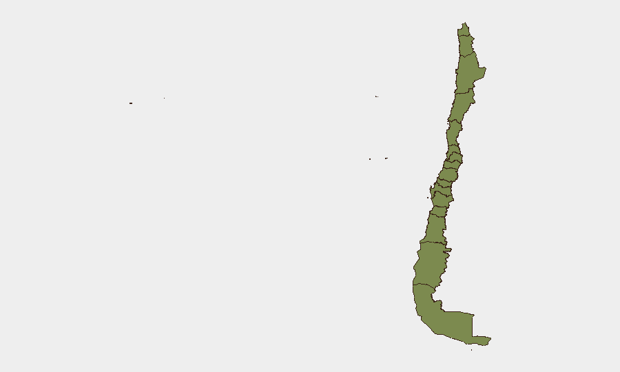
Santiago Metropolitan Region (risk 28.2) and Coquimbo Region (risk 28.2) dominate the sub-national ranking and account for the majority of tracked threat events. Santiago's elevated score reflects the active manhunt for the Lo Espejo shooter and the region's population density; Coquimbo's score is driven by the convergence of storm-related infrastructure damage and regional crime activity. Tarapacá Region (risk 8.5) represents a distant secondary concern. All ten regions under emergency declaration face elevated near-term risk from flooding and associated access constraints, though the emergency is weather-driven rather than security-driven.
How GeoBit Would Assist
Security teams should deploy AOI Monitoring & Early Warning to track real-time developments in Santiago's Lo Espejo and surrounding communes, paired with Intel Sweep and OSINT fusion (X/Twitter, Telegram, local news) to monitor manhunt progress and police operations. Routing & Network Analysis should be activated to model alternative travel corridors and supply-chain routes around the ten flood-affected regions, identifying passable roads and infrastructure status. Continuous sentiment & temporal analysis of local reporting will provide early indication of any escalation in police-criminal violence or public-order deterioration.
7-Day Outlook
The emergency declaration expires July 21; weather conditions are expected to improve thereafter, allowing infrastructure repair and transport normalization. However, the Lo Espejo manhunt may persist beyond the week if the suspect remains at large, sustaining elevated police presence and checkpoint activity in southern Santiago. No indicators suggest broader civil unrest or political instability; threat trajectory remains localized to storm recovery and law-enforcement operations.
Highest-Risk Areas — Ranked
| # | State / Region | Risk |
|---|---|---|
| 1 | Santiago Metropolitan Region | 31.8 |
| 2 | Coquimbo Region | 28.2 |
| 3 | Tarapacа Region | 8.5 |
| 4 | Magallanes and Chilean Antarctica Region | 3.4 |
| 5 | Antofagasta Region | 2.3 |
| 6 | Valparaiso Region | 1.8 |
| 7 | Atacama Region | 1.8 |
| 8 | Aysen del General Carlos Ibanez del Campo Region | 1.8 |
| 9 | Los Lagos Region | 1.8 |
| 10 | O'Higgins Region | 1.8 |
| 11 | Maule Region | 1.8 |
| 12 | Nuble Region | 1.8 |
Sources
Previous Daily Briefs
A new Chile brief is written every day — each with its own risk map and downloadable CSV. Here's the last week; use the calendar to go further back.
📅 Browse every day by calendar →
Highlighted days have a brief. Tap a day for that day's map & analysis, or “csv” for that day's dataset ($5).
Atlas — our AI intelligence desk — emails them this snapshot personally. Nothing else, no list.