Situation Summary
Cuba remains a low-to-moderate composite threat environment (rank #105 globally; threat score 10) but faces persistent operational hazards driven by island-wide shortages of fuel, electricity, food, water, and medicine. Power cuts are frequent and unpredictable, with occasional nationwide outages exceeding 24 hours; fuel shortages have severely disrupted transport and created queuing-related friction. State security apparatus continues to suppress civil unrest without tolerance, and personal-safety risks (sexual assault, crime in public spaces) remain elevated for foreign nationals. The security picture is shaped less by discrete violent incidents than by chronic resource constraints and state behavior.
Key Developments
- Nationwide (Cuba) – 2026-06-28 to 2026-06-30 · Multiple public statements by Cuban officials and residents, coupled with disapproval signals directed at the presidency and government, suggest mounting frustration over unresolved shortages and governance. No corroborated large-scale protest or unrest has been reported in open sources in the last 48 hours, but the frequency of public commentary indicates simmering discontent.
- Havana (HAV) – 2026-06-28 to 2026-06-29 · A "Reject" signal between Havana and the presidency, alongside an arrest/detention event involving citizens, points to continued friction between city-level governance and national authorities; circumstances remain unclear from open sources.
- Cuba (national) – 2026-06-29 · A "Reduce Relations" signal involving an external actor (labeled "EMPEROR" in event data) suggests possible diplomatic or economic pressure or cooling of ties; full context is not available in public reporting.
- Caseworker Investigation (national) – 2026-06-30 · An "Investigate" signal involving a caseworker was triggered on 2026-06-30; no additional details are available, but such signals may indicate labor disputes, corruption inquiries, or NGO/humanitarian worker complications.
- Embassy Communication (Havana) – 2026-06-29 · A "Cuba vs EMBASSY" public statement signal on 2026-06-29 suggests a public disagreement or statement by Cuban authorities regarding diplomatic representation; details are not yet available in corroborated open sources.
Note: Open-source intelligence for the last 24–48 hours is extremely limited. No clearly documented major incidents of civil violence, mass unrest, infrastructure failure, or discrete crime events are corroborated by multiple independent outlets. Risk remains driven by ongoing resource shortages and state suppression patterns rather than new discrete incidents.
Highest-Risk Areas
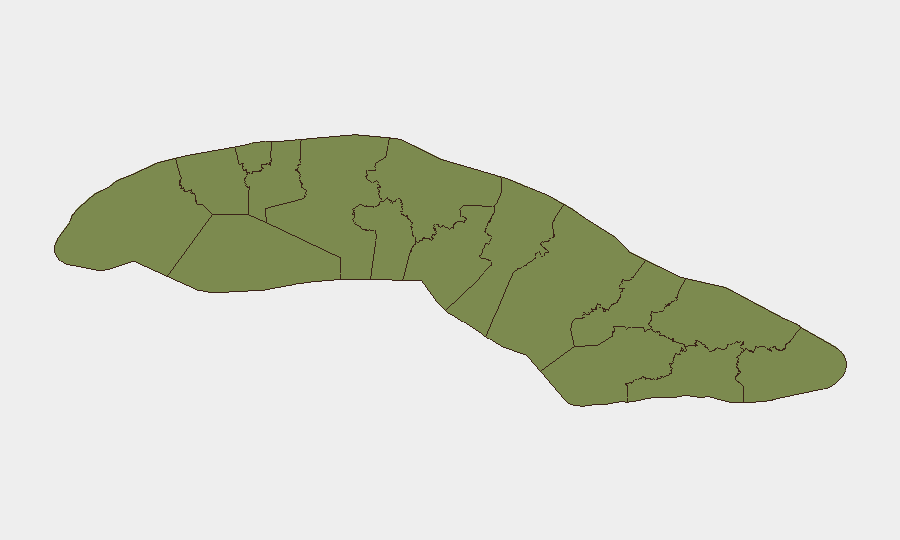
Sancti Spiritus (score 34.2) is a significant outlier and the dominant sub-national risk driver; the specific threat(s) driving this ranking are not fully transparent in open reporting and warrant urgent investigation. Havana (13.9) carries risk tied to political friction, civil unrest sensitivity, and crime/personal safety. Santiago de Cuba (11.5) and Pinar del Rio (9) present moderate elevated risk, likely linked to resource scarcity, transportation disruption, and state security posture. All other provinces cluster below 10, indicating that security risk is concentrated in a small number of regions.
How GeoBit Would Assist
Corporate security teams would deploy AOI Monitoring & Early Warning on Sancti Spiritus and Havana to detect protest, civil unrest, or security force activity in real time; Intel Sweep and X/Twitter & Telegram OSINT to capture public statements, sentiment, and actor movements; and Risk & Threat Assessment to correlate shortages, power outages, and diplomatic signals into actionable alerts for personnel and asset protection. Routing & Network Analysis would identify alternative travel and supply chains during fuel and transport disruptions.
7-Day Outlook
Shortages and power instability will likely persist, with heightened risk during any new public statements or demonstrations. State suppression of dissent remains consistent. Risk of discrete violent incidents remains low in open reporting, but operational friction—stranded personnel, transport delays, communication blackouts—will remain elevated.
Highest-Risk Areas — Ranked
| # | State / Region | Risk |
|---|---|---|
| 1 | Sancti Spiritus | 34.2 |
| 2 | Havana | 13.9 |
| 3 | Santiago de Cuba | 11.5 |
| 4 | Pinar del Rio | 9 |
| 5 | Matanzas | 7.1 |
| 6 | Mayabeque | 5.2 |
| 7 | Cienfuegos | 5.2 |
| 8 | Las Tunas | 5.2 |
| 9 | Artemisa | 4.2 |
| 10 | Villa Clara | 4.2 |
| 11 | Isle of Youth | 4.2 |
| 12 | Ciego de Avila | 4.2 |
Sources
Previous Daily Briefs
A new Cuba brief is written every day — each with its own risk map and downloadable CSV. Here's the last week; use the calendar to go further back.
📅 Browse every day by calendar →
Highlighted days have a brief. Tap a day for that day's map & analysis, or “csv” for that day's dataset ($5).