Situation Summary
Eswatini maintains a stable security environment with no confirmed incidents or acute threats reported in the last 24–48 hours. Open-source monitoring across news, social media, and risk dashboards indicates a quiet operational baseline across all regions. The country's composite threat score remains low (9/global scale), with no active civil unrest, violence, infrastructure disruption, or travel-risk incidents currently tracked.
Key Developments
No discrete security, conflict, civil-unrest, crime, political-instability, infrastructure, or travel-risk incidents have been confirmed in Eswatini during the 24–48 hour reporting window (2–3 August 2026). Live risk dashboards, aggregated news feeds, and social media OSINT monitoring report no new protests, roadblocks, violence, or service disruptions across the country. Structural issues (food security, economic planning) remain under discussion in regional media but do not reflect acute security events. No active disaster alerts or emergency declarations are in effect. The security environment is assessed as quiet and stable with no trajectory toward deterioration at this time.
Highest-Risk Areas
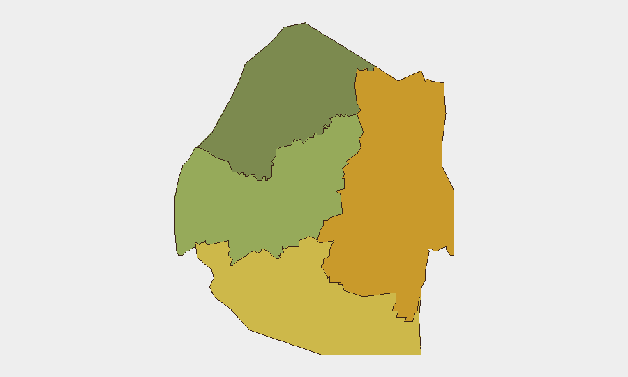
Lubombo (risk 72) and Shiselweni (risk 68) regions command the highest composite threat scores and warrant priority monitoring for corporate assets and personnel. These two southern and eastern regions likely reflect cumulative vulnerability to cross-border activity, historical instability patterns, and structural economic or governance challenges rather than current active incidents. Manzini Region (risk 55) represents a secondary concern zone. Hhohho Region (risk 35) carries the lowest risk profile. Security teams should apply heightened awareness and contingency planning for staff or assets in Lubombo and Shiselweni, even during periods of national calm, as these areas retain structural risk factors.
How GeoBit Would Assist
Security teams can employ AOI Monitoring & Early Warning to maintain persistent watch over Lubombo and Shiselweni with automated alerting if incident patterns emerge. Intel Sweep and multi-language OSINT (including X/Twitter, Telegram, and local-language social media) enable continuous detection of civil unrest, political instability, or crime signals before mainstream news publication. Routing & Network Analysis supports alternative journey planning and real-time adjustment of personnel movement through high-risk regions. For longer-term duty-of-care planning, Risk & Threat Assessment and Regime-Stability Search provide structured analysis of underlying political and economic drivers in each region.
7-Day Outlook
No escalation in security incidents is anticipated over the next 7 days based on current baseline and open-source indicators. Eswatini's stability appears sustained; however, security teams should maintain routine monitoring of Lubombo and Shiselweni through automated alerts and periodic intelligence sweeps. Any significant political statement, regional cross-border activity, or economic announcement should be tracked for potential downstream impact on the currently quiet environment.
Highest-Risk Areas — Ranked
| # | State / Region | Risk |
|---|---|---|
| 1 | Lubombo | 72 |
| 2 | Shiselweni | 68 |
| 3 | Manzini Region | 55 |
| 4 | Hhohho Region | 35 |
Sources
- geobit.ai
- independentnews.co.sz
- swazimedia.blogspot.com
- times.co.sz
- travelriskcalculator.com
- eswatinipositivenews.online
- swazibridge.com
- agribusinessmedia.com
- independentnews.co.sz
- africanewshunt.com
- ewn.co.za
- youtube.com
- swazibridge.com
- iol.co.za
- reuters.com
- aljazeera.com
- eswatinipositivenews.online
- virtualizationreview.com
Previous Daily Briefs
A new Eswatini brief is written every day — each with its own risk map and downloadable CSV. Here's the last week; use the calendar to go further back.
📅 Browse every day by calendar →
Highlighted days have a brief. Tap a day for that day's map & analysis, or “csv” for that day's dataset ($5).
Atlas — our AI intelligence desk — emails them this snapshot personally. Nothing else, no list.