Situation Summary
Guatemala remains a moderate-risk environment (global rank #60) with a composite threat score of 21 across 48 tracked events. The security picture is currently split between acute natural hazard response (two significant earthquakes in 48 hours affecting western departments) and endemic violent crime concentrated in Alta Verapaz and Guatemala City. No nationwide destabilization is evident, but seismic disruptions and localized gang activity create overlapping duty-of-care exposure for organizations operating in affected zones.
Key Developments
- 07-17, Southern Mexico–Guatemala Border (San Marcos, Quetzaltenango, Suchitepéquez, Retalhuleu): A magnitude 7.3 earthquake struck the Pacific coast near the Mexico–Guatemala border. Guatemala's disaster agency CONRED reported no immediate structural damage in-country, but landslides were documented on western roads; the Ministry of Education suspended in-person classes in four western departments as a precautionary measure.
- 07-18, Pacific Coast off Guatemala: A magnitude 5.0 earthquake was recorded off the Guatemalan Pacific coast per INSIVUMEH; no major damage or casualties reported, but authorities emphasized continued seismic monitoring.
- 07-17, Coatepeque, Quetzaltenango: A man was shot and killed in an armed attack in Barrio El Rosario, zone 2; municipal firefighters confirmed multiple gunshot wounds, illustrating ongoing violent crime risk in secondary urban centers outside Guatemala City.
- 07-18, Guatemala City & National Urban Centers: Traffic congestion and mobility disruptions were reported in and around Guatemala City on Saturday, affecting transportation and potentially emergency response times; underlying causes include event activity and routine congestion.
- 07-18, Western Departments (ongoing): Road-safety monitoring and precautionary transport restrictions remain in place in San Marcos, Quetzaltenango, Suchitepéquez, and Retalhuleu due to seismic damage and landslide risk on western routes.
- National (updated mid-2026): International travel advisories continue to flag high levels of violent crime, armed robbery, and gang activity in Guatemala City (zones 10, 13, 14) and other urban centers, with increased security-force presence linked to an ongoing *estado de prevención*.
Highest-Risk Areas
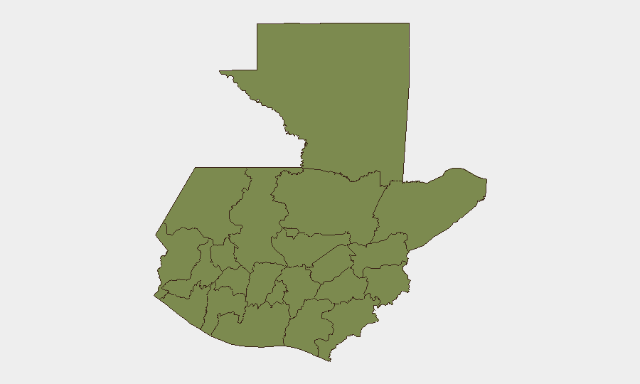
Alta Verapaz (risk 14.1) and Guatemala Department (risk 14.1) dominate the sub-national threat ranking, together accounting for approximately 67% of tracked risk in the country. Alta Verapaz's elevated score reflects persistent gang activity and organized crime; Guatemala Department risk is driven by violent crime in the capital's high-crime zones and surrounding municipalities. Western departments (Quetzaltenango, San Marcos, Retalhuleu, Totonicapán, Sololá) face secondary risk, now compounded by seismic disruption and landslide exposure from the 07-17 and 07-18 earthquakes. Organizations with personnel or logistics operations in Alta Verapaz or Guatemala City should prioritize immediate risk review.
How GeoBit Would Assist
Organizations operating in Guatemala should deploy AOI Monitoring & Early Warning on Alta Verapaz, Guatemala City high-crime zones, and the western seismic-affected corridor to detect escalations in violent crime or aftershock activity in real time. Routing & Network Analysis can provide updated alternative travel corridors around landslide zones and traffic congestion in Guatemala City. Conflict & Crime Intelligence with OSINT Fusion (X/Twitter, local media, municipal feeds) enables continuous threat tracking of gang activity and security-force responses across departments, supporting informed duty-of-care decisions.
7-Day Outlook
Seismic activity is expected to diminish over the next 7 days as aftershocks attenuate, but road infrastructure in western departments will require monitoring for secondary landslides and access disruptions through mid-to-late July. Violent crime patterns in Alta Verapaz and Guatemala City are unlikely to change materially in the near term; the *estado de prevención* will likely persist. Organizations should maintain elevated vigilance in both zones and track any correlation between seismic displacement and gang territorial shifts in affected border regions.
Highest-Risk Areas — Ranked
| # | State / Region | Risk |
|---|---|---|
| 1 | Alta Verapaz | 31.8 |
| 2 | Guatemala Department | 14.1 |
| 3 | Izabal | 3.2 |
| 4 | Quetzaltenango | 2.5 |
| 5 | Totonicapán | 2.5 |
| 6 | Sololá | 2.5 |
| 7 | Petén | 1.8 |
| 8 | Huehuetenango | 1.8 |
| 9 | San Marcos | 1.8 |
| 10 | Retalhuleu | 1.8 |
| 11 | Quiché | 1.8 |
| 12 | Chimaltenango | 1.8 |
Sources
Previous Daily Briefs
A new Guatemala brief is written every day — each with its own risk map and downloadable CSV. Here's the last week; use the calendar to go further back.
📅 Browse every day by calendar →
Highlighted days have a brief. Tap a day for that day's map & analysis, or “csv” for that day's dataset ($5).
Atlas — our AI intelligence desk — emails them this snapshot personally. Nothing else, no list.