Situation Summary
Honduras remains at composite threat rank #56 globally (score 24), with a stable security posture over the last 48 hours and no confirmed acute incidents, armed clashes, major protests, or transport disruptions nationwide. Multi-source monitoring indicates that primary highways and cross-border routes are open and baseline criminal and organized-crime risk persists, particularly in Olancho and Copán departments, without evidence of acute escalation. A localized flood event has been recorded within Honduras and is under ongoing assessment for regional infrastructure and livelihood impact, though no widespread transport failures have been confirmed as of 5 July.
Key Developments
- National – 3–5 July 2026: Multi-source monitoring (open-source media, official channels, social feeds) reports no corroborated armed clashes, significant shootings, transport strikes, major protests, or roadblocks nationwide in the 48-hour window; major highways and cross-border routes remain open and unobstructed.
- Tegucigalpa / Francisco Morazán – 3–5 July 2026: No new mass-casualty events, large police operations, or civil-unrest incidents confirmed in the capital region during the 24–48-hour assessment window, though baseline homicide and organized-crime risk remains elevated.
- Olancho department – 3–5 July 2026: Despite Olancho's status as the highest-risk department for organized crime and trafficking, no new armed clashes, mass-casualty incidents, or road blockages have been confirmed; risk assessed as baseline rather than acutely escalating.
- Copán department – 3–5 July 2026: No confirmed acute incidents (shootings, clashes, or protests) reported by multi-source monitoring in the 24–48-hour window, though elevated secondary security risk continues.
- Honduras (location pending) – up to 5 July 2026: A flood event has been recorded; ongoing monitoring shows no widespread infrastructure failures or major transport disruptions confirmed as of the last 24–48 hours, though localized impacts remain under assessment.
- Political activity – 5 July 2026: Public statements from multiple actors (ruler, government, village, judge vs. Congress, Honduras vs. Congress) and a demonstration by ministry personnel are recorded; arrests/detentions involving prison administration and U.S. involvement noted but lacking confirmed escalatory context at this time.
Highest-Risk Areas
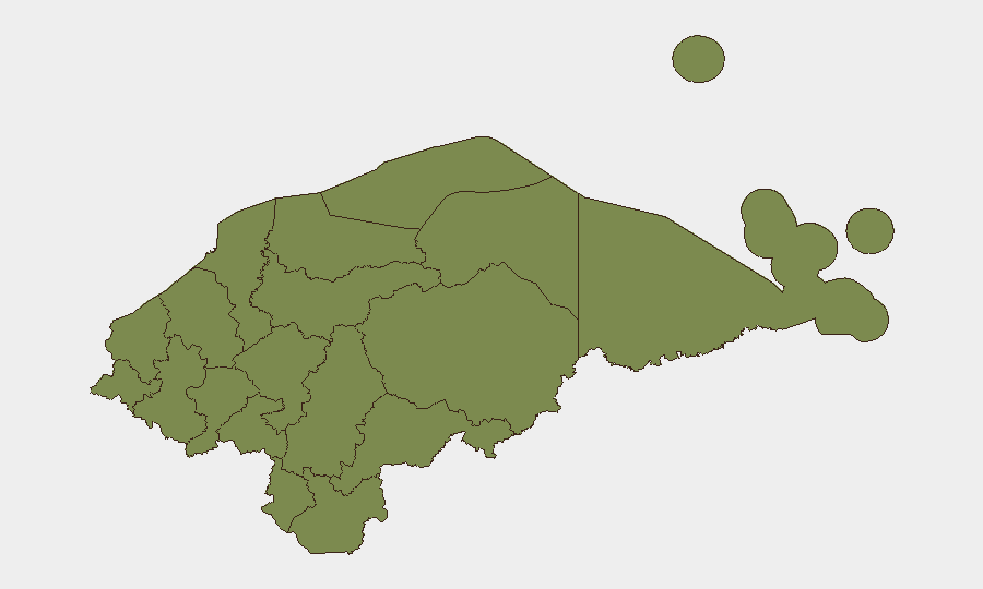
Olancho department (risk score 31.5) significantly outpaces all other regions and remains the primary driver of Honduras's composite threat profile, primarily owing to entrenched organized-crime and drug-trafficking networks. Copán (risk 19) ranks second and warrants sustained attention for secondary criminal and trafficking risk. The remaining ten departments cluster at risk 1.5, indicating either lower incident density or lower severity; baseline criminal activity and gang presence persist nationwide, but geographic concentration of elevated risk is narrow.
How GeoBit Would Assist
Security teams operating in Honduras should employ AOI Monitoring & Early Warning to track Olancho and Copán departments for emerging trafficking, violent-crime, or protest activity; pair this with OSINT fusion & corroboration (X/Twitter, Telegram, local media aggregation) to detect early signals of transport disruption, civil unrest, or criminal escalation. Conflict & Military network analysis and entity extraction would support identification of key organized-crime actors and their operational patterns, informing route planning and duty-of-care decisions. GIS & Spatial Analysis of flood-affected areas and alternative routing & network analysis should be applied to assess transport corridor resilience and personnel movement contingencies in real time.
7-Day Outlook
Security analysts report no acute security shock anticipated in the next seven days, with risk trajectory at baseline through at least 5 July. Ongoing political tensions and localized flooding warrant continued passive monitoring but show no indication of imminent escalation into civil unrest, major criminal violence, or widespread transport disruption. Routine situational awareness is appropriate; no heightened alert posture is warranted at this time.
Highest-Risk Areas — Ranked
| # | State / Region | Risk |
|---|---|---|
| 1 | Olancho | 31.5 |
| 2 | Copán | 19 |
| 3 | El Paraíso | 1.5 |
| 4 | Ocotepeque | 1.5 |
| 5 | Cortés | 1.5 |
| 6 | Yoro | 1.5 |
| 7 | Santa Bárbara | 1.5 |
| 8 | Lempira | 1.5 |
| 9 | Intibucá | 1.5 |
| 10 | Comayagua | 1.5 |
| 11 | La Paz | 1.5 |
| 12 | Valle | 1.5 |
Sources
Previous Daily Briefs
A new Honduras brief is written every day — each with its own risk map and downloadable CSV. Here's the last week; use the calendar to go further back.
📅 Browse every day by calendar →
Highlighted days have a brief. Tap a day for that day's map & analysis, or “csv” for that day's dataset ($5).
Atlas — our AI intelligence desk — emails them this snapshot personally. Nothing else, no list.