Situation Summary
Jordan faces acute military escalation driven by Iran–U.S. conflict, with Iranian missile and drone strikes against U.S. military bases inside Jordanian territory resulting in at least 2 confirmed U.S. fatalities, 1 missing, and 4 wounded as of 19 July 2026. The Jordanian Armed Forces have successfully intercepted multiple Iranian salvos (10 missiles on 18 July; 4 on 13–14 July), preventing significant domestic casualties, but the pattern indicates sustained Iranian targeting and a cycle of U.S. retaliatory strikes that is likely to continue. Civil-order risks remain low outside military zones, but airspace disruption, travel advisories, and potential for wider regional escalation are now primary duty-of-care concerns for corporate personnel and assets in the kingdom.
Key Developments
- Muwaffaq Salti Air Base, Azraq (eastern Jordan) – Friday, 17 July 2026
Iranian missile/drone strike killed 2 U.S. service members, left 1 missing, and wounded 4 others; CENTCOM confirmed the attack as part of a series of Iranian strikes on U.S. facilities in Jordan.
- Jordanian airspace, multiple locations – Saturday, 18 July 2026
Jordanian Armed Forces announced interception and destruction of 10 Iranian missiles entering Jordanian airspace; no Jordanian casualties or material damage reported.
- U.S. military bases, Jordan (location unspecified) – Friday–Saturday, 17–18 July 2026
U.S. officials reported Iran attacked at least two Jordanian bases within the week, injuring several American service members; attack pattern characterized as 4 strikes in 5 days.
- U.S. Embassy, Amman – Security Alert issued Thursday, 17 July 2026
Embassy published advisory urging U.S. citizens to reconsider travel to Jordan, avoid military bases, and monitor flight status due to escalating military activity and regional conflict.
- Gulf and Levantine airspace – Friday–Saturday, 17–18 July 2026
European Union Aviation Safety Agency advised air operators to avoid specified Gulf airspace until at least 29 July 2026 in response to ongoing missile attacks; commercial flight routing to/from Jordan now affected.
- CENTCOM retaliatory strikes – Saturday evening, 18 July 2026
U.S. Central Command announced new airstrikes on Iran in response to Friday attack on U.S. forces in Jordan, explicitly framing response as punishment and signaling continued escalation cycle.
Highest-Risk Areas
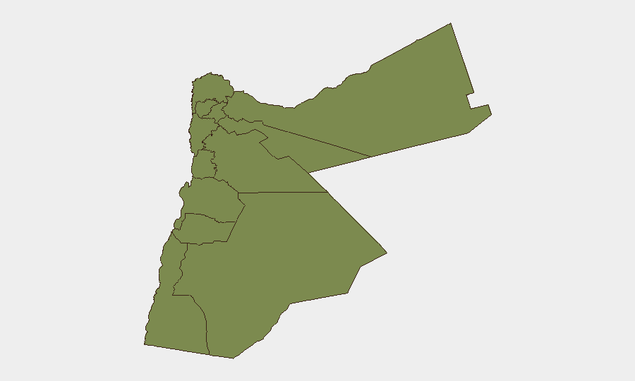
Karak Governorate carries risk composite more than 7 times higher than all other Jordanian regions (31.8 vs. 4.5 for Zarqa), though the current event signal is primarily military-to-military rather than localized civil instability in Karak itself. Zarqa and Amman (risk 4.5 and 3.4 respectively) rank second and third, likely reflecting proximity to U.S. military facilities and population density. All other governorates cluster at risk 1.8, indicating that the current threat landscape is heavily concentrated in military operational zones rather than spread across civil or urban centers; corporate operations and personnel in remote southern and northern regions (Aqaba, Maan, Irbid, Ajlun) face materially lower escalation risk than those near bases or in larger urban hubs.
How GeoBit Would Assist
Corporate security teams should deploy AOI Monitoring & Early Warning on U.S. military bases and approach routes to detect missile launch signatures and intercept events in real time, coupled with Aviation tracking to monitor commercial flight disruptions and rerouting. Intel Sweep and multi-language X/Telegram OSINT will surface emerging Iranian attack announcements and Jordanian military responses within hours, enabling rapid duty-of-care notifications. Conflict & Military mapping and GIS spatial analysis will help plot safe corridors and movement windows outside strike zones and airspace restrictions.
7-Day Outlook
Iranian missile activity is likely to continue or intensify in response to U.S. retaliatory strikes, sustaining elevated threat to U.S. bases and Jordanian airspace through at least 25 July. Commercial aviation restrictions are expected to remain in place until late July, creating logistical friction for personnel movement. Civil order in major cities (Amman, Zarqa, Irbid) is projected to remain stable, but widespread travel warnings and international staff departures may accelerate over the next 7–10 days.
Highest-Risk Areas — Ranked
| # | State / Region | Risk |
|---|---|---|
| 1 | Karak | 31.8 |
| 2 | Zarqa | 4.5 |
| 3 | Amman | 3.4 |
| 4 | Irbid | 1.8 |
| 5 | Ajlun | 1.8 |
| 6 | Balqa | 1.8 |
| 7 | Jarash | 1.8 |
| 8 | Mafraq | 1.8 |
| 9 | Madaba | 1.8 |
| 10 | Tafilah | 1.8 |
| 11 | Aqaba | 1.8 |
| 12 | Maan | 1.8 |
Sources
Previous Daily Briefs
A new Jordan brief is written every day — each with its own risk map and downloadable CSV. Here's the last week; use the calendar to go further back.
📅 Browse every day by calendar →
Highlighted days have a brief. Tap a day for that day's map & analysis, or “csv” for that day's dataset ($5).
Atlas — our AI intelligence desk — emails them this snapshot personally. Nothing else, no list.