Situation Summary
The Maldives remains a low-threat jurisdiction (composite score 2; no tracked systemic events), with security risks concentrated in the capital region and northern atolls. Recent incidents—mosque vandalism, drug arrests, airport drug seizures, and minor infrastructure fires—reflect localized crime and operational disruptions rather than organized threats or instability. No indicators suggest deterioration in the security environment over the past 48 hours.
Key Developments
- Hulhumalé, Malé region – mosque vandalism (July 27, ~03:47): Glass door panel at Masjid Azeeza Moosa smashed; police investigation ongoing, no arrests reported. This marks a second incident at the same mosque within one week, with a suspect previously involved in the first incident (July 22) now under separate investigation.
- Gan International Airport, Addu City – drug seizure (July 18): Customs seized approximately 5.5 kg of drugs valued at MVR 4.4 million from two Indian passengers; narcotics and customs investigation initiated into smuggling routes and methods.
- R. Dhuvaafaru, Raa Atoll – drug operation arrests (July 22): Joint Counter Narcotics Intelligence and local police operation arrested four men (aged 19–22) for alleged drug use and dealing; suspected drugs and consumption equipment seized from a café; all remanded by court.
- Kaafu Himmafushi – expatriate altercation (July 19): Two Egyptian men arrested following a reported fight at 19:24; immigration deportation proceedings initiated following police investigation completion.
- Thilafushi waste site – operational disruption (July 19–20): Fire at WAMCO facility extinguished Monday morning; subsequent reduction in waste acceptance capacity affecting Malé region operations.
- Hanimaadhoo harbour, Haa Dhaalu Atoll – maritime incident (late July): Engine fire on a launch contained by MNDF firefighters; no casualties reported.
Highest-Risk Areas
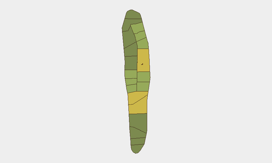
Malé and Malé Atoll (risk scores 85 and 68 respectively) drive the national risk profile, reflecting concentration of population, commercial activity, and law-enforcement reporting density in the capital. The recent repeat vandalism at Hulhumalé and airport drug seizure reinforce that narcotics trafficking and petty crime remain the primary localized risk vectors in the capital region. Northern atolls (Hadhdhunmathi, Kolhumadulu, Felidhu) show elevated scores consistent with drug-trafficking activity and remote-area operational challenges; southern and central atolls register moderate risk, typical of low-population-density island jurisdictions.
How GeoBit Would Assist
Security teams with personnel or assets in Maldives would employ OSINT fusion and corroboration to track recurring incidents (e.g., the mosque vandalism pattern) and entity extraction and network analysis to map narcotics-trafficking actors and routes, particularly following airport seizures. AOI monitoring and early warning on Malé, Hulhumalé, and port facilities would provide persistent visibility into emerging crime clusters and operational disruptions; cross-platform intelligence (social media, local news, radio SIGINT) would enable rapid detection of civil unrest or security incidents before they escalate.
7-Day Outlook
No indicators suggest imminent escalation of security threats. The pattern of repeat vandalism and drug arrests reflects ongoing endemic crime rather than organized activity; however, the clustering of narcotics operations warrants continued monitoring of trafficking routes via airports and maritime approaches. Duty-of-care teams should maintain standard vigilance protocols in Malé and northern atolls and track any recurrence at religious sites or public infrastructure.
Highest-Risk Areas — Ranked
| # | State / Region | Risk |
|---|---|---|
| 1 | Malé | 85 |
| 2 | Malé Atoll | 68 |
| 3 | Hadhdhunmathi | 65 |
| 4 | Kolhumadulu | 60 |
| 5 | Felidhu Atoll | 58 |
| 6 | Mulaku Atoll | 55 |
| 7 | Faadhippolhu | 52 |
| 8 | South Miladhunmadulu | 48 |
| 9 | North Miladhunmadulu | 45 |
| 10 | South Nilandhe Atoll | 44 |
| 11 | North Nilandhe Atoll | 42 |
| 12 | South Ari Atoll | 40 |
Sources
Previous Daily Briefs
A new Maldives brief is written every day — each with its own risk map and downloadable CSV. Here's the last week; use the calendar to go further back.
📅 Browse every day by calendar →
Highlighted days have a brief. Tap a day for that day's map & analysis, or “csv” for that day's dataset ($5).
Atlas — our AI intelligence desk — emails them this snapshot personally. Nothing else, no list.