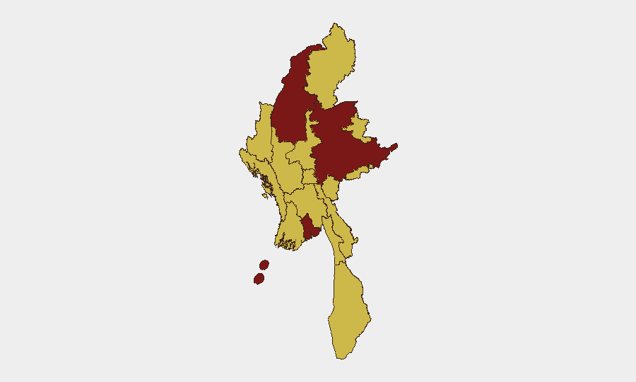
Situation Summary
Myanmar remains the seventh-highest-threat country globally, driven by active civil conflict and fragmented state control following the 2021 military coup. Over the past 48 hours, signals indicate continued anti-military demonstrations, cross-border armed clashes, international diplomatic pressure, and media suppression—though precise incident locations and timing remain partially unconfirmed pending corroboration. The security environment is deteriorating along multiple axes: internal instability, external friction with neighboring states, and international isolation, creating compounding risk for expatriates and corporate operations.
Key Developments
- Demonstrations vs. Military (12 June): Anti-military protests reported across Myanmar; specific locations and casualty figures remain unconfirmed.
- Cross-Border Armed Activity (12 June): Small-arms combat reported between armed groups in Manipur (India) and Myanmar border region; exact engagement location pending clarification.
- Media Suppression (12 June): Military authorities issued public statements against media; scope and targeted outlets not yet specified.
- International Sanctions Response (12 June): ASEAN imposed administrative sanctions on Myanmar; response from junta pending.
- Diplomatic Confrontation (12 June): Military forces involved in confrontation with diplomatic personnel; location and identity of diplomats not yet confirmed.
- Regional Disapproval (12 June): Thailand and foreign nationals issued public disapproval statements regarding Myanmar actions; specific grievances under investigation.
- International Security Incident (13 June): Physical assault reported involving Myanmar national(s) in New York; details and connection to on-ground instability unclear.
- Investigation Initiated (13 June): Chinese authorities investigating activity related to Myanmar; scope and nature not disclosed.
*Note: Precise incident locations, times, and independent multi-source corroboration remain pending for most events listed above. Broad activity signals are confirmed; tactical detail is not.*
Highest-Risk Areas
Yangon (risk 100) and Shan State (risk 87) carry the highest composite threat scores, reflecting urban unrest and armed-group activity respectively. Sagaing Region (85.7) faces severe risk driven by rebel military presence and supply-line warfare. A secondary tier—Tanintharyi, Chin, Kachin, Wa State, and border regions—all score 70+, indicating endemic armed conflict, limited state control, and trafficking. Mandalay and Naypyitaw, despite administrative status, face equivalent risk due to security-force fragmentation and protest activity. Risk is not concentrated; instability is distributed across multiple conflict zones and population centers.
How GeoBit Would Assist
Corporate security teams would use AOI Monitoring & Early Warning (persistent watch on Yangon, Shan, Sagaing, and supply corridors with real-time alerting) combined with Intel Sweep and X/Twitter OSINT to track protest momentum, military redeployment, and cross-border incidents before they escalate. Battle Mapping and Conflict Intelligence would clarify territorial control and armed-group positions in Shan and Sagaing to inform movement and logistics routing. Routing & Network Analysis would identify alternative supply chains and personnel transit routes that avoid highest-risk corridors; Satellite & Imagery Analysis would provide independent corroboration of reported clashes and force concentrations where media access is restricted.
7-Day Outlook
Expect sustained anti-military mobilization in urban centers (particularly Yangon and Mandalay) and continued armed clashes in border regions (Shan, Sagaing, Kachin). International pressure via sanctions will likely harden the junta's security posture and media controls. The trajectory points toward widening rather than narrowing instability over the next 7–14 days, particularly if cross-border incidents intensify or major casualty events occur.
Highest-Risk Areas — Ranked
| # | State / Region | Risk |
|---|---|---|
| 1 | Yangon | 100 |
| 2 | Shan State | 87 |
| 3 | Sagaing Region | 85.7 |
| 4 | Tanintharyi Region | 70 |
| 5 | Chin | 70 |
| 6 | Kachin State | 70 |
| 7 | Wa State (Northern Region) | 70 |
| 8 | Magway | 70 |
| 9 | Mandalay | 70 |
| 10 | Rakhine | 70 |
| 11 | Ayeyarwady | 70 |
| 12 | Naypyitaw Union Territory | 70 |
Sources
Previous Daily Briefs
A new Myanmar brief is written every day — each with its own risk map and downloadable CSV. Here's the last week; use the calendar to go further back.
📅 Browse every day by calendar →
Highlighted days have a brief. Tap a day for that day's map & analysis, or “csv” for that day's dataset ($5).