Situation Summary
Nepal's composite threat score of 24 places it in the lower-to-moderate risk band globally, but sub-national concentration in Bagamati Province (risk 31.2)—which includes Kathmandu and the capital region—indicates localized volatility requiring focused attention. Recent event signals (39 tracked events) show mixed actor involvement: government and presidential statements, activist disapproval, documented physical assault between government and citizens, and small-arms combat incident reporting. Road-traffic fatalities remain the highest-frequency mass-casualty driver (8 deaths, 105 injured in the past 24 hours across Nepal), though this reflects chronic infrastructure and enforcement gaps rather than acute security deterioration. The trajectory suggests containable but persistent civil friction, with political and administrative actors dominating the signal landscape.
Key Developments
- 2026-06-23 · Physical Assault (Government vs. Citizen) – Location unspecified; one documented incident of state-citizen physical confrontation recorded in event feed, suggesting localized law-enforcement or protest-response interaction.
- 2026-06-23 · Small-Arms Combat (Seoul venue reference) – Attribution and location require clarification; may indicate diaspora or transnational incident rather than domestic Nepal territory event.
- 2026-06-22 · Administrative Rejections (Multiple) – Government and administration-level rejections documented; likely policy or treaty-related (possibly connected to South Asian Free Trade Area statement below).
- 2026-06-22 · SAFTA Trade Disapproval – Nepal issued disapproval statement regarding South Asian Free Trade Area framework; economic/diplomatic friction, not security event.
- 2026-06-21–23 · Government & Presidential Public Statements (Multiple) – Three government-level statements detected; content and policy direction require source confirmation; no immediate security escalation evident.
- 2026-06-22 · Industry Investigations (Two separate) – Two concurrent industry-sector investigations initiated; scope (labor, environmental, corruption, safety) not yet determined from available signals.
- 2026-06-23 · Activist Disapproval – Civil-society or activist organization issued statement of disapproval (target unclear); suggests ongoing advocacy or protest posture.
- 2026-06-24 · Road Traffic Fatalities – Eight deaths and 105 injuries recorded in 24-hour period; reflects persistent transport-safety and infrastructure risk, the primary mass-casualty threat in Nepal.
Highest-Risk Areas
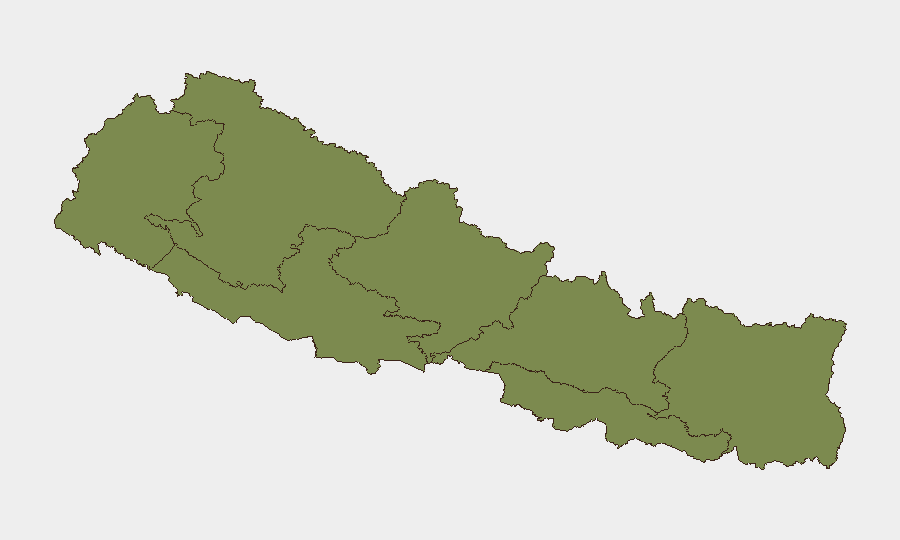
Bagamati Province dominates the risk landscape (31.2), driven by Kathmandu's density, political concentration, and protest-prone civil society. Gandaki Province (14.3) presents secondary risk, likely tied to tourism corridors, altitude-zone infrastructure, and inter-community tensions. All other provinces score substantially lower (≤3.1), indicating that security incidents, political friction, and civil unrest are geographically concentrated in the capital region and central highland zones. Organizations with operations in Kathmandu and the Bagamati Valley should prioritize localized monitoring; regional presence elsewhere in Nepal faces materially lower acute threat.
How GeoBit Would Assist
Security teams should deploy AOI Monitoring & Early Warning on Kathmandu and Bagamati Province to detect protests, roadblocks, or government-citizen friction before operational impact occurs. OSINT Fusion (social media, news feeds, activist channels, government statements) will disambiguate the current event signals—particularly the trade-policy and industry-investigation developments—and clarify whether escalation is underway. Routing & Network Analysis can pre-stage alternative transport and supply routes if civil unrest intensifies, and Risk & Threat Assessment modules will track whether state-actor statements presage policy shifts affecting business licensing, taxation, or sector restrictions.
7-Day Outlook
Near-term trajectory suggests continued low-level civil and administrative friction rather than sudden escalation. Bagamati Province will remain the primary watch zone; any expansion of physical-assault incidents or large-scale protests would constitute a shift requiring immediate re-assessment. Road-safety fatalities will likely persist as the highest-frequency casualty driver, independent of political developments.
Highest-Risk Areas — Ranked
| # | State / Region | Risk |
|---|---|---|
| 1 | Bagamati Province | 31.2 |
| 2 | Gandaki Province | 14.3 |
| 3 | Lumbini Province | 3.1 |
| 4 | Karnali Province | 2.6 |
| 5 | Koshi Province | 2.2 |
| 6 | Sudurpashchim Province | 1.2 |
| 7 | Madhesh Province | 1.2 |
Sources
Previous Daily Briefs
A new Nepal brief is written every day — each with its own risk map and downloadable CSV. Here's the last week; use the calendar to go further back.
📅 Browse every day by calendar →
Highlighted days have a brief. Tap a day for that day's map & analysis, or “csv” for that day's dataset ($5).