Situation Summary
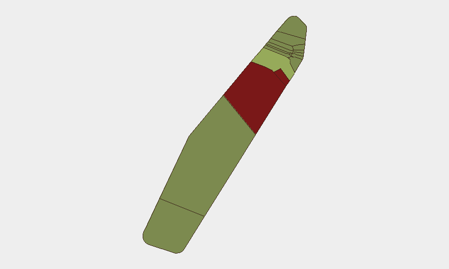
Palau remains a low-threat, stable environment with no verified security incidents, civil unrest, conflict, or travel disruptions reported in the last 24–48 hours. The country's composite threat score of 3 places it outside the global tracking threshold. Current risk is concentrated in two outlier states—Peleliu and Angaur—where elevated composite scores (92 and 88 respectively) reflect historical and structural factors rather than active incidents. Trajectory is stable; no indicators suggest imminent escalation.
Key Developments
No verified security or travel-risk incidents have occurred in Palau in the last 24–48 hours. Open-source monitoring, regional security briefs, and incident feeds returned no corroborated reports of:
- Protests, civil unrest, or politically motivated violence
- Infrastructure failures, cyberattacks, or transport disruptions
- Maritime security incidents or military confrontations within or adjacent to Palauan territory
- Crime spikes, accidents, or natural-hazard emergencies
The most recent dedicated security assessment (mid-July 2026) classified Palau as low-threat and stable. Planning discussions around the upcoming Pacific Islands Forum Leaders' Meeting reflect routine security posture-building, not response to current incidents.
Highest-Risk Areas
Peleliu (risk 92) and Angaur (risk 88) are outliers, driving the sub-national ranking. Both states historically feature elevated risk profiles—Peleliu in particular carries legacy conflict sensitivity and population density dynamics. Koror (risk 45), the commercial and administrative center, carries moderate risk primarily associated with general crime and port-activity exposure. The remaining states cluster below risk 35, reflecting Palau's overall stability. No current events are triggering these scores; they reflect structural vulnerability and baseline conditions.
How GeoBit Would Assist
Security teams with personnel or assets in Palau should deploy AOI Monitoring & Early Warning on Koror (port, commercial district) and Peleliu (population centers) to catch any uptick in incident reporting or social-media activity before it escalates. Intel Sweep (global event feeds, X/Telegram OSINT, multi-language search) should run on a 48-hour cycle to detect emerging crime, labor disputes, or maritime incidents affecting business continuity. For duty-of-care teams planning movement in higher-risk states, Routing & Network Analysis can identify alternative transit corridors and safe zones. Periodic Sentiment & Temporal Analysis of local media and community channels will flag early warning of civil tension.
7-Day Outlook
No indicators suggest deterioration over the next 7 days. Palau's governance, maritime environment, and crime baseline remain stable. Attention should remain on the Pacific Islands Forum Leaders' Meeting logistics to ensure any security measures or access restrictions do not disrupt personnel movements or supply chains. Standard monitoring cadence is sufficient unless regional signals (e.g., maritime incidents, geopolitical friction in wider Pacific) warrant uplift.
Next update: 2026-07-22 (or upon significant event detection).
Highest-Risk Areas — Ranked
| # | State / Region | Risk |
|---|---|---|
| 1 | Peleliu | 92 |
| 2 | Angaur | 88 |
| 3 | Koror | 45 |
| 4 | Melekeok | 35 |
| 5 | Airai | 32 |
| 6 | Ngatpang | 28 |
| 7 | Ngeremlengui | 26 |
| 8 | Ngaraard | 25 |
| 9 | Ngardmau | 24 |
| 10 | Aimeliik | 23 |
| 11 | Ngiwal | 22 |
| 12 | Ngchesar | 21 |
Sources
Previous Daily Briefs
A new Palau brief is written every day — each with its own risk map and downloadable CSV. Here's the last week; use the calendar to go further back.
📅 Browse every day by calendar →
Highlighted days have a brief. Tap a day for that day's map & analysis, or “csv” for that day's dataset ($5).
Atlas — our AI intelligence desk — emails them this snapshot personally. Nothing else, no list.