Situation Summary
Panama remains a lower-middle-tier global security risk (rank #72, score 18) with no acute political instability or large-scale civil unrest, but elevated baseline crime, active law-enforcement operations, and localized infrastructure impacts from weather. The security picture is characterized by sustained organized-crime pressure—particularly trafficking and smuggling—paired with consistently high lethal violence (300 homicides in H1 2026, 31 femicides). Colón province significantly outweighs all other regions in risk profile, while weather disruptions in the Caribbean northwest create secondary mobility and safety hazards.
Key Developments
- Panamá, Panamá Oeste, Bocas del Toro, Veraguas – 17–18 July | Coordinated raids on a child sexual-exploitation network resulted in four arrests and seizure of evidence-bearing electronics; case remains under prosecutorial secrecy.
- Nationwide – 18 July | Under the "Firmness Plan" security initiative, National Police reported 173 arrests in a 24-hour period; parallel Customs (ANA) operation seized approximately USD 60 million in illicit cigarettes, underscoring intensified anti-smuggling enforcement.
- Panamá Oeste – mid-July (within 48 hours) | Three individuals detained following interdiction of US-origin firearm parts; operation reflects ongoing weapons-trafficking suppression linked to local criminal groups.
- Multiple provinces – last 48 hours | "Operación Impacto Escolar" anti-drug campaign netted 20 prison sentences (up to 14 years), 16 provisional detentions, and 33 court hearings across nine provinces, targeting narcotics distribution near schools.
- Bocas del Toro (Sixaola, Changuinola, Teribe basins) – 18 July | Heavy rains damaged 222 homes and prompted elevated-water alerts on multiple river systems; civil-protection authorities (Sinaproc) issued warnings and school-closure advisories for affected areas.
- Chiriquí Grande, Bocas del Toro – 18 July | Ministry of Public Works (MOP) deployed emergency operations to repair rainfall and landslide-induced road damage, ongoing effort to maintain regional transit.
- National – mid-July | Meteorological agencies issued concurrent alerts for heavy rain, extreme heat, and strong surf; Sahara dust expected to persist for approximately three days, affecting air quality and visibility.
Highest-Risk Areas
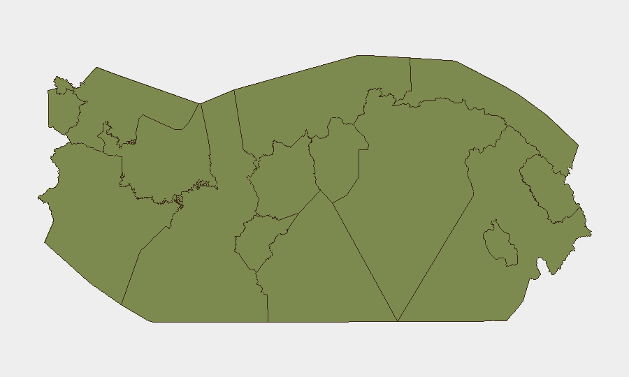
Colón province is the dominant risk driver at 31.8, approximately eleven times higher than Herrera (2.9) and substantially above all other provinces (1.8). Colón's elevated score reflects its role as a major port and transit hub for contraband, coupled with historical gang activity and limited state presence in peripheral areas. The remaining eleven provinces cluster at near-parity, indicating that while localized crime, gang presence, and infrastructure vulnerabilities exist, risk is broadly diffuse; Panamá Oeste and Panamá Province show slightly elevated exposure due to proximity to the capital and ongoing organized-crime activity, while Caribbean regions (Bocas del Toro, Guna Yala, Darién) carry environmental and transnational-trafficking hazards.
How GeoBit Would Assist
Security teams would employ Intel Sweep and OSINT fusion to monitor arrest patterns, police operations, and gang communications across platforms; AOI Monitoring with early-warning alerting on Colón, Panamá Oeste, and Panama City to detect spikes in violence or enforcement activity; and Risk & Threat Assessment plus GIS & Spatial Analysis to map weather impacts, road closures, and safe routing alternatives in flood-affected areas. Network & Actor Analysis would track trafficking organizations and their operational shifts in response to the "Firmness Plan" operations.
7-Day Outlook
Law-enforcement intensity is likely to remain elevated as the "Firmness Plan" continues; further arrests and asset seizures are probable. Bocas del Toro flooding poses short-term mobility and humanitarian risks but is not expected to precipitate wider instability. Crime levels are forecast to track at or near current high baselines absent a significant shift in state capacity or gang dynamics.
Highest-Risk Areas — Ranked
| # | State / Region | Risk |
|---|---|---|
| 1 | Colón | 31.8 |
| 2 | Herrera | 2.9 |
| 3 | Panamá Province | 1.8 |
| 4 | Guna Yala | 1.8 |
| 5 | Darién | 1.8 |
| 6 | Emberá-Wounaan | 1.8 |
| 7 | Naso Tjër Di | 1.8 |
| 8 | Bocas del Toro | 1.8 |
| 9 | Ngäbe-Buglé | 1.8 |
| 10 | Chiriquí | 1.8 |
| 11 | Coclé | 1.8 |
| 12 | Panamá Oeste | 1.8 |
Sources
Previous Daily Briefs
A new Panama brief is written every day — each with its own risk map and downloadable CSV. Here's the last week; use the calendar to go further back.
📅 Browse every day by calendar →
Highlighted days have a brief. Tap a day for that day's map & analysis, or “csv” for that day's dataset ($5).
Atlas — our AI intelligence desk — emails them this snapshot personally. Nothing else, no list.