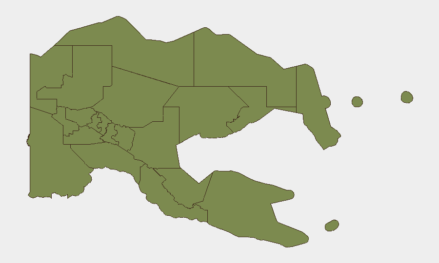
Situation Summary
Papua New Guinea remains a low-to-moderate security concern globally (rank #127, composite score 7.0) with concentrated risk in Morobe Province, which accounts for the majority of tracked threat activity. Recent natural hazards—including a magnitude 5.1 earthquake north of Lae and an active wildfire—present operational disruption risks alongside persistent public-health concerns. The security environment is characterized by localized rather than nationwide instability, with most provinces registering baseline risk levels (1.5) typical of developing-economy contexts.
Key Developments
- 2026-07-06 · Earthquake, Morobe Province – Magnitude 5.1 seismic event recorded 135 km north of Lae; potential for aftershocks and infrastructure impact in mining/logistics corridors.
- 2026-07-06 · Wildfire event (ID 1029296) – Active wildfire reported; extent and proximity to populated/industrial areas under assessment.
- Recent · Public Health – Circulating vaccine-derived poliovirus type 2 (cVDPV2) detected; implication for personnel health protocols and medical preparedness.
- 2026-07-06 · Government Investigation (unspecified) – Official investigation flagged; nature and scope not yet clarified from open sources.
*Note:* No confirmed security incidents (armed activity, civil unrest, criminal mass-casualty events) have been reliably identified in the last 24–48 hours from accessible web and social-media sources. Reporting gaps are common for Papua New Guinea; absence of reports does not indicate absence of risk.
Highest-Risk Areas
Morobe Province (risk 31.5) dominates the sub-national threat landscape and warrants proportionate focus. The province encompasses Lae, Papua New Guinea's second-largest city and a major port/logistics hub; earthquake risk, infrastructure fragility, and historical criminal activity in urban corridors elevate operational exposure. All other tracked provinces (Eastern Highlands, Gulf, Madang, Manus, West New Britain, New Ireland, East New Britain, National Capital District, Central, Oro, Milne Bay) cluster at risk 1.5, suggesting either lower baseline threat or data-collection concentration in Morobe. Security teams should treat Morobe as the primary area of concern for personnel safety and supply-chain continuity; secondary provinces warrant monitoring for emerging events but do not currently signal acute crisis.
How GeoBit Would Assist
Intel Sweep and OSINT Fusion would aggregate PNG-specific event feeds, X/Twitter sources, and local-outlet reporting to fill reporting gaps and provide real-time situational updates—particularly from Morobe. Area-of-Interest (AOI) Monitoring & Early Warning with persistent watch on Lae port, mining operations, and National Capital District would generate alerts for civil unrest, security incidents, or infrastructure disruption before they impact operations. Routing & Network Analysis would support alternative logistical routing around earthquake-affected zones and identify safe transit corridors. Environmental & Health monitoring would track earthquake aftershock probability, wildfire spread, and disease surveillance (including cVDPV2 circulation) to inform duty-of-care and personnel-health decisions.
7-Day Outlook
Seismic activity around Lae is likely to continue (aftershocks typical for M5.1 events); infrastructure inspections and supply-chain contingency planning should be prioritized. The wildfire and cVDPV2 circulation represent lower-urgency but persistent operational/health considerations. No near-term escalation in armed conflict or major civil unrest is signaled; baseline vigilance in Morobe remains appropriate.
Highest-Risk Areas — Ranked
| # | State / Region | Risk |
|---|---|---|
| 1 | Morobe | 31.5 |
| 2 | Eastern Highlands | 1.5 |
| 3 | Gulf | 1.5 |
| 4 | Madang | 1.5 |
| 5 | Manus | 1.5 |
| 6 | West New Britain | 1.5 |
| 7 | New Ireland | 1.5 |
| 8 | East New Britain | 1.5 |
| 9 | National Capital District | 1.5 |
| 10 | Central | 1.5 |
| 11 | Oro | 1.5 |
| 12 | Milne Bay | 1.5 |
Sources
Previous Daily Briefs
A new Papua New Guinea brief is written every day — each with its own risk map and downloadable CSV. Here's the last week; use the calendar to go further back.
📅 Browse every day by calendar →
Highlighted days have a brief. Tap a day for that day's map & analysis, or “csv” for that day's dataset ($5).
Atlas — our AI intelligence desk — emails them this snapshot personally. Nothing else, no list.