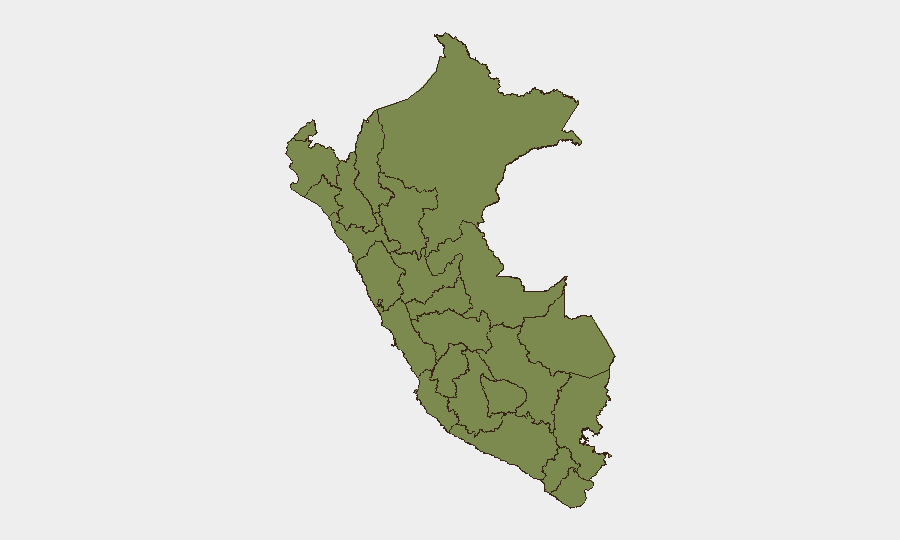
Situation Summary
Peru currently faces a nationwide infrastructure and environmental security crisis rather than acute civil or political instability. On July 2–3, the government declared a 60-day state of emergency across all 24 departments and Callao province due to imminent El Niño heavy rainfall, shifting the primary risk driver from conflict to flooding, landslides, and transportation disruption. Open-source verification over the last 24–48 hours confirms no major protests, organized violence, or crime events meeting professional corroboration standards; latent structural risks in Huánuco and La Libertad regions remain elevated but currently dormant.
Key Developments
- Nationwide (all departments and Callao), July 2–3, 2026 – Peruvian government issued 60-day state-of-emergency decree enabling exceptional civil-defense authority; primary trigger is El Niño rainfall forecast, not political unrest or security incident.
- Ayacucho, Cusco, Junín regions, July 6, 2026 – State-of-emergency measures extended or intensified in high-risk Andean departments effective today, increasing likelihood of road closures, movement constraints on mountain routes, and localized evacuation orders.
- National road network, early July 2026 – Forecasts indicate heightened travel and logistics disruption countrywide over coming days due to El Niño precipitation; mountainous and riverine areas face elevated landslide and flash-flood risk.
- Huánuco region (central Peru), July 4–5 monitoring period – Flagged as Peru's highest-risk department (composite score 31.5) but no time-stamped violent incidents, civil unrest, or infrastructure attacks confirmed in last 24–48 hours; risk remains structural and latent.
- Lima region, July 4–5, 2026 – Authorities and open-source monitors noted only routine administrative tensions and property disputes; no acute large-scale security incident or organized-crime event confirmed in last 24–48 hours.
Highest-Risk Areas
Huánuco (risk score 31.5) is Peru's dominant risk driver by a significant margin, followed distantly by La Libertad (15.2) and Lima (8.8). Huánuco's elevated score reflects structural vulnerabilities—remote geography, limited governance presence, and historical links to illicit agriculture and armed actors—rather than observable events in the current reporting window. La Libertad similarly carries latent risk tied to gang activity and informal mining; Lima's 8.8 score, despite hosting the capital and largest urban population, indicates that absolute risk concentration remains low under current conditions. The nationwide emergency declaration and focus on environmental hazards do not materially alter these regional vulnerability profiles but may constrain official security resources and visibility in remote areas.
How GeoBit Would Assist
Teams with personnel or assets in Peru would deploy Intel Sweep and multi-source OSINT fusion to monitor El Niño impacts on road networks, supply chains, and facility access in real time, while leveraging GIS & spatial analysis and satellite/imagery monitoring to track flooding and landslide risk in high-consequence regions (Ayacucho, Cusco, Junín, and Huánuco). AOI monitoring with persistent alerting on Huánuco and La Libertad would flag re-emergence of organized activity, armed group movements, or unrest as environmental stress eases, enabling proactive duty-of-care escalation before incidents scale.
7-Day Outlook
El Niño rainfall is forecast to intensify over the next 7 days, with primary risks concentrated on infrastructure disruption, travel delays, and supply-chain bottlenecks rather than conflict escalation. Barring unexpected political flashpoints or organized-crime incidents, Peru's composite threat trajectory remains stable; however, environmental strain and deployment of emergency powers may reduce official transparency and increase reporting gaps in remote departments, particularly Huánuco.
Highest-Risk Areas — Ranked
| # | State / Region | Risk |
|---|---|---|
| 1 | Huánuco | 31.5 |
| 2 | La Libertad | 15.2 |
| 3 | Lima | 8.8 |
| 4 | Piura | 7.5 |
| 5 | Cajamarca | 4.9 |
| 6 | constitucional del Callao Province | 1.9 |
| 7 | Apurímac | 1.9 |
| 8 | Loreto | 1.5 |
| 9 | Tumbes | 1.5 |
| 10 | Lambayeque | 1.5 |
| 11 | Amazonas | 1.5 |
| 12 | Ancash | 1.5 |
Sources
Previous Daily Briefs
A new Peru brief is written every day — each with its own risk map and downloadable CSV. Here's the last week; use the calendar to go further back.
📅 Browse every day by calendar →
Highlighted days have a brief. Tap a day for that day's map & analysis, or “csv” for that day's dataset ($5).
Atlas — our AI intelligence desk — emails them this snapshot personally. Nothing else, no list.