Situation Summary
Qatar remains in a state of elevated but stable security posture following Iranian regional military operations in late June 2026. The national threat level, announced as high in late June, has not been revised in the past 24–48 hours, and no new internal security incidents or fresh attacks on Qatari territory have been reported. Current risk derives primarily from indirect exposure to regional conflict—maritime threats in the Strait of Hormuz, energy-sector infrastructure vulnerability, and potential escalation ripple effects—rather than active domestic instability.
Key Developments
- 2026-08-03 · Regional Diplomatic Tension – Saudi Arabia and the United Arab Emirates have issued strike/boycott signals against Qatar, marking a significant shift in bilateral relations; no physical incidents reported in-country but signaling potential economic and diplomatic pressure.
- 2026-08-01 · Al Jazeera Statement – Qatar issued a public statement regarding Al Jazeera, details under review; no direct security impact reported.
- 2026-08-01 · Hamas Stance – Hamas formally rejected an unspecified Qatari position or proposal; no operational security incident in Qatar itself.
- 2026-08-02 · Iranian Regional Threat – Iran issued threats toward Tehran-related targets; no new confirmed attack on Qatar reported in the past 24–48 hours, though regional tensions remain elevated.
- No new internal security incidents, infrastructure attacks, or civilian casualties reported in Qatar in the past 24–48 hours.
Highest-Risk Areas
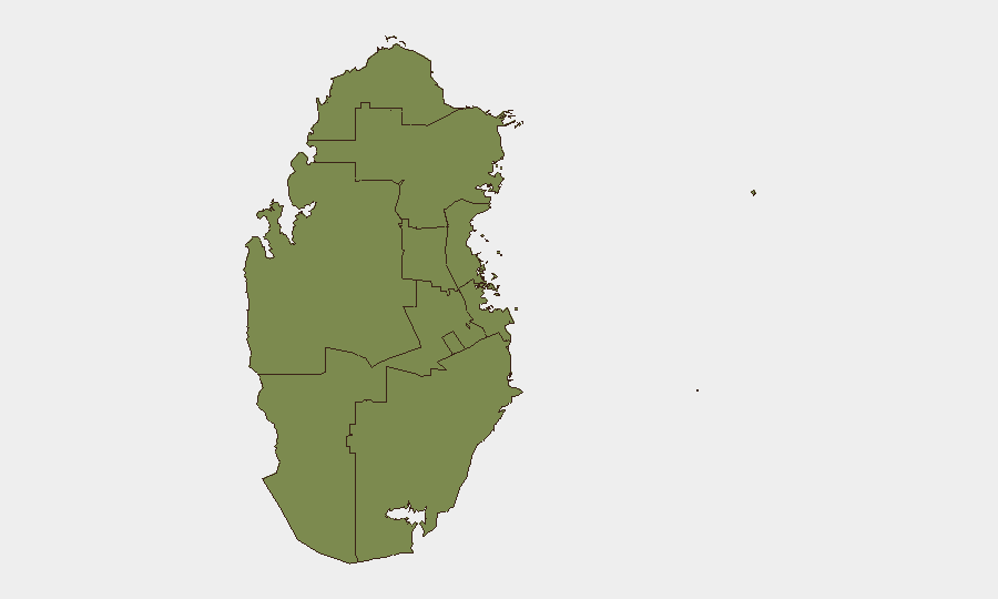
Al Khor and Al Thakhira dominate the sub-national risk ranking (31.3), likely reflecting critical energy infrastructure (Ras Laffan Industrial City, LNG terminals) and coastal/maritime exposure to regional military activity in the Persian Gulf and Strait of Hormuz. All other municipalities—including Doha—show substantially lower composite scores (1.3), indicating that risk concentration is tightly geographic rather than dispersed. The stark differential suggests that duty-of-care teams should prioritize asset and personnel monitoring in northern industrial and port zones, particularly around LNG export facilities and maritime transit corridors, while maintaining standard awareness protocols elsewhere.
How GeoBit Would Assist
Security teams should deploy Area-of-Interest (AOI) Monitoring & Early Warning with persistent watch on Al Khor, Ras Laffan, and Hamad International Airport to detect any resurgence of aerial activity or infrastructure incidents. Maritime & Aviation Tracking combined with Intel Sweep (multi-language OSINT fusion and X/Telegram monitoring) will provide real-time visibility into Strait of Hormuz shipping threats and regional military signals before they escalate into direct Qatar impacts. Conflict & Military force-structure and weapons-capability tracking will support assessment of Iranian and regional military posture changes and enable early-warning triggers for threat-level escalation.
7-Day Outlook
Regional diplomatic tension (Saudi/UAE boycott signals, Hamas rejection, Iranian threats) suggests a period of elevated political friction but does not yet indicate imminent military escalation against Qatar itself. Infrastructure and maritime risk will likely remain the primary exposure vectors; energy facilities and LNG tanker transits merit continued close monitoring. No material change in the national threat level is anticipated in the next 7 days absent a significant new Iranian strike or major regional conflict escalation.
Highest-Risk Areas — Ranked
| # | State / Region | Risk |
|---|---|---|
| 1 | Al Khor and Al Thakhira | 31.3 |
| 2 | Ash Shamal | 1.3 |
| 3 | Al Shahaniya | 1.3 |
| 4 | Al Rayyan | 1.3 |
| 5 | Al-Daayen | 1.3 |
| 6 | Umm Salal | 1.3 |
| 7 | Doha | 1.3 |
| 8 | Al Wakrah | 1.3 |
Sources
Previous Daily Briefs
A new Qatar brief is written every day — each with its own risk map and downloadable CSV. Here's the last week; use the calendar to go further back.
📅 Browse every day by calendar →
Highlighted days have a brief. Tap a day for that day's map & analysis, or “csv” for that day's dataset ($5).
Atlas — our AI intelligence desk — emails them this snapshot personally. Nothing else, no list.