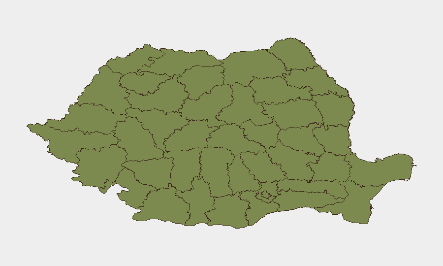
Situation Summary
Romania faces escalating drone incursion risk along its eastern border with Ukraine, following three confirmed Russian Shahed-type drone interceptions in three days (24–27 July). One drone strike on a civilian residence in southeast Romania on 24 July caused injuries and property damage, triggering NATO support statements. Broader political and security tension is evident from multiple governmental disapproval signals and military/police posturing, while a fatal transport incident in western Timiș County remains under criminal investigation.
Key Developments
- Sulina–Chilia area, Black Sea (Tulcea County) – 26 July, ~10:13 local
Romanian F-16s from Fetești air base, operating under NATO command, shot down a suspected Russian drone over Romanian territorial waters in the Black Sea. This marks the third confirmed interception in three consecutive days.
- Sfântu Gheorghe, Danube Delta (Tulcea County) – 25 July, ~08:30 local
An F-16 intercepted and destroyed a drone approximately 10 km west of Sfântu Gheorghe in unpopulated terrain. Debris analysis indicates a Russian Shahed-type attack UAV consistent with systems used against southern Ukraine.
- Padina, northeast of Bucharest – 24 July, ~11:00 local
Romania's first confirmed drone kill occurred when an F-16 shot down a Shahed-type attack UAV carrying explosives over an unpopulated area. The Prosecutor General's Office confirmed Russian origin and explosive payload.
- Residential building strike, southeast Romania – 24 July, early morning (specific location withheld)
Debris from a Russian drone struck a civilian residence, injuring two people and damaging property. Romania's Foreign Minister and NATO Secretary-General confirmed Russian origin and explosive payload.
- Timiș County, western Romania – recent days (active investigation)
Romanian authorities are investigating a fatal minibus crash involving PAOK Thessaloniki football fans. Seven deaths and three injuries were reported; toxicology results indicate the driver had drugs in his bloodstream, and a criminal probe into prohibited substances is ongoing.
Highest-Risk Areas
Bucharest dominates the national risk ranking (31.4) due to proximity to Ukrainian conflict spillover and critical infrastructure concentration. Mehedinți (12.8) and Vrancea (11.1) counties, located along the border and Danube corridor, show elevated risk linked to drone activity and cross-border military operations. Buzău (6.9) and Brăila (6.7) counties follow, reflecting the concentration of threat along the eastern frontier and Danube Delta. Western and central regions (Cluj, Brașov, Timiș, Bihor) carry lower composite scores, though Timiș's current criminal investigation and transport incident merit localized monitoring.
How GeoBit Would Assist
A security team with staff or assets in Romania would use AOI Monitoring & Early Warning to track drone activity and cross-border incursions in real time across Tulcea, Vrancea, and Mehedinți counties, with persistent alerting on airspace breaches. Maritime & Aviation tracking, combined with Conflict & Military force-structure and weapons-capability monitoring, would enable teams to correlate drone profiles, launcher positions, and NATO response patterns. GIS & Spatial Analysis and alternative routing services would support duty-of-care teams in re-planning logistics and personnel movement away from highest-risk eastern border zones and around Bucharest's critical infrastructure.
7-Day Outlook
Drone incursion frequency is likely to remain elevated given ongoing operations in adjacent Ukraine and the demonstrated ability of Russian systems to reach Romanian airspace. NATO air policing posture will remain heightened, increasing intercept probability but not eliminating civilian risk from debris or undetected launches. Ground security teams should expect continued RO-Alert warnings in border counties and monitor transport-incident outcomes in Timiș for any links to organized crime or broader instability.
Highest-Risk Areas — Ranked
| # | State / Region | Risk |
|---|---|---|
| 1 | Bucharest | 31.4 |
| 2 | Mehedinți | 12.8 |
| 3 | Vrancea | 11.1 |
| 4 | Buzău | 6.9 |
| 5 | Brăila | 6.7 |
| 6 | Mureș | 6.3 |
| 7 | Cluj | 2.6 |
| 8 | Prahova | 1.8 |
| 9 | Vâlcea | 1.4 |
| 10 | Brașov | 1.4 |
| 11 | Bihor | 1.4 |
| 12 | Timiș | 1.4 |
Sources
Previous Daily Briefs
A new Romania brief is written every day — each with its own risk map and downloadable CSV. Here's the last week; use the calendar to go further back.
📅 Browse every day by calendar →
Highlighted days have a brief. Tap a day for that day's map & analysis, or “csv” for that day's dataset ($5).
Atlas — our AI intelligence desk — emails them this snapshot personally. Nothing else, no list.