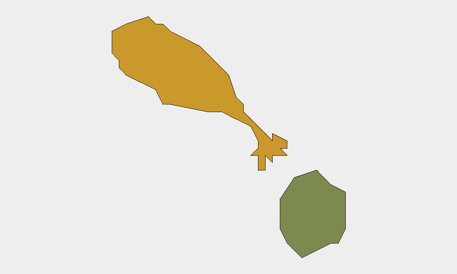
Situation Summary
Saint Kitts and Nevis presents a stable security environment as of 26 July 2026, with no credible reports of acute incidents, civil unrest, major crime events, infrastructure failures, or travel disruptions in the last 24–48 hours. Routine governance and community activity continue across both islands, with official and local news sources showing no alerts or emergency advisories. The composite threat score remains low, though Saint Kitts carries elevated baseline risk (72) relative to Nevis (28), reflecting persistent underlying crime and socioeconomic conditions rather than current acute developments.
Key Developments
- No discrete security incidents confirmed in the last 24–48 hours across Saint Kitts and Nevis. Official Government of Saint Kitts and Nevis Information Service (SKNIS) announcements as of 20 July show routine administrative activity with no emergency alerts or reports of unrest.
- No civil unrest, protests, or politically motivated violence reported in the last 24–48 hours. Local and regional news outlets, including NevisPages, document community and weather updates only, with no corroboration of disruption events.
- No infrastructure outages or transport disruptions reported in the last 24–48 hours affecting airports, ports, utilities, or inter-island connectivity.
- No new travel advisories or security warnings issued by major states or organizations within the last 24–48 hours, indicating no sudden shift in risk environment.
- Social media activity consistent with absence of acute security events. Recent X/Twitter content referencing Saint Kitts and Nevis focuses on tourism, routine political commentary, and general travel—no corroborated claims of violence or safety incidents.
- No cyber or critical-infrastructure incidents reported in the last 24–48 hours affecting Saint Kitts and Nevis by regional or global cybersecurity intelligence sources.
Highest-Risk Areas
Saint Kitts (composite risk 72) drives the islands' overall threat profile, reflecting concentrations of property crime, street violence, and gang activity in urban centers—primarily Basseterre and surrounding parishes. These baseline conditions persist but have not escalated in the current 24–48-hour window. Nevis (risk 28) remains substantially lower-risk, with lower crime prevalence and smaller urban density. Both islands remain subject to seasonal hurricane risk (June–November), though no tropical threats are currently tracked in this briefing period.
How GeoBit Would Assist
Security teams managing personnel or assets in Saint Kitts and Nevis would benefit from AOI Monitoring & Early Warning to detect emerging unrest, crime spikes, or infrastructure failures with persistent watch and alerting; Intel Sweep and multi-language OSINT fusion to corroborate local and regional incident reporting in real time; and Routing & Network Analysis to plan alternative transport and supply routes in the event of port, airport, or road disruptions. These capabilities enable continuous baseline monitoring and rapid escalation detection without requiring reactive research.
7-Day Outlook
The near-term security trajectory for Saint Kitts and Nevis is expected to remain stable and low-risk through early August, absent new external shocks or crime escalation. Seasonal hurricane monitoring remains a standing environmental risk during the Atlantic basin season. No political, economic, or infrastructure developments currently suggest deviation from baseline conditions in the coming week.
Highest-Risk Areas — Ranked
| # | State / Region | Risk |
|---|---|---|
| 1 | Saint Kitts | 72 |
| 2 | Nevis | 28 |
Previous Daily Briefs
A new Saint Kitts and Nevis brief is written every day — each with its own risk map and downloadable CSV. Here's the last week; use the calendar to go further back.
📅 Browse every day by calendar →
Highlighted days have a brief. Tap a day for that day's map & analysis, or “csv” for that day's dataset ($5).
Atlas — our AI intelligence desk — emails them this snapshot personally. Nothing else, no list.